guys, how can i combine two IW into one, i’ve tried assembly and topsar merge, still the image cannot be processed together, there is a sign that in the middle the map is overlayed, how can we combine this map so it can be proceed two IW togather without false information in overlayed area on map

Please include all steps that led to this. This helps us understand what might have happened.
I think it would be better then to merge the parts after the second step and apply the unwarpping on the merged data.
1 Like
thank for the answer brother, i really appreciate, i will try and give you feedback asap
@ABraun the phase can be merged but cannot be unwrapped, i do the third step after the data merged, can we unwrapped merge data?
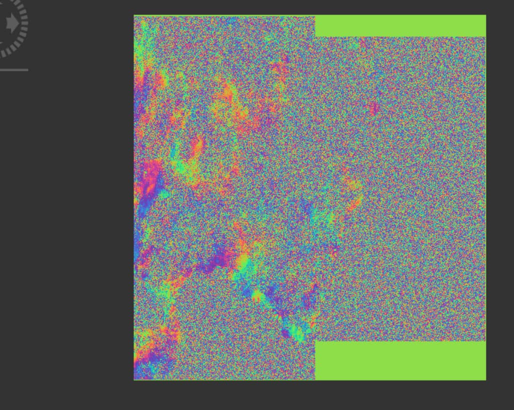
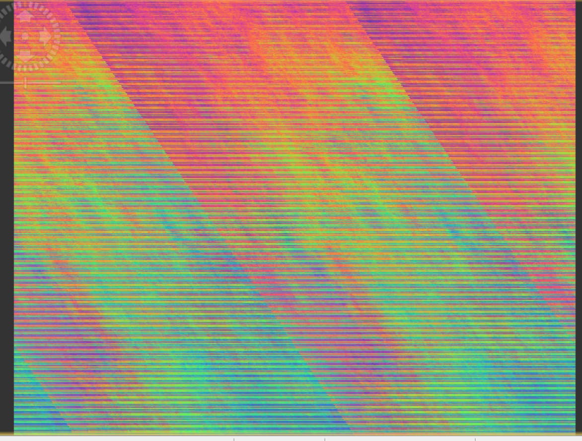
That is mainly because it contains no fringe pattern to unwrap. Sure, there are these strip artefacts, but especially the right swath has no coherent quality.
The stripes could be addressed by nearest neighbor resampling (just a guess), but I’m afraid the actual result won’t be much better.
1 Like
what is the solution do you think?, using other data or taking other step of processing data or making the area area smaller to see fringe pattern so it can be unwrapped, thanks bro for fast responding
The processing won’t change too much. If you find a more suitable image pair, it’s worth a try. But if vegetation is the reason for the phase decorrelation, you won’t be lucky with other dates as well.
1 Like
thanks for helping me much sir , can i overcome the vegetation problem by using a higher wavelength, for example, ALOS satellite image or other higher than band C for vegetation problem to get a better fringe image? do you have paper i could read or cite?
higher wavelengths are less prone to temporal decorrelation, but they similarly fail over dense vegetation. In the end it is always a compromise between the temporal baseline, the wavelength and the observed period.
ESA provides an extellent introduction to all these aspects: InSAR Principles: Guidelines for SAR Interferometry Processing and Interpretation (ESA TM-19)
Also these are well summarized: Echoes in Space - InSAR Error sources
1 Like