hello everyone,
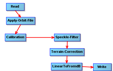
I am trying to processing ERS 1&2 IMP imagery of Gabon area (west Africa), my workflow graph is as below. I have tried both terrain correctin and sarsim-terrain correction, and tried both delft precise and prare precise, tried tick and untick “mask out area without elevation” but the processed image still have a large shift. Do you perhaps know why is this and how can I orthorectify ERS imagery correctly? Thanks in advance!