Hi, I’m a data journalist and recently I started using SNAP. I need help with assessment of the current water contamination crisis in Gdansk, Poland. On 15.05 the local sewage pumping station broke and started pumping sewage directly to the Motława river, only few kilometers from the Baltic Sea. The pumping station is located on Ołowianka island (red circle).
I was wondering if there is any possibility to know the scale of the leak, using SNAP tool and sentinel2 images?
Here are two sentinel2 RGB images, the left one from 13.05 and the right one from 16.05.
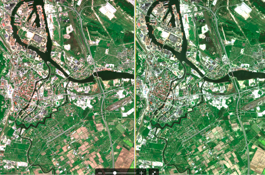
It seems to me, that there is some contamination visible in the water (yellow circle) but I don’t have skills in remote sensor analysis to decide if this is only a distortion in the picture or a contamination. It would be great if you could tell me how I can measure the scale of contamination, maybe should I use some filters? I managed to calculate ndvi for other projects so I have basic knowledge of SNAP.