Hi @ABraun and @mdelgado, thank you…
I was able to solve the problem by reinstalling OS, going from opensuse Tumbleweed to Leap 15, and now I do not have core dumped in mt_prep_snap … just reinstalling StaMPS did not work.
I have another problem, SNAP download the srtm file “http://srtm.csi.cgiar.org/SRT-ZIP/SRTM_V41/SRTM_Data_GeoTiff/srtm_23_17.zip” … but the page is not found …
is manually downloading an option? You can place the file in the directory under auxdata\dems\
Regarding the DEM download, in fact this is a page not found so it should be any developer taking the action to fix it.
Can any of you (@marpet or @lveci) please solve this? Maybe getting a local repository instead of third party’s dependencies??
Regarding the StaMPS installation… it is weird that did not work. Can you share with us how did happen? You only need to compile the src folder with make and later make install and add the paths to your environment.
Thanks!
It seems that the service was revised and the URL changed.
For example this one works:
http://srtm.csi.cgiar.org/wp-content/uploads/files/srtm_5x5/TIFF/srtm_21_06.zip
Regarding the tile srtm_23_7.zip, I think it is a water tile and therefore not present.
As referenz have a look here:
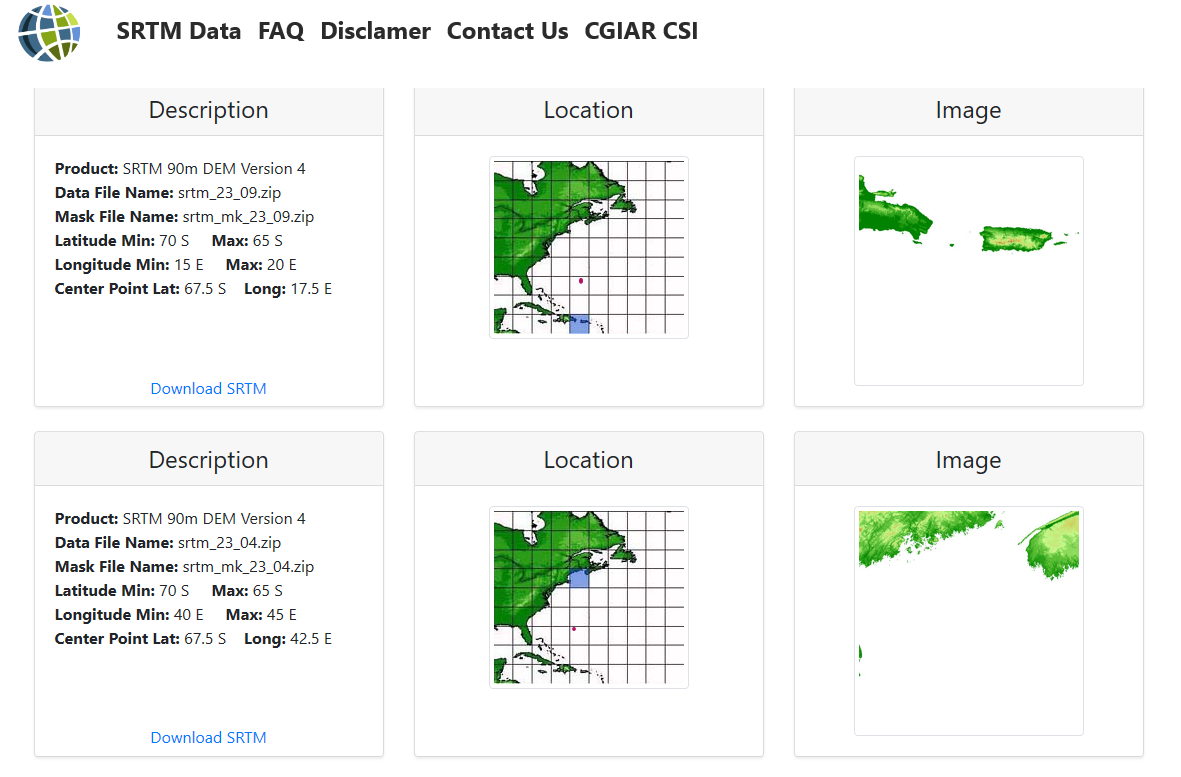
I’ve marked the 23_7 tile with a red dot.
I think the solution would be to update the URLs in the DEM Downloader and to consider that tiles might not be present because they contain only water. What do you think @lveci?
Regarding hosting the data, I don’t think this should be the duty of SNAP. We need to rely on external services and can’t host everything on our own. Otherwise we would end up being another DIAS. 
As a temporary workaround, it might work if you change the URL in the snap.auxdata.properties file. It is located in the etc folder of the SNAP installation directory.
DEM.srtm3GeoTiffDEM_HTTP = http://srtm.csi.cgiar.org/SRT-ZIP/SRTM_V41/SRTM_Data_GeoTiff/
to
DEM.srtm3GeoTiffDEM_HTTP = http://srtm.csi.cgiar.org/wp-content/uploads/files/srtm_5x5/TIFF/
But still the problem persists that the tile srtm_23_7 does not exist.
2 Likes
hi @ABraun @mdelgado @marpet
ok… i can use a external dem in coregistration and interferogram process, but i can’t use it in StaMPSexport (SNAP), i don’t have the option …
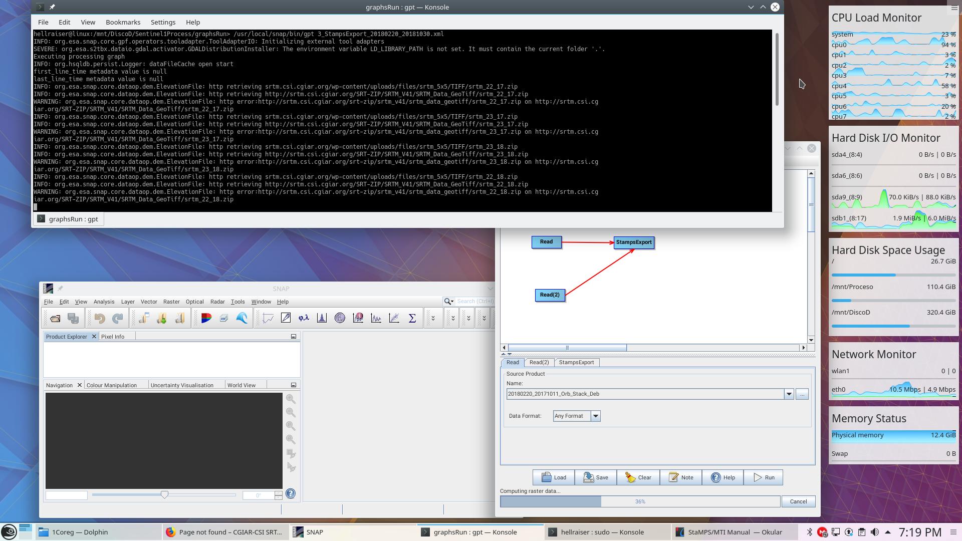
/mnt/DiscoD/Sentinel1Process/graphsRun/3_StampsExport_20180220_20171011.xml
i change the snap.auxdata.properties file to: “DEM.srtm3GeoTiffDEM_HTTP = srtm.csi.cgiar.org/wp-content/uploads/files/srtm_5x5/TIFF/” … but SNAP is trying to download the wrong page too.
INFO: org.esa.snap.core.dataop.dem.ElevationFile: http retrieving srtm.csi.cgiar.org/wp-content/uploads/files/srtm_5x5/TIFF/srtm_22_17.zip
INFO: org.esa.snap.core.dataop.dem.ElevationFile: http retrieving http://srtm.csi.cgiar.org/SRT-ZIP/SRTM_V41/SRTM_Data_GeoTiff/srtm_22_17.zip
WARNING: org.esa.snap.core.dataop.dem.ElevationFile: http error:http://srtm.csi.cgiar.org/srt-zip/srtm_v41/srtm_data_geotiff/srtm_22_17.zip on http://srtm.csi.cgiar.org/SRT-ZIP/SRTM_V41/SRTM_Data_GeoTiff/srtm_22_17.zip
thanks !!
1 Like
So this means that both URLs are used. The old one and the new one you have specified.
Actualy either only the newly specified one should be used.
But in the end it worked for you? I don’t get it from your post.
no…it does’t work … because snap is trying to download the old site too … i erased and replaced the old line, maybe i need to change other file too…
I don’t get it. The StaMPS export itself doesn’t download any SRTM data. Do you mean the topographic phase removal?
… yes, this is weird, because if I run it from a console with GPT, the xml graph asks for SRTM; however, if I run it from SNAP, the same graph works correctly … i don’t now !!!
1 Like
Dear Sir,
I am new to StaMPS software. i kindly request you to please assist me in installing the software.
- I have Installed Cygwin compiler in windows.
it would be very helpful if you could assist me in installing.
Thankyou in advance,
best regards
vishnu
Dear Helper,
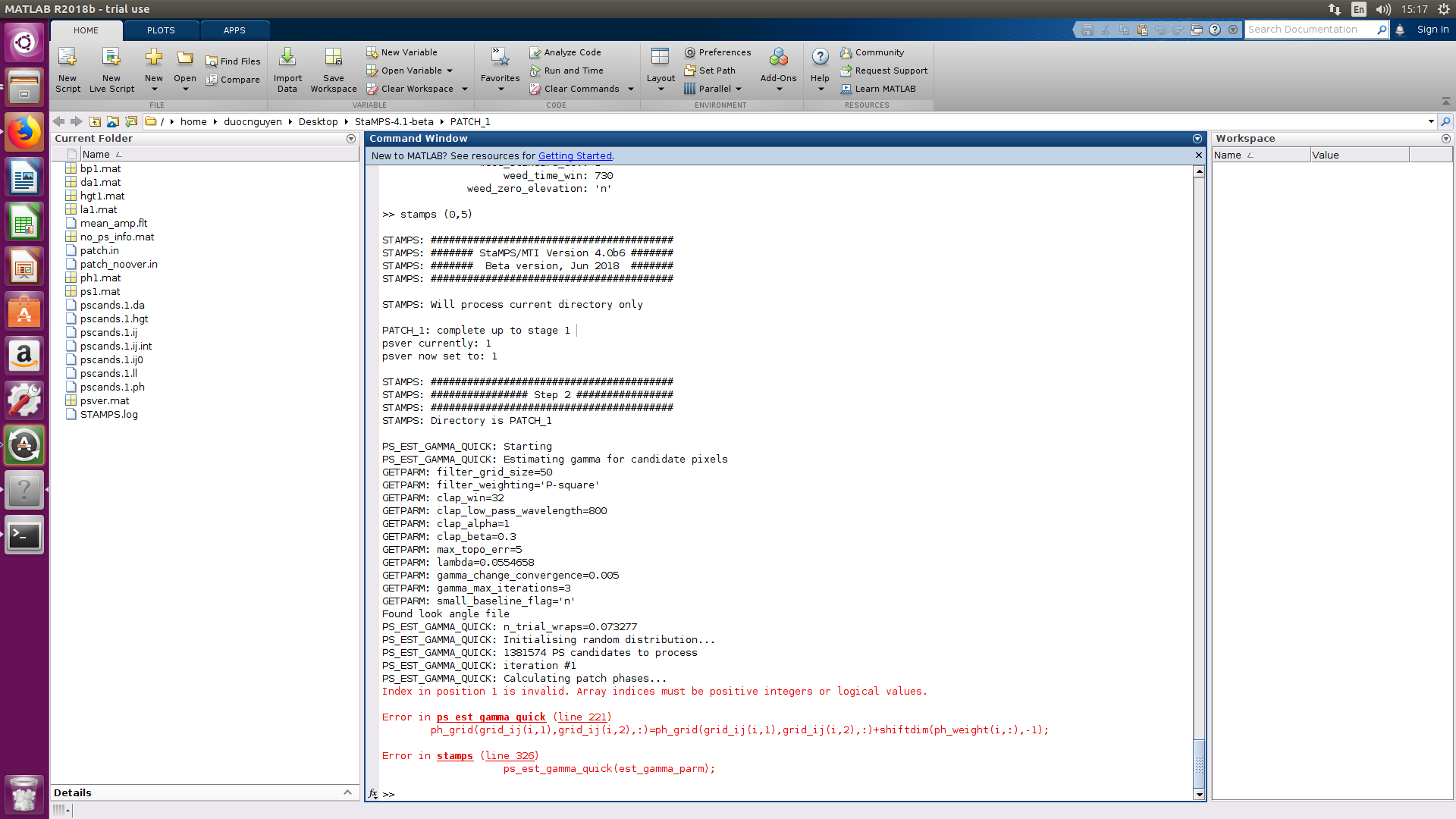
I am duoc nguyen, I have some problems when run step 2 (stamps) in matlab like figure.
Can you help me reslove and explain this problem.
Thank you so much.

 .
.
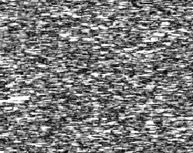
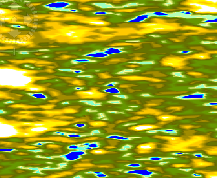
**After i execute the interferogram formation.**I got an unexpected result.The first picture is the cohenrence,and the second is the elevation.was I wrong.If that,please point that where was wrong.I got no idea. need help.thanks before.
low coherence leads to bad interferograms. I don’t think you did anything wrong but in regions with high vegetation cover, InSAR is hardly possible.
yeah.you were right.the ROI with low coherence ,and much wet .but before i made a experience .I have
ten images,i only picked the last four images to coregistration and then picked master between this four images and done interferogram formation ,the phase of result could see fringles ,but this time they were going away.don’t know why.(note that this time i picked master using all ten images).Good
night!See you tomorrow.
it is important to keep the temporal baseline short and avoid images from the rainy season. So, different pairs can lead to distinctively different InSAR patterns.
The cgiar srtm problem should be fixed with snap-engine 6.0.6 update.
1 Like
@katherine,
Dear katherine, thank you for you processing,
When I run stamps in Matlab, I have some problem on Step 2.
Can you helop me solve this problem?
Thank you so much,
Dear @katherine
Can you share me mail of Dr. Andy Hooper?
I have some question to ask him.
Thank you so much