Coordinate system

Hi all!

my question is very simple and dont need so much work (i think) but i cant find the solution to my problem in internet. Im just start like 2 days ago with this work on Snap so i dont know much about the software.

Im student from Chile and i have to do bands mathematics to intepretate geologic structures and other things (lithology, alterations, etc)…but before this, i need to work in the UTM CS but whatever i do… always keeps the “degree” sistem of reference…

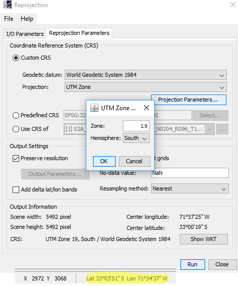
im trying the “reproject” tool to convert the CS to UTM WSG 1984 19H S but does not work because is still showing me the CS in degrees besides in meters.


i need that the lat/long of the pixels of the image be in meters.

Can anyone help me with this please?

Thanks!

UTM is based on meters, so if the re-projection worked your data should be correct.
I don’t know if SNAP supports other displayed coordinates than WGS84.

Just as an advise: uncheck the “re-project tie-point grids” option as it takes much more time and produces unnecessary bands (for most cases).

1 Like

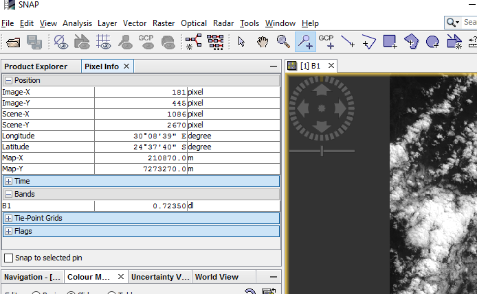
The default display of geo-coordinates in SNAP is lat/lon.
But if you go to the Pixel Info View. You can see the coordinates in the map unit. For UTM meter.

1 Like

thanks to both of you!

now i undertand how to see the coordinates of the pines that i put on the image more easily.

now i will search some band combinations for copper minerals to try on my study area.

Thanks a lot!

First of all, Thanks for your solution.
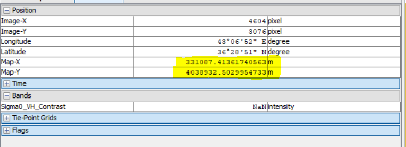
But when I work with Sentinel-1 (SAR) data, The pixel info view doesn’t content coordinates in UTM.
Is there any way to show coordinate in meter ?

Regard

Did you read this above post, “But if you go to the Pixel Info View. You can see the coordinates in the map unit. For UTM meter.”

Source of the post

If it doesn’t work for you, you should reproject the image from EPSG:4326 to for example, AUTO:42001 - WGS84/AUTO UTM

This is an example case,

Hi,

I have these coordinates:
N30 53.266 W4 00.723
N30 53.812 W4 00.365
N30 53.866 W4 00.166

How can I find the location on Google Maps??? They don’t look like GPS coordinate for me?! Any help will be appreciate it! Thanks.

30 N is the degree, 53.266 is the minute (same for West)

Divide the minutes by 60 to get decimal degrees. For your first line, it would be
30.887766667 °N 04.01205°W

If you enter it like this, Google Maps can read it:
30° 53.266' N 4° 0.723' W

They do not look like GPS coordinates because GPS often works with UTM coordinates which are based on meters (not degrees).

This might also clarify: