my question is very simple and dont need so much work (i think) but i cant find the solution to my problem in internet. Im just start like 2 days ago with this work on Snap so i dont know much about the software.
Im student from Chile and i have to do bands mathematics to intepretate geologic structures and other things (lithology, alterations, etc)…but before this, i need to work in the UTM CS but whatever i do… always keeps the “degree” sistem of reference…
im trying the “reproject” tool to convert the CS to UTM WSG 1984 19H S but does not work because is still showing me the CS in degrees besides in meters.
UTM is based on meters, so if the re-projection worked your data should be correct.
I don’t know if SNAP supports other displayed coordinates than WGS84.
Just as an advise: uncheck the “re-project tie-point grids” option as it takes much more time and produces unnecessary bands (for most cases).
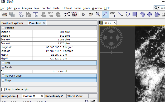
The default display of geo-coordinates in SNAP is lat/lon.
But if you go to the Pixel Info View. You can see the coordinates in the map unit. For UTM meter.
First of all, Thanks for your solution.
But when I work with Sentinel-1 (SAR) data, The pixel info view doesn’t content coordinates in UTM.
Is there any way to show coordinate in meter ?