DEM-assisted with xcorr coregistration won’t run and complains “The product ‘filename_Orb_Stack’ already contains a band with the name ‘Intensity_VV_mst_16Dec2005’.”
The only coregistration algorithms that ran for us were:
[standard] coregistration disabling option “Apply Fine for SLCs”
DEM-assisted coregistration disabling option “apply mask”
But then coherence is super low and we’re not sure if its genuinely a non-coherent geographic region and spatial/temporal baseline conditions or only a coregistration artifact.
Is anyone able to reproduce the issues above?
Thanks.
PS: “Close all other” could keep open all selected products, not just the last one selected.
PPS: the menus could wait a few milliseconds before redrawing.
Yesterday we were using ENVISAT ASAR and Fine Registration produced a blank slave image.
Now using ALOS-1 PALSAR and coregistration worked fine.
We’re seeing fringes!
We’re still not sure if coherence is better only because of the longer wavelength (L- vs. C-band).
Temporal baseline are similar, of the order of one month.
Thanks,
-Felipe.
InSAR should work fine with ASAR. Did you apply the precise orbits first?
Maybe the threshold values aren’t ok for the data. Have you tried larger windows and many more GCPs?
Could you supply the data products to reproduce the problem?
Yes! We applied the precise orbits before processing.
Yesterday, I tried larger windows and many more GCPs… the results are the same!
Follow the link for download of subsets:
You don’t need to input GCPs yourself. GCPs are automatically generated points at which the images are tested for statistics that indicate correct registration. If the measure of one point is too low it will be removed from the set of GCPs. In the end, only a couple of remaining GCPs are used for the coregistration.
good coherence depends on the temporal and perpendicular baseline to a large degree. So a careful selection of image pairs is decesive. Have a look at this ESA document, it gives hints on how to get a good image pair.
can you give me information to know the good perpendicular when download the image? because when I use https://vertex.daac.asf.alaska.edu/ the perpendicular results on the website and in different snap software.
Any clue if this kind of tool or something similar to calculate perp baseline will be implemented by ESA on a specific website, SNAP, Copernicus Hub, etc.?
Hi
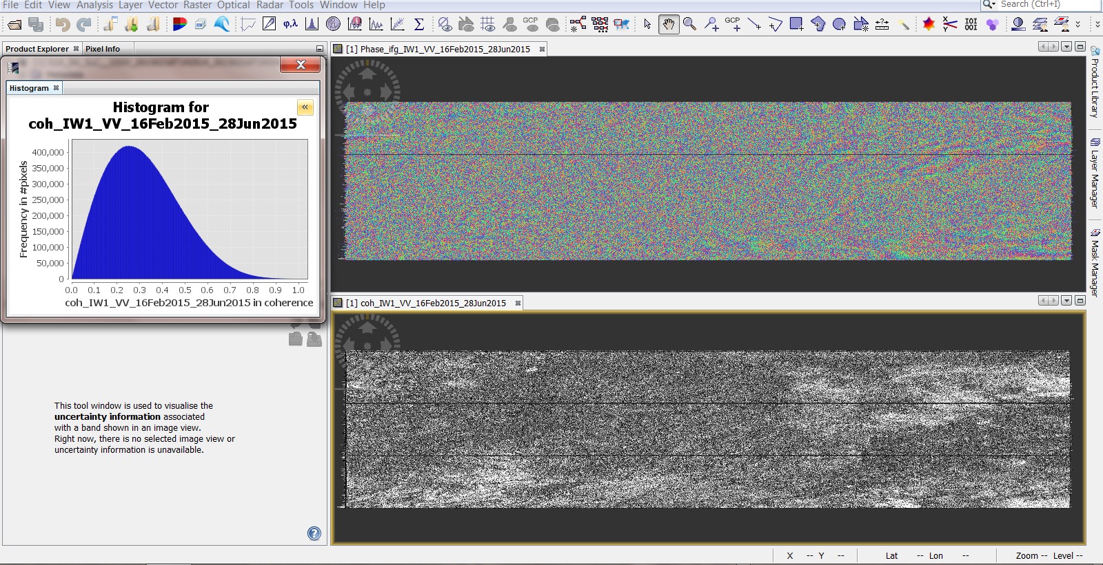
I generated a interferogram with sentinel 1 images, but the coherence is low and now I have to download two other images and that’s very hard.
Is there a way to get the coherence before downloading the images?
The coherence of the images was initially 0.79 but now the results are as follows
no, it has to be computed based on the information in the images. The estimated coherence in the InSAR Stack Overview does not include different types of surfaces or the atmospheric conditions during the image acquisitions, so the only way to find out is to test different images’s interferograms and coherence.
There are some light patterns in your interferogram, but probably not enough to get areliable result over your image. Please have a look at the InSAR tutorials how interferograms should look before you can proceed.
Thanks
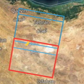
The my study area in the image above is on the right side of the image that fringes are more visible.Can I subset it after debursting? And no problem to download If the images dont overlap perfectly ? Like the image below