I have tried to apply interferogram formation operator on the step 2’s results (the backgeocoded stack ), @Abdel have mentioned above, but I got an error that apply interferogram formation on debursted stack didn’t get.
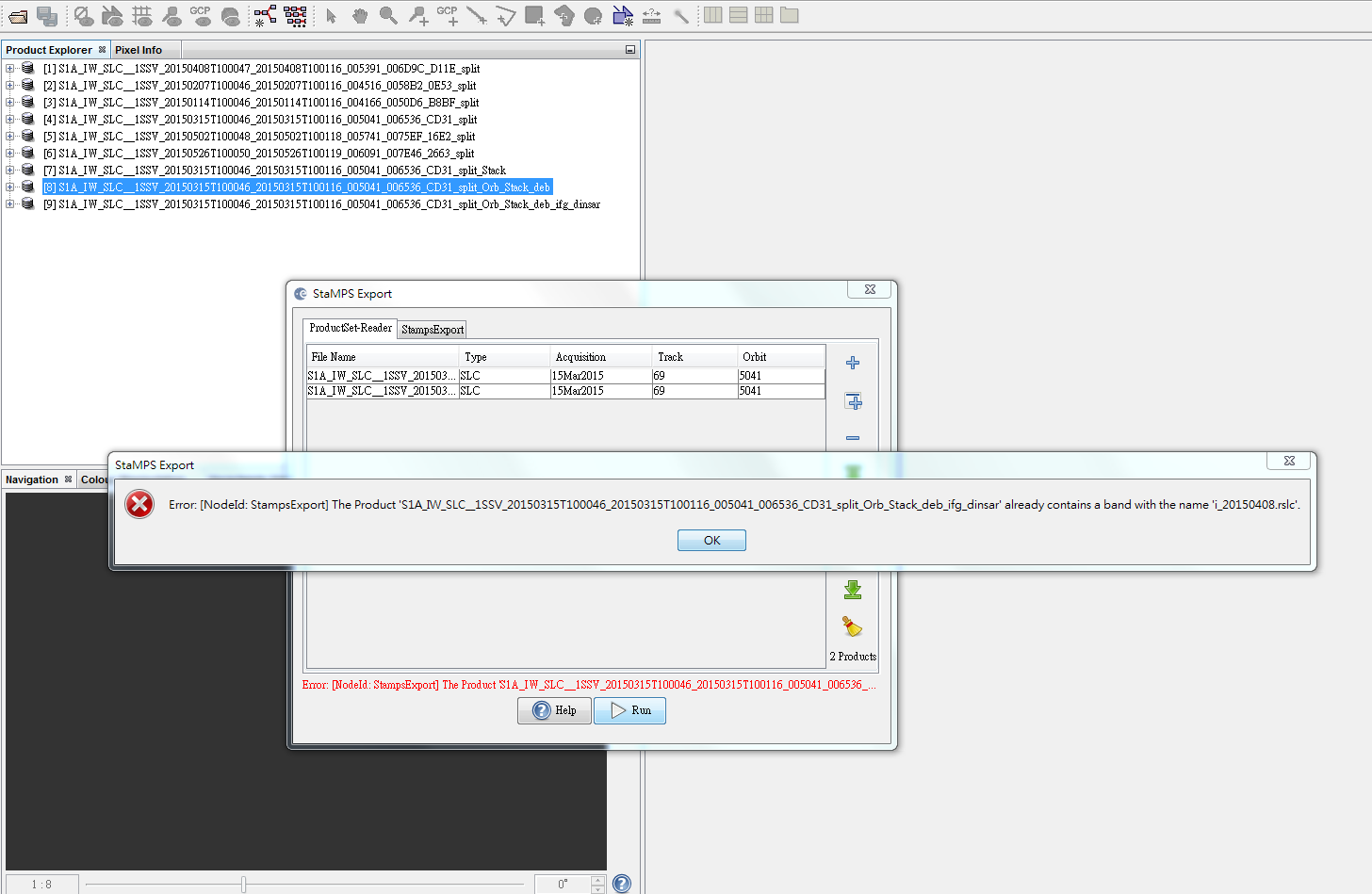
And from the steps @katherine provided, I also got an error at step 8 (StaMPS export) like this “The product … already contains a band with the name ‘i_201150408_rslc’.”
Hi Sharon,
the first problem is due to the existence of one or many images, in your stack, with sensing dates are befor Mars 2015, and the other images dates are after. To get ride of this proplem you have to apply the EAP correction (Radar-> S1-Tops -> EAP phase correction) on all your images that are sensed befor mars 2015 and start again from step 1.
I don’t understand very well.
Why I need to apply the EAP correction when I make interferograms before deburst? If I deburst first and then make interferograms, there won’t appear this error.
I have successfully export the data for stamps by following step:
Split and Apply_Orbit_File ==> Apply the EAP correction that sensed before March 2015 ==>Coregistration-S-1Backgeocoding ==> Interferogram formation ==> Deburst ==> TopoPhase Removal ==> Add elevation band ==> StaMPS Export
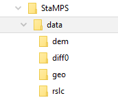
But I only got three folders - diff0、geo、rslc. I didn’t get the folder of “dem”.
Could anyone help me? Thank you very much!
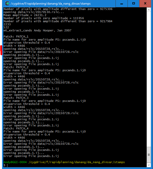
It is stated that data/rslc/20150728.rslc cannot be opened but it is located in that directory and was also correctly used in the previous step (mt_prep_gamma).
Am I missing something? Did i run the script from the correct location or should the file structure somehow different? I also looked in the code of mt_extract_cands but couldn’t find why the file cannot be opened.
The same happens for mt_prep_gamma_snap which you provided in your post.
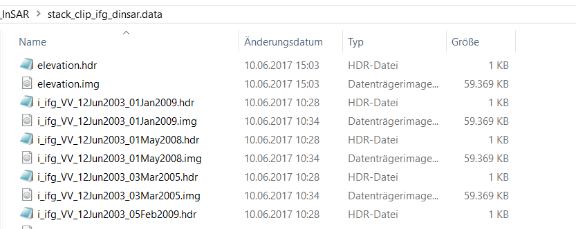
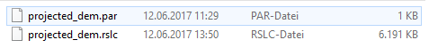
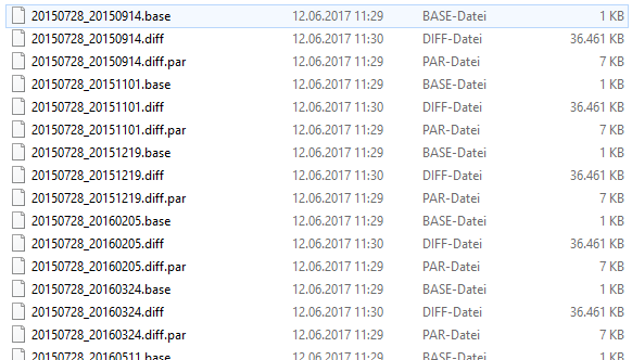
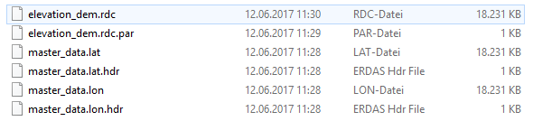
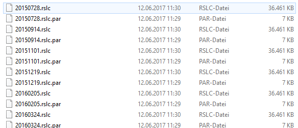
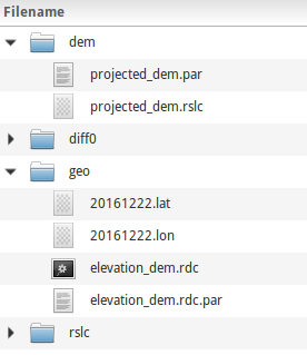
I don’t know why you get this error message, but it seems that your data structure is different from mine in geo floder, here is mine export data structure:
And maybe you should use absolute path in mt_prep_gamma_snap(I don’t know if it’s the reason). Meantime I get error under Cygwin but works fine in Linux, same case for use StaMPS in Matlab.
The two file post by Katherine, “mt_prep_gamma_snap” is different from “mt_prep_gamma”, and I use “mt_prep_gamma_snap”, it works for me(and I haven’t use “mt_prep_gamma”). But the file “ps_load_initial_gamma_snap” is same as “ps_load_initial_gamma” expect for a ‘;’, which has some problems in my work, so I have modified it.
I think you should have the full path to your folder ‘data’ when you run mt_prep_gamma script,
i.e.
mt_prep_gamma 20150728 full_path/data 0.4 2 2 50 200
2/ if your master is 20150728 then files with lon and lat should have names
20150728.lon
20150728.lat
Good luck,
Katherine
thanks so much for your answers, guys. I changed the names of the lat/lon files and added the full path in the command and now the script is executed. I don’t know if the results make sense in a technical way but I am one step further
Yes, I added the elevation band to the product of interferograms with removed topographic phase.
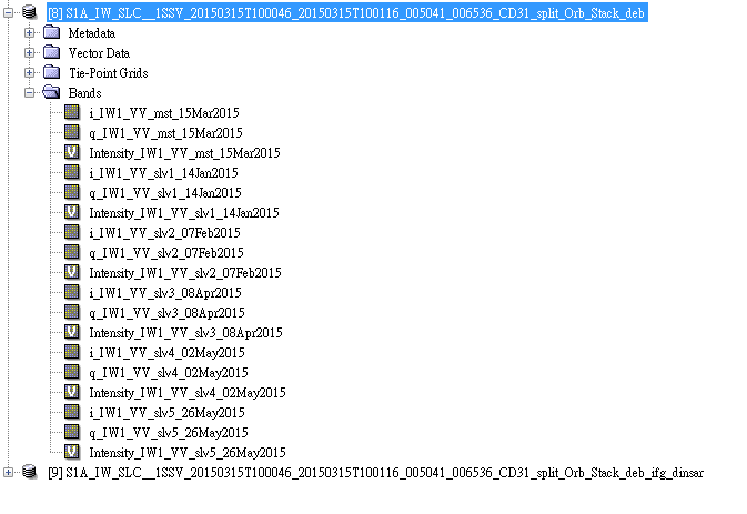
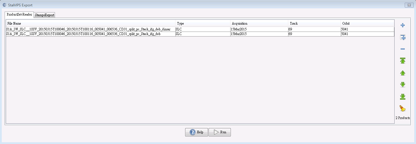
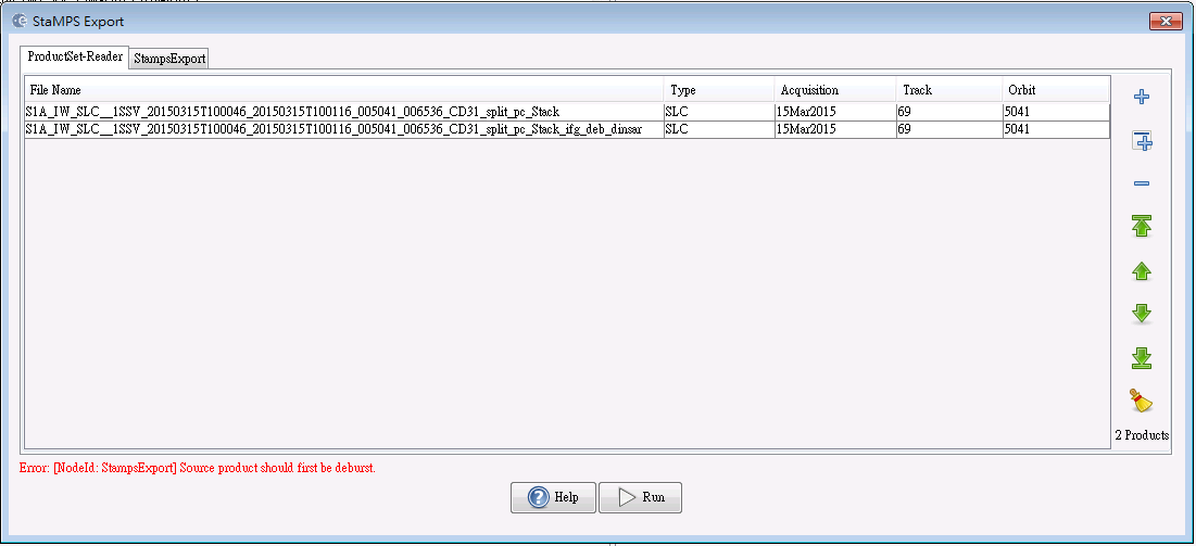
But I put stack_ifg_deb instead of _stack products in the export step.I think I may make wrong here?!
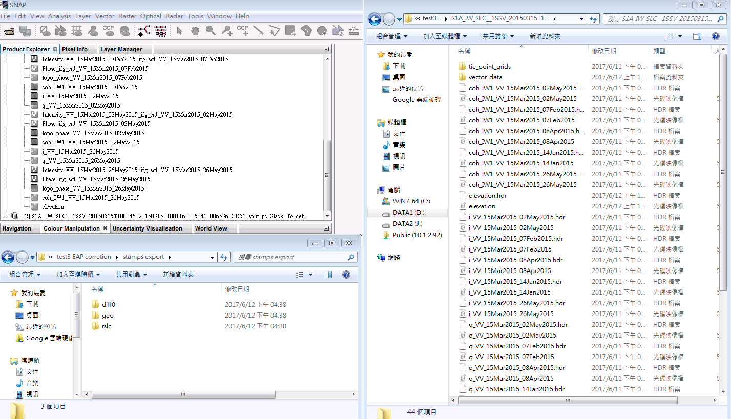
I have changed the input products as following figure, and I get an error “Source product should first be deburst”. So the product I put before (stack_ifg_deb) is the right one?
Sorry for bothered you again! Thank you!
First, thank you all a lot for helping the whole community make advances in the connexion between SNAP and StaMPS. A special thank to @katherine who helped a lot with her detailed step to step how-to.
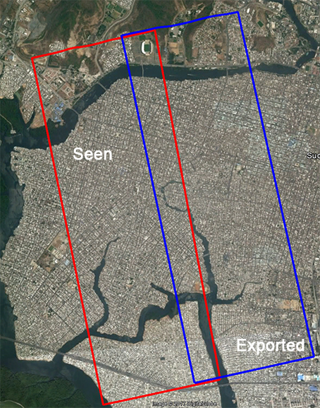
I managed to make the whole process work, but I have a strange issue. It seems that the processed area is not the area seen during the scene subsetting. By that, I mean that the scene I substracted does not correspond to the final geolocation after the whole process. One image talks more that a thousand explanation I think:
@ABraun at the same step Katherine indicated, it is to say after the backgeocoding and debursting of the data. I used the “Spatial subset from view” tool.