When I import a shp file exported from Arc into snap, it seems like the coastline etc is offset. I have both the Arc shp and the S3 image file reprojected as WGS 84 geographic lat/lon projection. Am I doing something wrong, is there a way to nudge the two coastlines to align?
Maybe you are using the tie-point grids for the S3 products before reprojection.
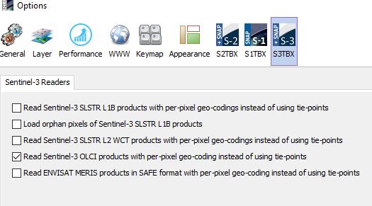
Try switching to the pixel-based geo-coding before opening the next OLCI product.
Select Tools / Options from the menu and select the S3TBX tab.
Mark the OLCI option.
If you now reproject, the alignment with coastline should be better.