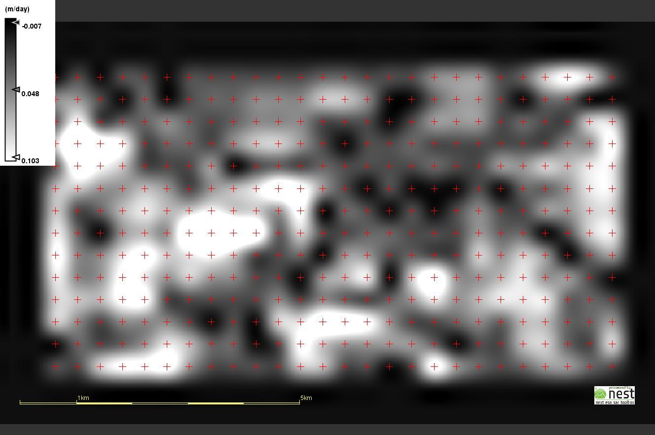
Task - to determine the speed of the movement of ice on a glacier Enylchek N 42,16; I 79,83.
The maximum speed is up to 0,5 m/day, average annual to 0,2 m/day
Data: Sentinel1 GRD
In Sentinel 1 Toolbox in Offset Tracking Tutorial for image 1 and 2 “Apply Orbit File” is executed and 2 files are received:
3) S1A_IW_GRDH_1SSV_20160805T004806_20160805T004831_012458_01376C_99F7_Orb
4) S1A_IW_GRDH_1SSV_20160818T123356_20160818T123421_012655_013DE8_E28F_Orb
then for files 1 and 2 “Coregister the images into a stack” with SRTM 3Sec is carried out.
The program is not carried out there are mistakes:
“Empty region”, when opening only files 1, 2.
“Cannot construct DataBuffer” when opening files 1,2,3,4
In what reason?
Memory 4 Gb, OS Windows 7/64
concerning the procedure shown above it is correct? The program itself uses result performance of “Apply Orbit File”, without participation of the user?
You need to update the orbital information using precise state vectors (Apply Orbit operator) then co-register the two products (containing updated orbits) using a DEM to remove any geometrical mis-registration due to topography. You might not have SRTM coverage over your area of interest, in that case use the GETASS DEM in co-registration. Then you may proceed with the offset tracking.
It is preferable to use products from same relative orbit (track). This information can be accessed in the product abstracted metadata (within SNAP) or before downloading the scene from the view product detail option in SciHub.
Dear Sir!
As I understand it is necessary that both images had identical number orbit-track or number relative orbit and Pass direction?
Concerning the procedure shown above it is correct? The program itself uses result performance of “Apply Orbit File”, without participation of the user?
Best regards!
Alex
Thanks for information. I am a beginner in this method therefore some moments are not clear to me. I understand that it is necessary to use results of the previous steps for performance of the following. Therefore in Toolbox it is unclear as result performance of “Apply Orbit File” are used, if in the following step primary images are entered?
Or the program does it automatically?
The inputs for the offset tracking operator are DEM-based co-registered images.
Applying orbits is optional, but usually it is preferable, especially when you are using not-recent scenes for which precise orbits are available (20-days after sensing).
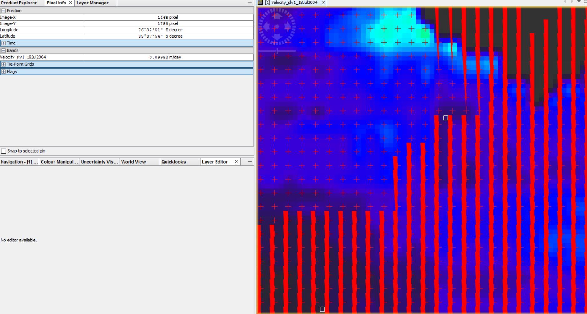
that’s impossible if we don’t know about your input data, which steps you have processed, how big your subset is, ect… Please provide more information.
Digitize a polygon around your area of interest and save your product
Use the Land/Sea mask module to clip out this area: Instead of masking the land or sea, use the third option where your geometry is used as the mask extent.
Run the offset tracking again with your masked product.
Hi guys, I have geocoded the velocity product and converted to Geotiff and it works pretty well. However, I am not sure how to convert the velocity vectors into ESRI shapefiles.
I have tried couple of ways but the heading (direction) shows the vectors in degree in SAR geometry not the WGS84 geometry. Any clues ?