Mistakes in Sentinel 1 Toolbox in Offset Tracking

You need to update the orbital information using precise state vectors (Apply Orbit operator) then co-register the two products (containing updated orbits) using a DEM to remove any geometrical mis-registration due to topography. You might not have SRTM coverage over your area of interest, in that case use the GETASS DEM in co-registration. Then you may proceed with the offset tracking.
It is preferable to use products from same relative orbit (track). This information can be accessed in the product abstracted metadata (within SNAP) or before downloading the scene from the view product detail option in SciHub.

Dear Sir!
As I understand it is necessary that both images had identical number orbit-track or number relative orbit and Pass direction?
Concerning the procedure shown above it is correct? The program itself uses result performance of “Apply Orbit File”, without participation of the user?
Best regards!
Alex

Thanks for information. I am a beginner in this method therefore some moments are not clear to me. I understand that it is necessary to use results of the previous steps for performance of the following. Therefore in Toolbox it is unclear as result performance of “Apply Orbit File” are used, if in the following step primary images are entered?
Or the program does it automatically?

The inputs for the offset tracking operator are DEM-based co-registered images.
Applying orbits is optional, but usually it is preferable, especially when you are using not-recent scenes for which precise orbits are available (20-days after sensing).

Problem with Offset Tracking velocity map generation

I used offset tracking using S1 A GRD data but it was not producing the velocity map.

anyone can know why because of it’s like that?

that’s impossible if we don’t know about your input data, which steps you have processed, how big your subset is, ect… Please provide more information.

I processed S1A (IW mode) GRD data (20161209 and 20170102)

Followed steps:

  1. Apply orbit file
  2. Dem assisted coregistration
  3. Subset
  4. Offset tracking

Subset area: 20x5 Sq Km

When I opened this velocity map in NEST, It showing like this,

In SNAP it’s showing like this…,

I think the search area is too big. Do you expect change within the whole image?

In the tutorial only the area where change is expected is used:
http://sentinel1.s3.amazonaws.com/docs/S1TBX%20Offset%20Tracking%20Tutorial.pdf

Can you try:

  1. Digitize a polygon around your area of interest and save your product
  2. Use the Land/Sea mask module to clip out this area: Instead of masking the land or sea, use the third option where your geometry is used as the mask extent.
  3. Run the offset tracking again with your masked product.

Balu you are probabbly opening mask file. You should opne band. I have used this operator, it works well. However, I follow these steps

  1. Apply orbit file
  2. Coregistration
  3. Offset Tracking

Dear Tania,
Did you try with the large area of a glacier? For my case, it’s giving good results only for the small area (2km x 3km)

Dear Tania,
When I am opening band then also it’s not giving velocity map.

Hi guys, I have geocoded the velocity product and converted to Geotiff and it works pretty well. However, I am not sure how to convert the velocity vectors into ESRI shapefiles.
I have tried couple of ways but the heading (direction) shows the vectors in degree in SAR geometry not the WGS84 geometry. Any clues ?

Sorry for late reply

Check whether your coregister image appears well. Then again apply offset tracking tool and let me know

Hi everybody

Do anyone know how to find velocity direction after applying offset tracking tool?

Open the layer manager, click on add (+) and select Offset Tracking Results (or something similar, should be there)

I have opened it but there is nothing like that I want

Yes i enabled coregistered GCP movement but it gives results like this which are not helpful for me.

I need direction in terms of degrees. Is there any way to find it?

This indicates that the module didn’t produce correct results. Is the offset image reasonable? A lager screenshot of your data would help us to understand it better.

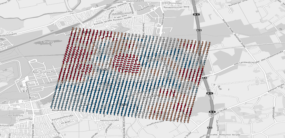
The “Coregistered GCP Movement Vector” does not display the results of the offset tracking tool. It shows the shift of the slave image resulting the coregistration and was already created before the offset tracking.

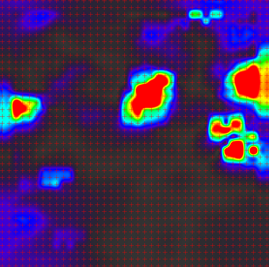
If this is your velocity map, the red crosses indicate where the displacement vectors are located

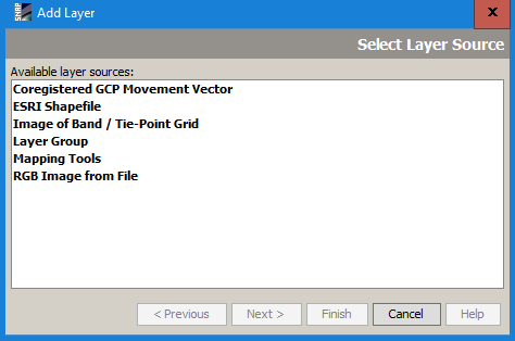
But you are right, there is no longer a map element for the results:

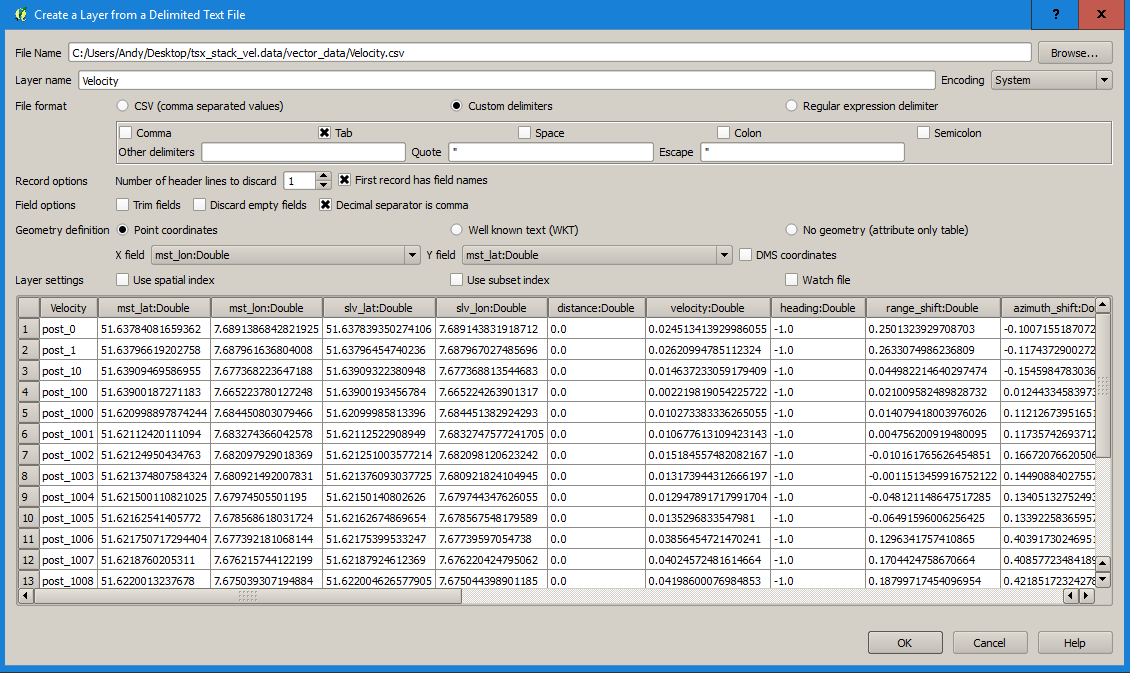
You can however open the generated file velocity.csv (in the data folder > vector data) in a GIS and display it based on the attribute columns:

2 Likes

I’m fascinated to know what was moving in this urban area please (with enough velocity to be detected by Offset Tracking)???

Many thanks

Andy

I believe that is not real movement but a display of “Coregistered GCP Movement Vector” as explained by @ABraun above.