I am trying to replicate an old IDL program with SNAP in python and I have the following problem:
In IDL a ER-Mapper File (without geoinformation) is combined with the geocoding of a reference image.
Afterwards this is saved as tiff with geoinformation.
I try now to do the same in python.
As a preparation I converted the ER-Mapper file to a tiff.
Then I use snappy.ProductUtils.copyGeoCoding(ref_image, target_product) to copy the geoinformation from the reference picture to the new target product.
The target product has now geoinformation. But this information has a shift of one pixel length in east direction (north south is correct).
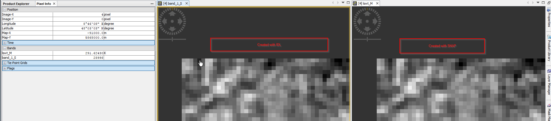
I made a screenshot where this is (a little) visible:
So the one in IDL created has one pixel more on the left side, what about the right side? Is there one pixel missing? Is the total width the same?
What happens if you open the files in another program, e.g. ArcGis or Envi? Finally, at which position is the black pixel in the original file?
Hello,
sorry for the late reply.
I found out by now that this could be releated to the pixel offset.
In the BEAM Help I found (http://www.brockmann-consult.de/beam/doc/help/general/BeamDefinitions.html):
Pixel coordinates In the BEAM software, pixel values always refer to the upper left corner of the pixel.
Is this also true for SNAP? Is it possible to configure this in SNAP?