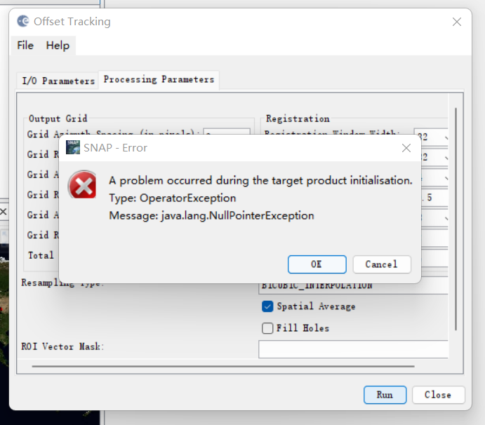
I would like to obtain the pixel offset between two ERS products. For this is thought of using the offset tracking tool (is it correct ?).
I have followed the tutorial (Apply orbit, DEM coregistration). When I try to apply the offset tracking I obtain this error: “Cannot find master or slave amplitude or intensity band” eventhough I can see the intensity bands in the input product.
Do you have a solution ?
In the offset tracking tutorial, there is no Range Doppler Correction. So if I want to do the step, should I put it before or after Offset Tracking? Thanks. Step of tutorial like this:
GRD Data
2.Apply Orbit
3.DEM Assisted Co-registration
4.Offset Tracking
I’d say first the offset tracking and in the end terrain correction.
TC involves resampling of your image, probably preventing correct offset estimates.
Thanks for you response. And I have an another question, how do I choose the right parameters?After all, different results will be got due to different parameters. Or, are there any evaluation indicators to evaluate image? And we can obtain the best parameters. Thanks again.
Lots of trials and errors until you know your area of interest.
For your first question, understand that georeferencing always implies resampling with its drawback (modifications of the speckle pattern, crucial for offset tracking). It the reason why it is always advised to always put the Range Doppler Terrain Correction as far as possible in your process.
How can we find the resolution of the generated velocity products through offset tracking?
for example, if i use the Grid azimuth and Range spacing of 40 pixels, does that mean the resolution of the result velocity product is 400 m?
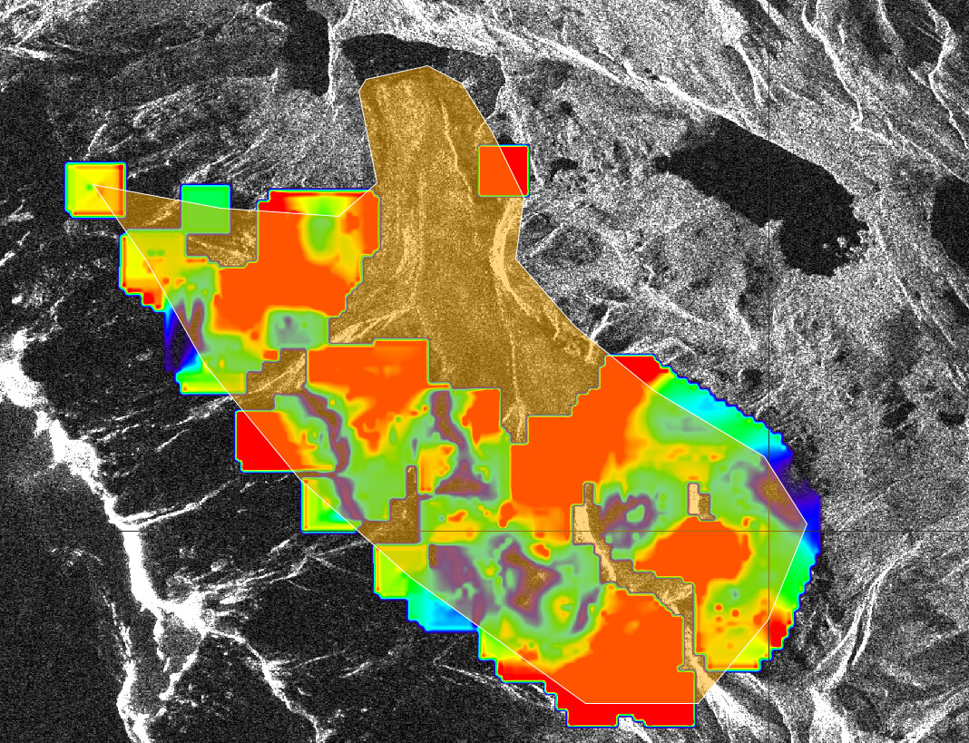
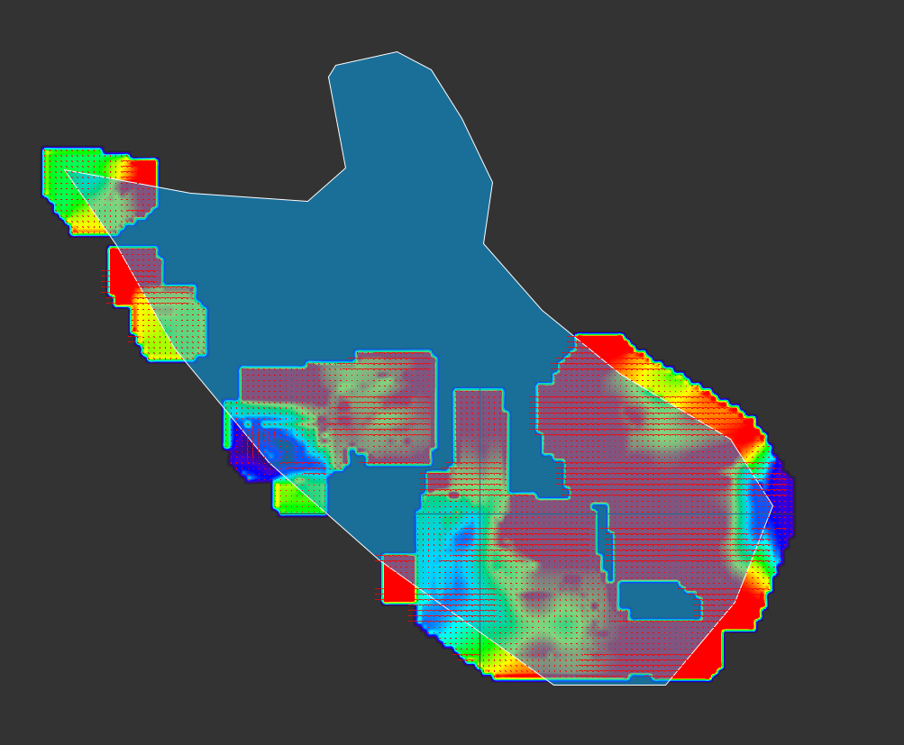
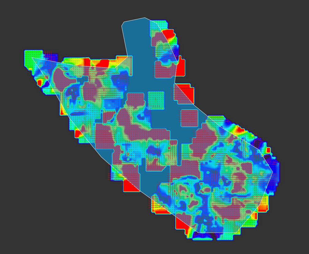
Regarding an offset tracking performed in some patagonian glaciers, I found these results where the velocities at the tongue of the glacier are not calculated. I wonder what can I do to correct this. The stack was made from two S1A:
S1A_IW_GRDH_1SDV_20170320T235545_20170320T235610_015782_019FD6_D2FA.SAFE
S1A_IW_GRDH_1SDV_20170326T000352_20170326T000417_015855_01A205_43C2.SAFE
Some parameters I used:
The max velocity of the glacier is 0.8 m/d.
Registration window: one test with 128x128 and other with 256x256
oversampling 64
dear all;
I have some questions
I use the GRD s1a product to make offset tracking,
in the last step poccess “offset tracking”
someting wrong i will be very happy if someone can help me!