Are you using the 64-bit version of SNAP?
Yes. Use 64bit Win SNAP
8GB RAM, i5
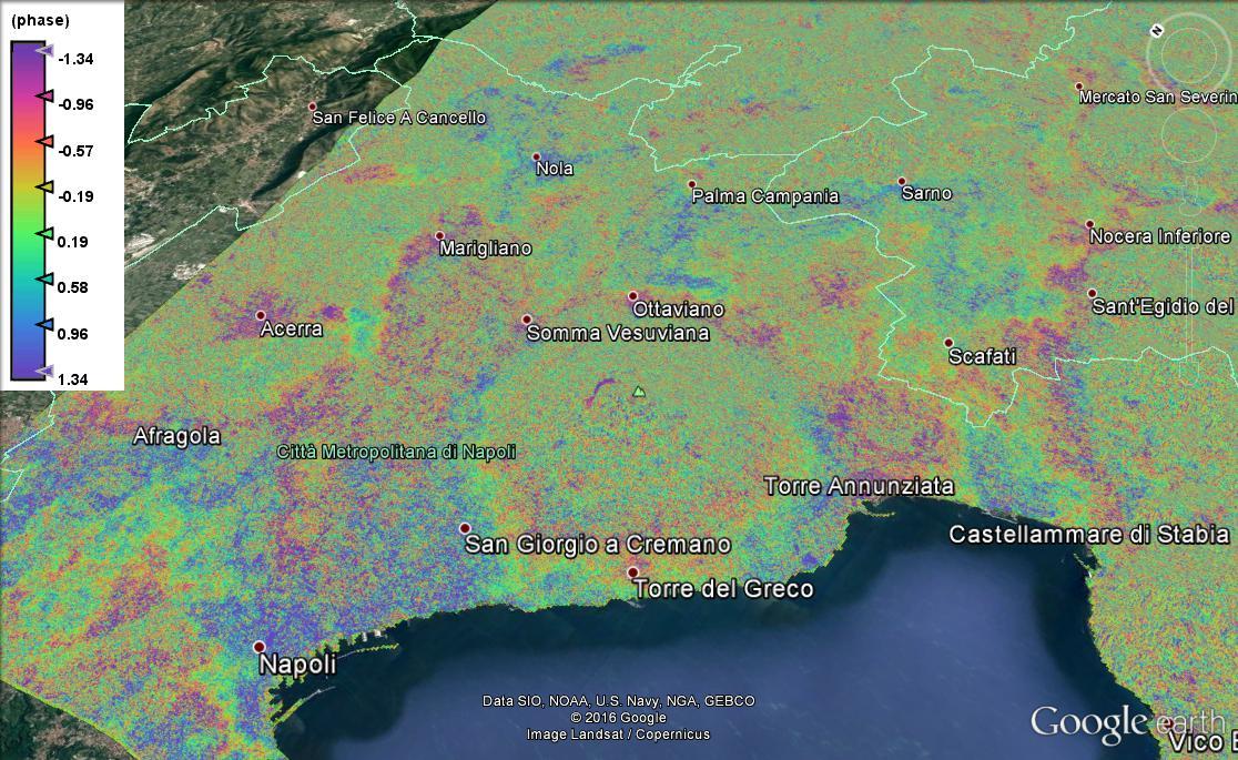
consider multi-looking before the export which helps you to reduce the number of pixels. The KMZ is a resampled product anyways.
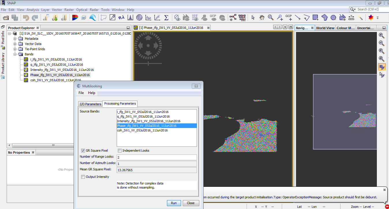
Thank you, YOU CAN Being more detailed (.multi-looking) Another thing I have to open the file TOPSAR Deburst or that obtained from Interferogram ???
Menu > Radar > Multi-Looking
Use the interferogram as an input and choose a higher number of looks, see how the resolution changes.
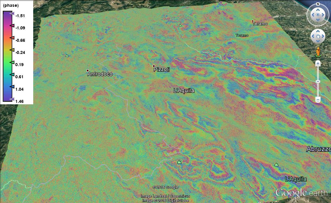
Open the Interferogram in your view, you can also zoom to the area of interest or clip a focused part in order to decrease the file size KMZ.
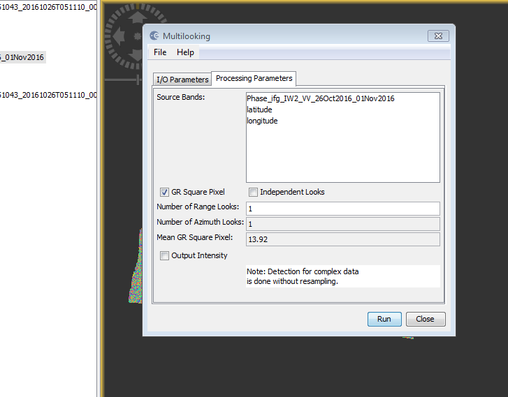
yes, select phase_ifg_IW2… and enter 5 range looks, for example. Your resolution will be around 80m but at least you can export the result in Google Earth.
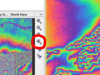
I also noticed that you displayed a larger area than your data actually covers. I’m not sure but this could additionally increase the disk space required for the exported file. Zoom to the data you need. You can also use this button to zoom to the whole extent:
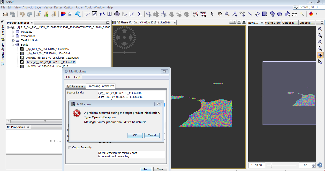
you didn’t use the interferogram as an input for the multi-looking. [quote=“ABraun, post:49, topic:4123”]
Menu > Radar > Multi-Looking
Use the interferogram as an input and choose a higher number of looks, see how the resolution changes.
[/quote]

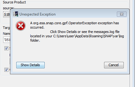
please don’t just post screenshots of the errors - we can’t help you like this.
Tell us what data you are using, what have you been doing with it and at which step (under wich parameters) the errors occurred.
Thank you. Then I tried a different file smallest of interferogram Size And I turned on the Menu> Radar> Multi-Looking And here is the RESULT. In the passage in Exporting to Google Earth KMZ me this error.
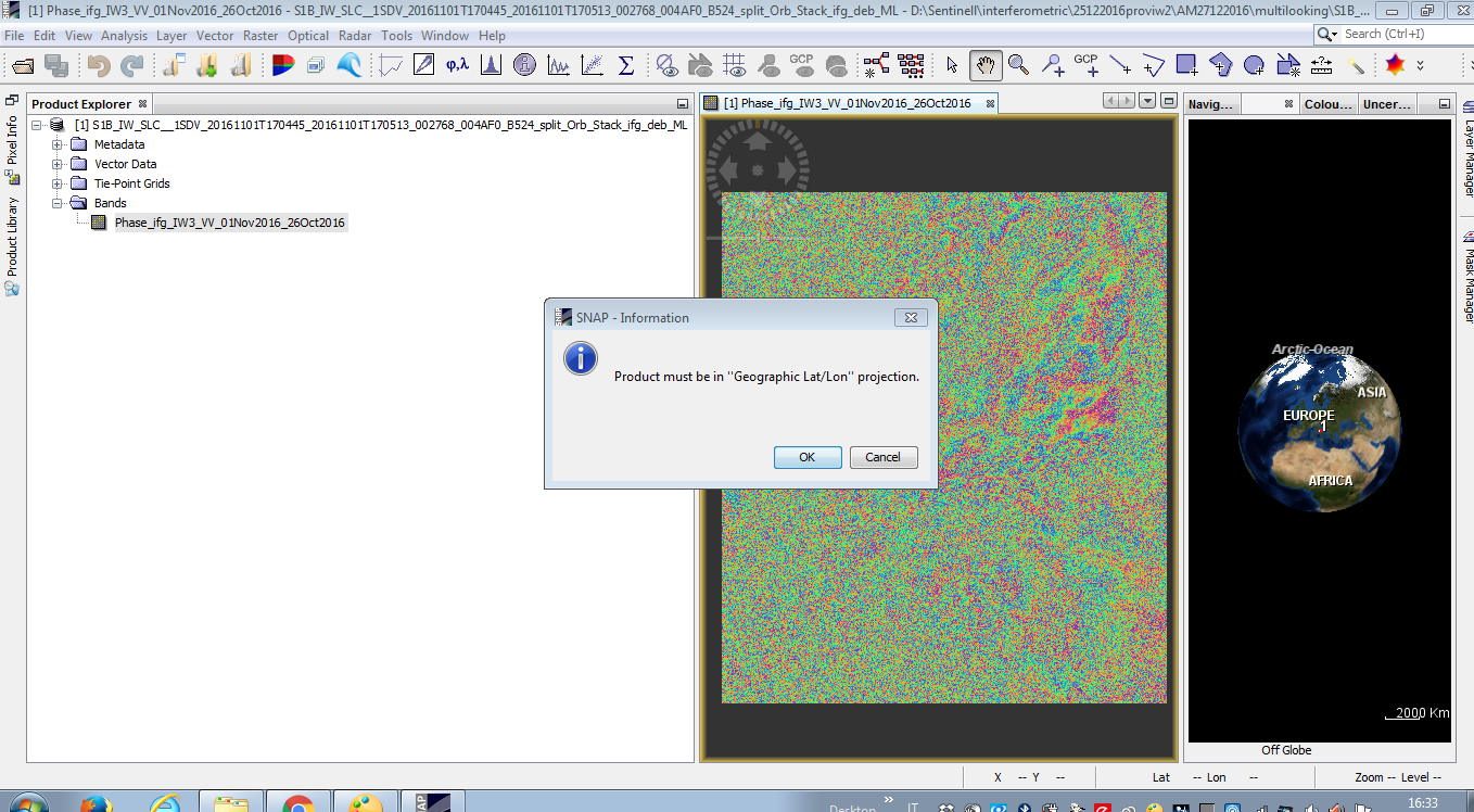
then follow this step to bring it in lat/lon projection.
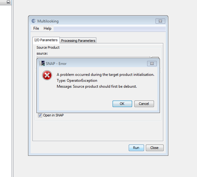
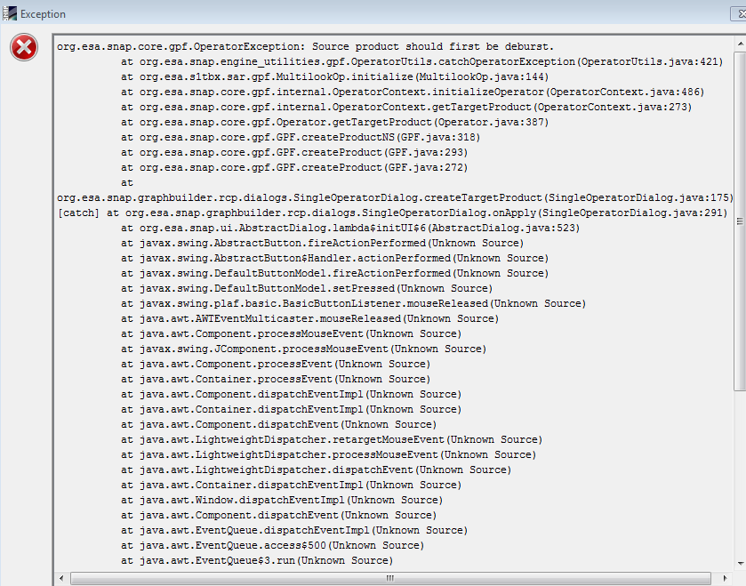
I then took interferogram generated files, I tried multi-looking. and I see this error. What is the reason?

I also tried to restart SNAP and PC but nothing.
if your data still has black stripes you should use the TOPSAR Deburst module first. But as you did the same with the interferogram already I guess there somewhere is the debursted version in your data.
I am sorry but it looks a bit like you lost overview over your data. Try to keep a clean file structure to avoid such errors.
All in all, it’s down these few steps:
- coregister and deburst your data
- calculate the interferogram
- multi-looking
- Range Doppler Terrain correction
- Export to Google Earth
thanks a lot I try again !!
if you want to compare interferograms of different dates you will have to apply the topographic phase removal first.
The subsequent task, phase unwrapping, can not be done in SNAP. You’lll find informations about it here: