i have a very general question regarding sentinel 1 sar images. The raw data directly from the safe folder contain the valid image as well as a 0 background (that’s the no-data value). If we check the dimensions of this array simply by performing a gdalinfo to the tiff file we will see (if not wrong here) that the dimensions refer to the actual data (ignoring the no-data background). After warping the image (using the flags -srcnodata 0 -dstnodata 0) I get a file which seems to have almost the double dimensions.
Here are some more info:
file: s1a-ew-grd-hh-20180208t071218-20180208t071323-020512-023164-001.tiff
Size is 10527, 10710
after warping: gdalwarp -tr 50 50 -multi -srcnodata 0 -dstnodata 0 -order 3 -t_srs "my projection"
Size is 17959, 18039
Since the EW mode comes with a 400 km Swath, 25 x 100 m spatial resolution I wouldn’t expect that choosing 50m resolution, would double the first dim of the matrix. So what those matrix dims refer to? Do they include now also the no-data background?
That is a EW GRDM-product with a pixel-spacing of 40x40 meters. I cannot comment on the gdalwarp-part.
Indeed thanks for spotting this mistake. However this strengths my argument that the dimensions should not be changed so dramatically. So still no idea what they actually represent here…
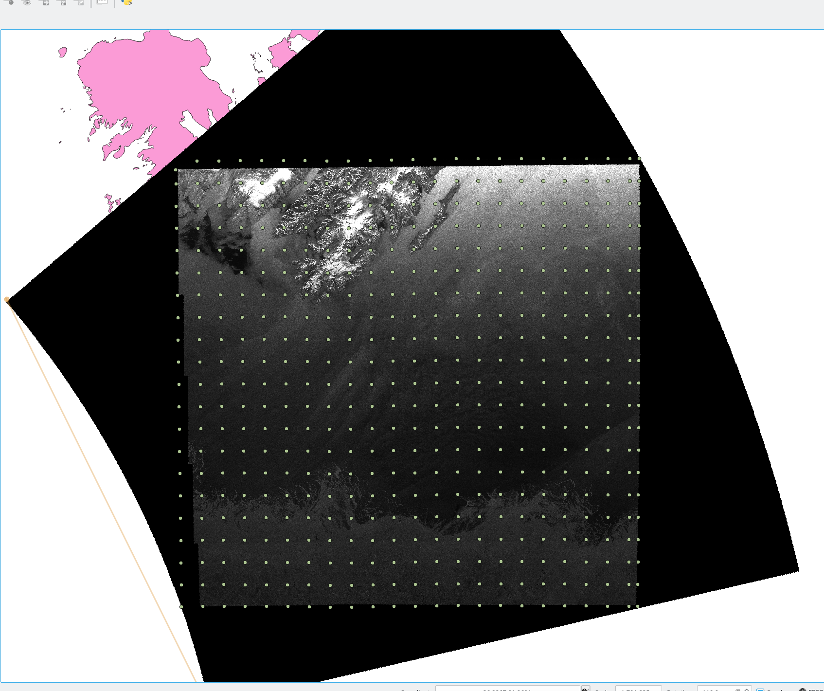
Ok I see, this is something I did not take into account. I guess since I warp the image it rotates. This would mean that the new dimensions, include the no-data pixels. In raw data I think that this is not the case but I might be wrong. For the above-mentioned raw image you can see the GCP’s plotted on top. GCP’s map the pixel position to positions in a given spatial reference system. GCP’s start from 0,0 position which (kind of) coincides with the UL corner and ends up to (10526,10709) which is the LR corner and its also the dimensions of the raster file.
Am I wrong if I say that the matrix dims contain only the valid data? My goal is to assign some ground control points to the warped image, although it does contain a projection… But I am lost how to calculate the correct pixel index for a given lat/lon.