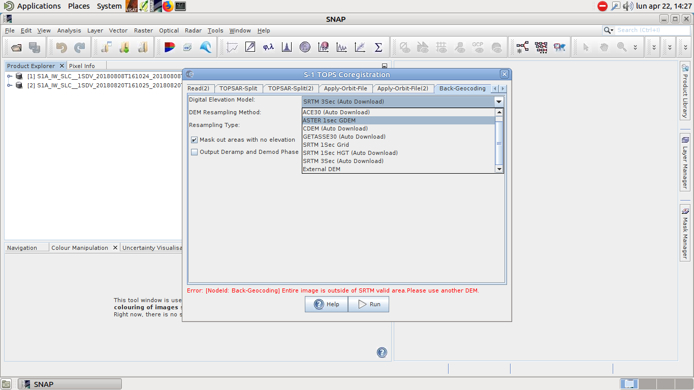
I would like to study the earthquake in Alaska using InSAR and SNAP processing but I found that there is no SRTM DEM in that area. I chose the ASTER DEM option for backgeocoding step in Coregistration processing. When I saw the produced interferogram, I found it in the same color means there is a fault in my selection. So, could you please guide me about this issue?
I can find and download it simple using earthexplorer.usgs.gov but I don’t know about the suitable format for SNAP because after downloading, I should mosaic them. Could you please tell me which format is suitable? Envi standard or Geotiff?
Thank you so much for your great information. In your view, AW3D DEM can be a good case as External DEM in SNAP? and also, I should give the SNAP software the DEM as same size as whole of S1 image or only my study area?
It is interesting to see your result in testing both since AW3D DEM, is very high resolution, in my personal opinion too high resolution DEM doesn’t affect the result, since the resolution of S1 is much higher.
AW3D DEM has an as same spatial resolution (30m) as the SRTM 1 sec but it is a little difficult to download the external DEM for the whole of S1 image.
Excuse me, the GETASSE30 (Auto Download) also works now?! Because, I saw the another post so that the guys said this option global and good enough for TOPS-coregistration.