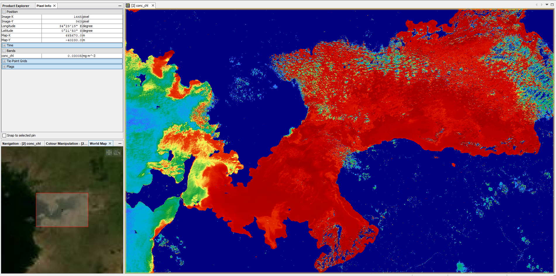
you; re right, sorry. It was masked for Sentinel-2 data, so I assumed it would be the same for every input. But I tested it and got the same result at first:
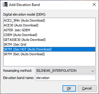
You can select “Add Elevation Band”, to get SRTM elevations into your product
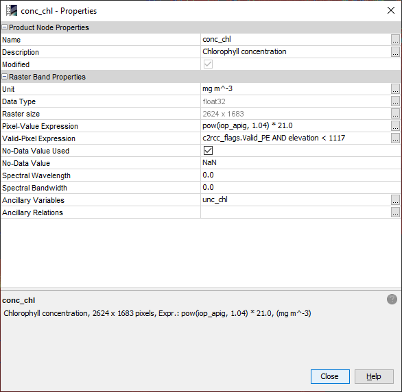
Then you open the band properties of your cocentration raster and add
AND elevation > 0 (0 if you’re working in coastal areas, the constant value of your sea surface, when you are working with inland water bodies, I had to select 1117 meters for Lake Victoria)
to the valid pixel expression (there is already some term defined, so let’s leave it in there)
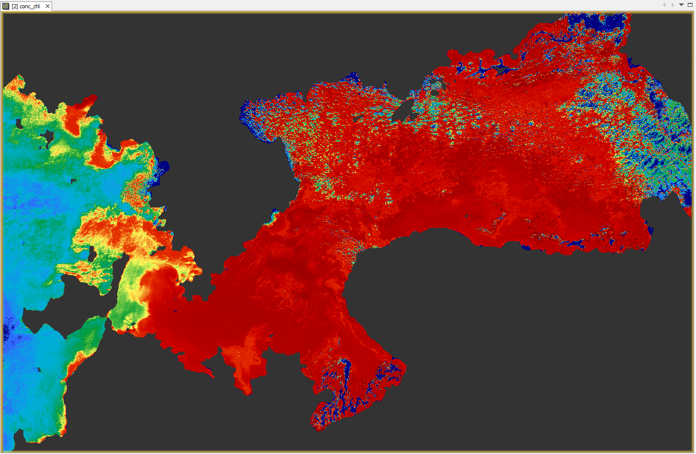
This is the result:
Is this a work-around you could use?
By the way: The reason why the Land/Sea mask operator failed (it did for me) is probably, because SRTM is in lat/lon coordinates and the Landsat product is in UTM coordinates. So another option would be to reproject your data to WGS84 and run the Land/Sea mask operator again.