Ok, I will!
(Already ordered, still waiting to receive it).
Thank you very much!
hi
I try to make a DEM from urban area with sentinel -1 repeat pass data
I make it like gyLona said
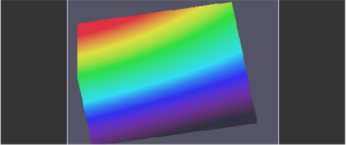
but i have a problem , when i do Terrain correction (range doppler trrain correction) , it just show a surface without any topography and object!
how can i solve it?
can we make an urban DEM from these data?
what is the difference between this method and DEM generation option in the S-1TBX?
in DEM generation option help says we shod use the output of stitch operator , i can’t find this operator in software, i know what it do but where is the stitch operator?
and another question
how we can remove atmospheric effect from this DEM in the repeat pass mode?
I don’t think you can extract urban altitudes with S1 repeat pass interferometry in a good quality.
However, the ramp should not exist, you’re right.
Which data did you use? Mode / dates of acquisition?
Maybe this gives you some more information about phase evaluation and atmospheric effects:
1 Like
i use IW TOPSAR Sentinel-1 data
S1A_IW_SLC__1SSV_20150324T143514_20150324T143541_005175_00686A_F1B7
S1A_IW_SLC__1SSV_20150417T143515_20150417T143542_005525_0070F5_FC2C
these are my data
did you get good coherence values? I could think that 24 days are a bit too much. You could try 12 days - or even better a Sentinel-1 A+B image pair.
1 Like
where i can download sentinel B data?
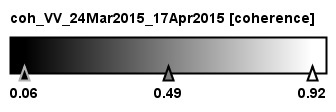
a histogram of your coherence would surely reveal more information than the legend.
S1B can be downloaded at the same locations where S1A is available. Just make sure you use data from the same track.
https://scihub.copernicus.eu/dhus/#/home
https://vertex.daac.asf.alaska.edu/
https://peps.cnes.fr/rocket/#/search
but when i try to download S-1 B data , it seems to there is not any data downloadable!!
it seems that s-1b donesn’t have complete data over the world
S1B launched in April 2016 and first images were available since late summer.
Additionally, different parts of the earth have different coverage rates:
https://sentinel.esa.int/web/sentinel/missions/sentinel-1/observation-scenario
These sites are very good
But I want images from capital of iran, tehran
It show that there is no data from sentinel 1 b
Hello,
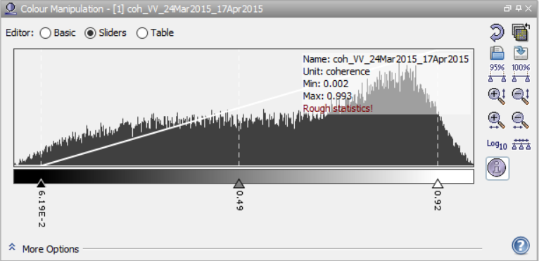
I have a problem to understand the coordinates in SNAP.
I have an image for a site located in Canada.
In the left-top corner I have two different coordinates for the same pixel.
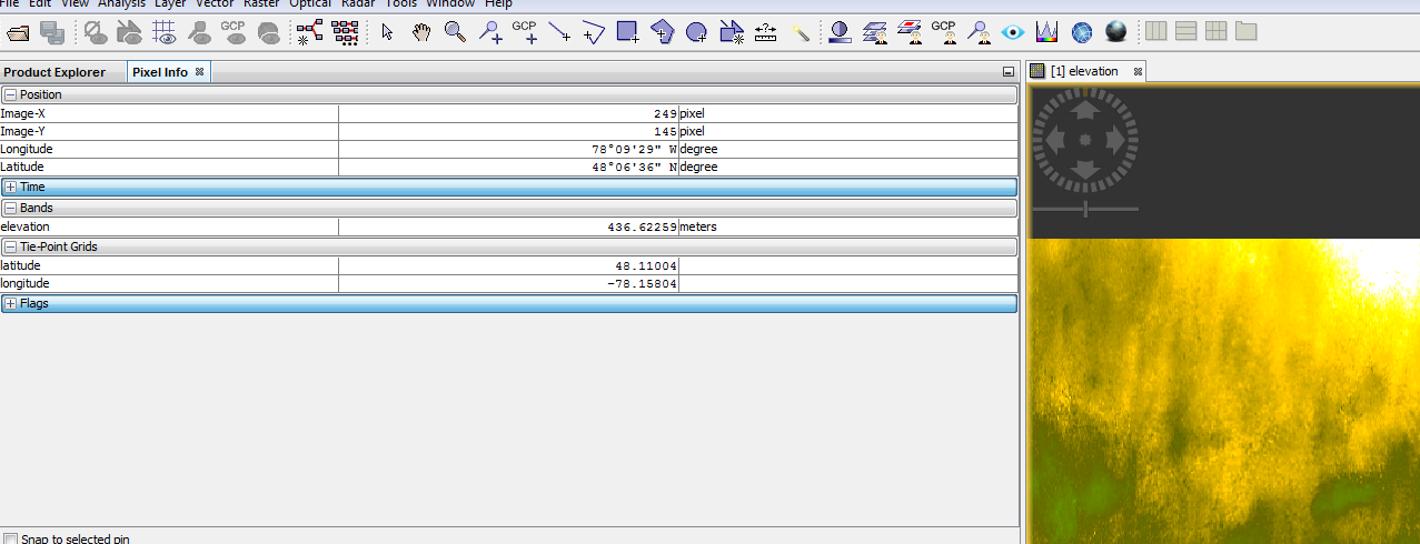
Moreover, the coordinates in the right-bottom corner are:
2/ Can export a DEM to a xyz table? [lat, long. Elev]
Thank you
Top-X and Top-Y are the numbers of pixel in your image. The first one should be 0,0
Longitude and Latitude (under position) are your coordinates in WGS84 in degree, minute second.
Longitude and Latitude (under Tie-point Grids) are your coordinates in WGS84 in decimal degree.
They mean the same, it’s just a different notation: http://www.onlineconversion.com/map_decimaldegrees.htm
1 Like
Thank you, I should be very tired yesterday 
There is a method to export the image (DEM) to a xyz table (lat, long. elev)?
unfortunately not.
But you could do it with GDAL. I just tested it and it works fine with the img-data in the .data folder:
gdal_translate -of XYZ input.img output.xyz
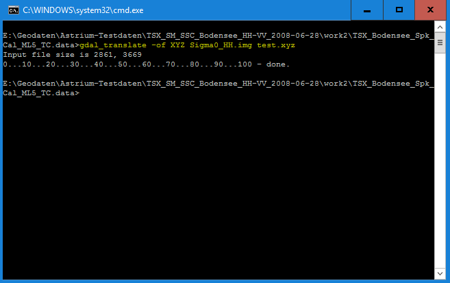
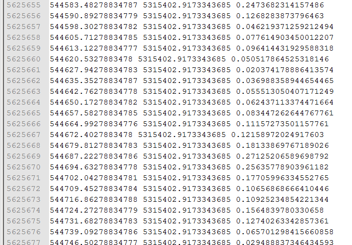
Thank you, It works!!