Dear Andreas (@ABraun),
thank you always for your help. My question is again related to this other my post Sentinel 1 data : terrain correction but now I am interested in comparison of a DEM downloaded and the one obtained after the Terrain Correction.
Briefly, I have downloaded a tile for SRTM1sec from https://dwtkns.com/srtm30m/ including my ROI and then I have imported it in SNAP.
- SRTM downloaded
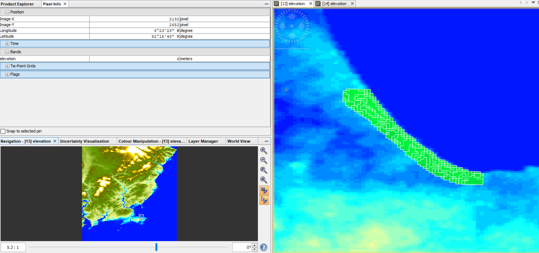
Relatively to my ROI, the height is between 1 and 16 m (and 0 is associated with the sea).
Then I have applied all the steps for InSAR DEM and in the tool Terrain Correction, I have ticked the box “DEM” and to have the same resolution of the DEM downloaded I have put as Pixel spacing (m) the value 30.
The band “elevation” in the final product is shown here:
- SRTM1sec DEM from SNAP
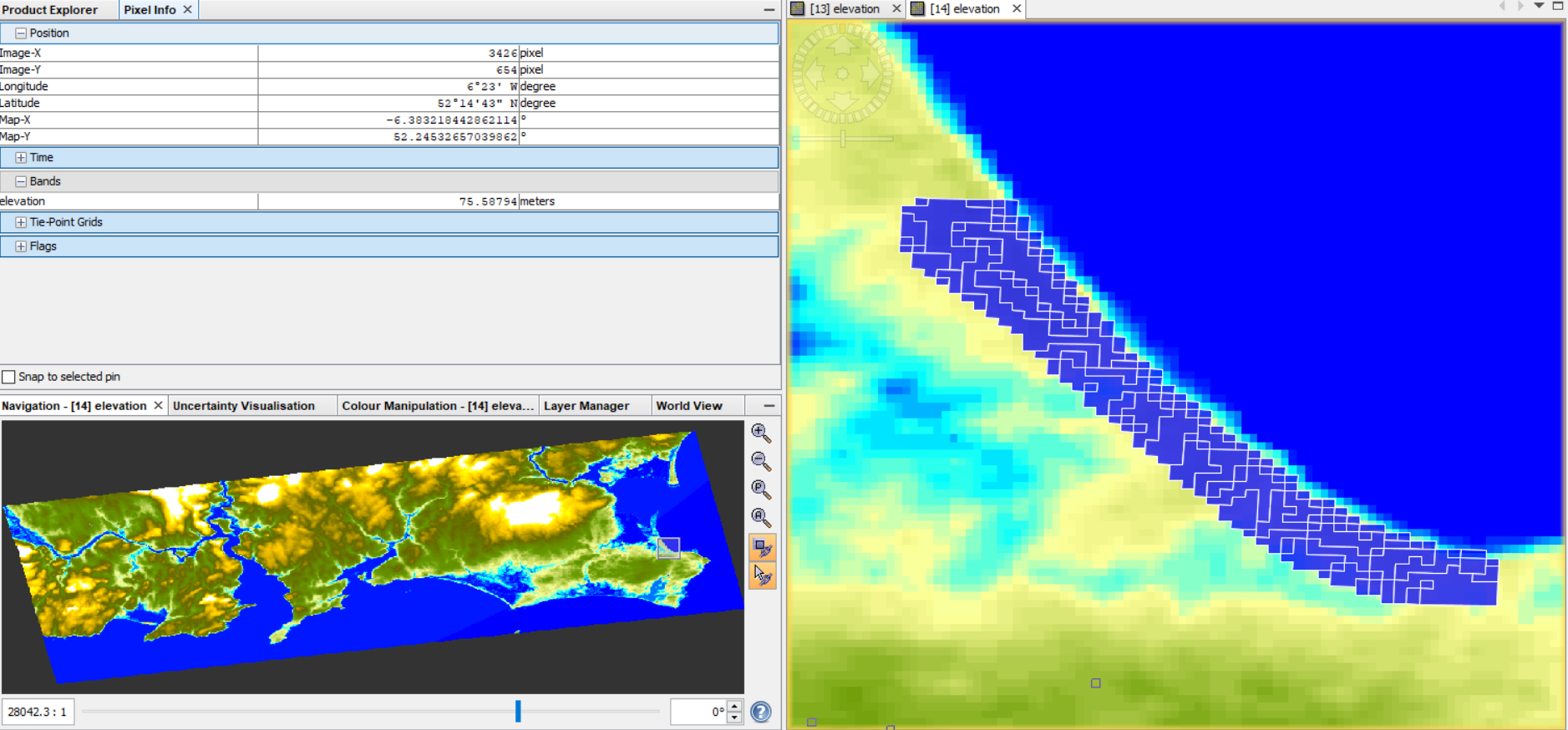
The problem is that now the range of height values in my ROI is completely changed (from 57 to 67 m) and at the pixels belonging to the sea is associated values around 55m.
This happens also if I use as external DEM, the one that I have downloaded.
Now I have read that probably this difference is due to the different system reference used as reported here Problem with Elevation Band.
So my questions are:
- Is this an explanation for these different height values?
- If it is true, also the DEM generated by InSAR technique is referenced to the ellipsoid?
- Is there a way also in QGIS to change this reference to the geoid?
Thank you for your support and guidance.
S Savastano