Hi Marcus (@mengdahl).
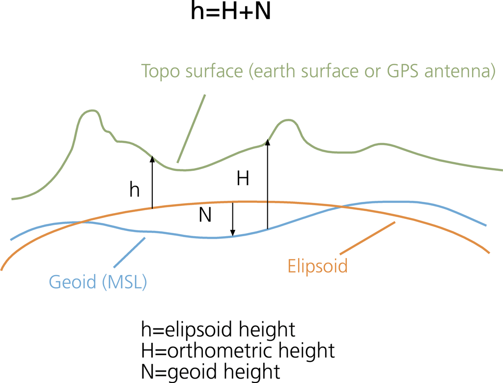
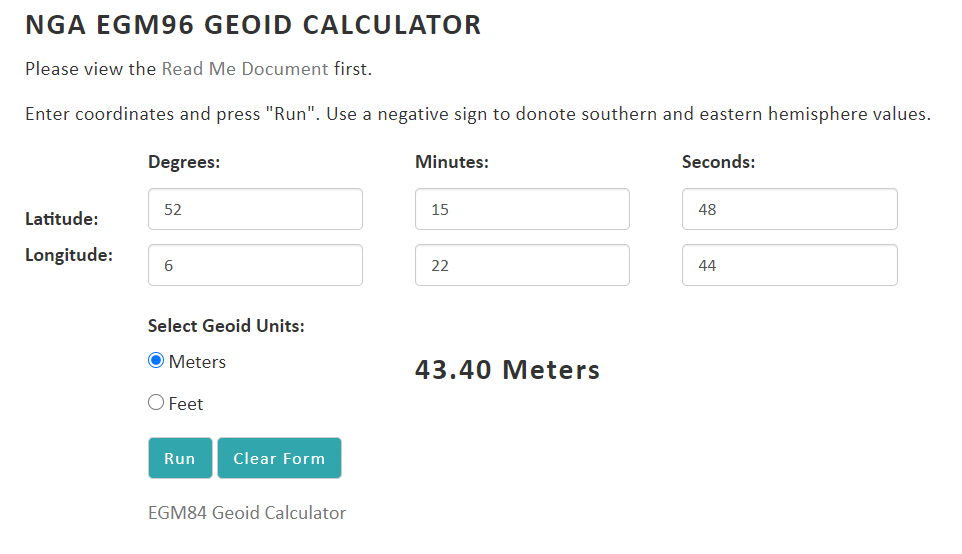
yes I agree with you but the weird thing is that if I used the lat lon of a pixel belonging to the sea and then I calculate the difference N between geoid and ellipsoid
Sorry Savastano, I didn’t fully understand your question before and wasted your time. Yes, you are right that EGM96 based SRTM DEM is converted to ellipsoid based DEM in SNAP and used for all position related calculation. The DEM output in Terrain Correction operator is not the original EGM96 based DEM, instead it is the ellipsoid based DEM. It is our fault that we didn’t make it clear. Hope my explanation above answers your question.
No problem at all @jun_lu.
your explanation is perfect and thanks to you again for your support. I appreciate that a lot!
For @mengdahl:
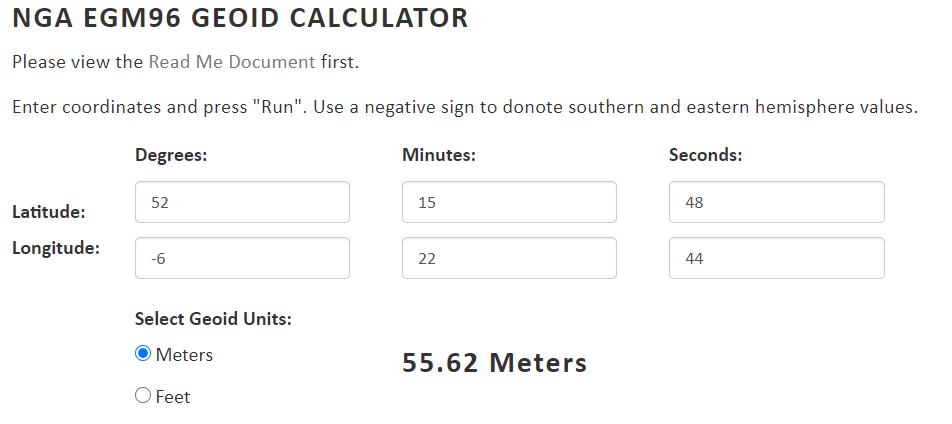
Marcus you were right, I forgot to consider the latitude in negative being in W and so recalculating the geoid for that pixel belonging to the sea, we have