The first thing yo digitize is normally called “geometry” and listed under the ‘vector data’ folder (unless you explicitly create a vector container first).
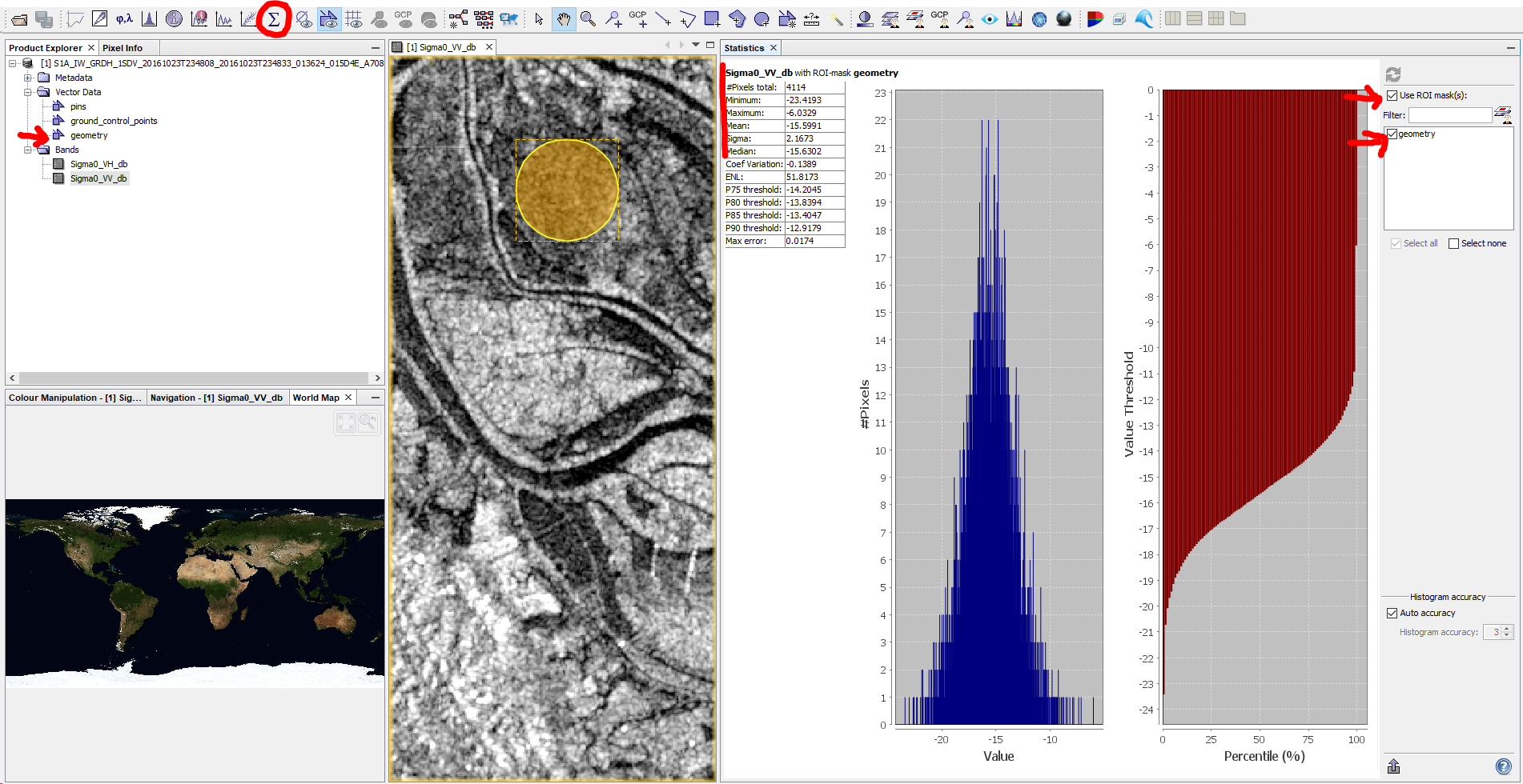
You can then use the statistics tool and limit the statistics to the ROI called “geometry” and hit “Refresh View” ![]() :
:
Actively clipping the raster with a vector is described in several other topics: Subset from shapefile