Hi, I solved this by updating the S1 toolbox of the snap. Thank you.
Greetings,
Karlmarx
Hi, I solved this by updating the S1 toolbox of the snap. Thank you.
Greetings,
Karlmarx
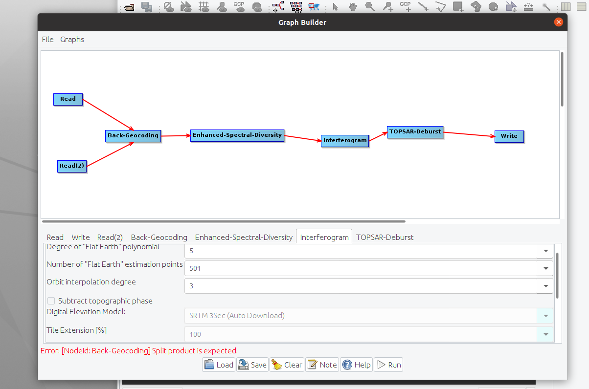
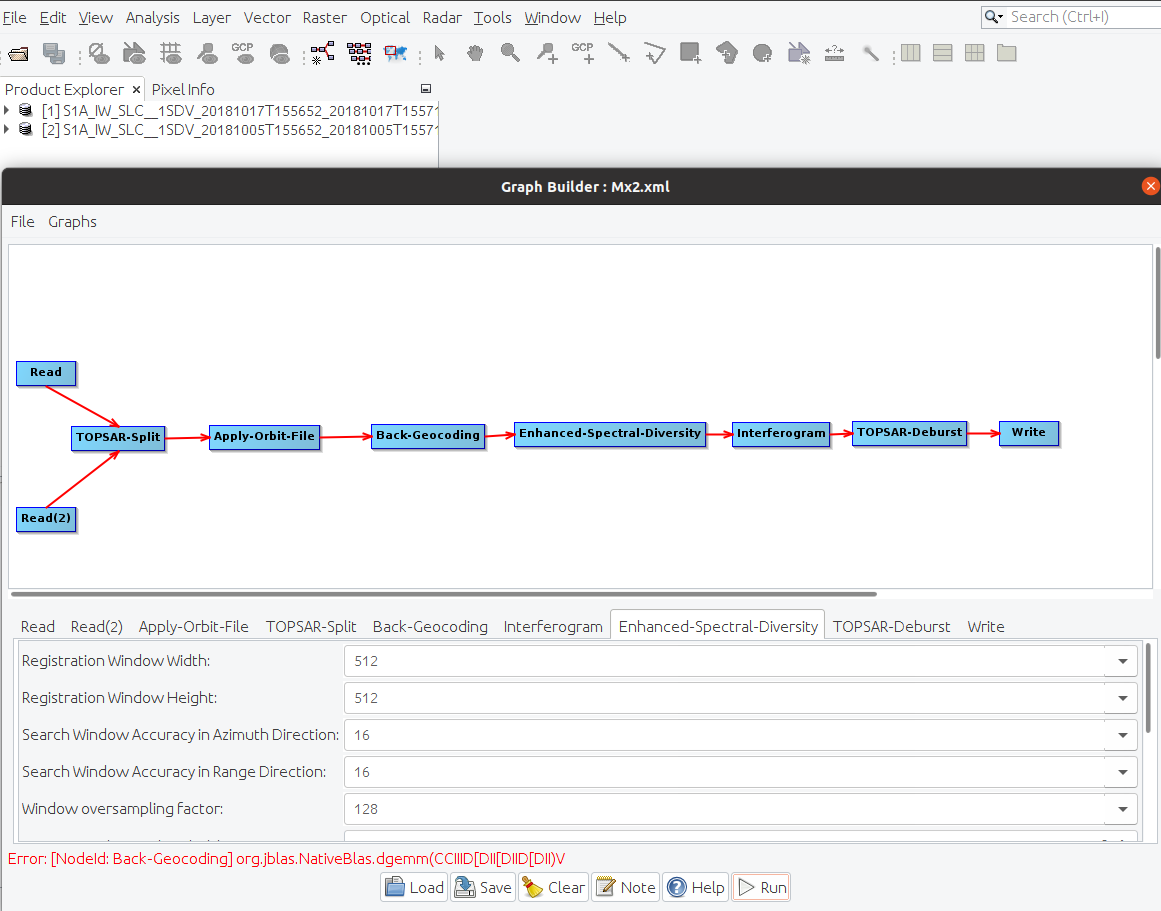
Hi there, I was getting the “Error: [NodeId: Back-Geocoding] org.jblas.Nativeblas.dgemm(CCIID[DII[DIID[DII)V”. I have followed the discussions on the platform, I installed libgfortran5. Then, I got another error. (Error:[Nodeled: Back-Geocoding] split product is expected). I believe it could be a quick thing to solve, but I have struggled. Kindly help with solutions. @ABraun @Anahita @suribabu
Do you use SLC or GRD as an input?
You need an SLC product; and use the “Split” operator (Radar → Sentinel-1 TOPS → TOPSAR Split" , and add it before Backgeocoding.
Moreover, I also don’t see “Apply-Orbit-File” operator in your model builder; did you apply it already?
I am using SLC data. My first Graph was “Read–TOPSAR Split–Apply-Orbit-File–write”. I saved this graph and used it for Batch processing. Then the error came at the coregistration stage when I added the Geo-Coding operator. @Anahita @ABraun
When I repeat the process considering the S1 images I downloaded, following @Anahita advice, the original error resurfaces.
yeah its working in linux by installing fortran3 and fortran5.
Thanks & Regards,
Hello Everyone, I was able to fix this by simply editing the name of my sentinel1 data, I removed any space in between each sentinel1 dataset name and any unnecessary brackets, then I ran my analysis again from master to splitting to coregistration making sure there were no unwanted spaces in the dataset names. I also installed all the java libraries listed above, but it was entirely because of the disjointed naming of the datasets.
If you look closely at the error it says you are trying to coregister a “null”, which means the program can’t see your dataset because there are spaces in between which definitely will result in a break. Hope this helps someone.
Hi Abraun, please how can i interpret the date format in the stamp CSV