Geocoding of the Polarimetric classification of Sentinel-1

Hi,

I have a Sentinel -1 polarimetric classified image with 0-9 classes in slant range.

I am unable to view these classes over the same raster after geo-coding.

could some one let me know how to geocode the classified image without losing class labelling information from the raster.

Thanks,

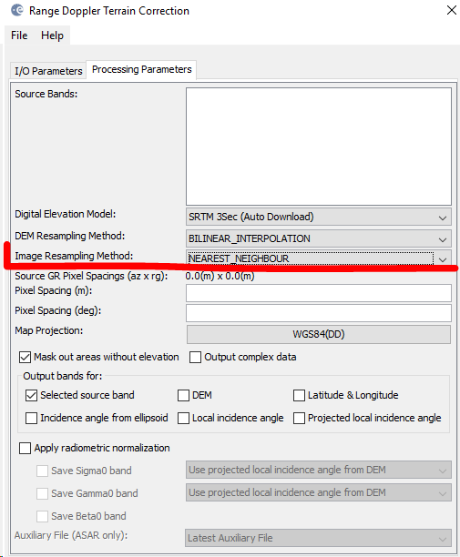
Are you selecting nearest neighbour for the image resampling method in terrain correction

I am choosing default values in the Terrain Correction module.

What lveci suggests is that you use nearest neighbour in the resampling of the image’spixels, because it is the only method which doesn’t change the actual values.Geometric correction requires to put the pixels at a new location. At this step, resampling is involved because the pixels are no longer aligned within the original grid.
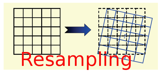

source: https://www.nicoladeinnocentis.it/en/resampling-theory

As you are dealing with ordinal values (classes 0-9) bilinear resampling is harmful because it creates averages of two (or more) adjacent pixels, thus converting the classified integers into continuous decimal values which no longer represent the classes.
Hi lveci and ABraun,
Thanks for the info.

I have terrain corrected the image as you suggested above (Nearest Neighbour in TC module for Image re-sampling method) . But I couldn’t find much change after Geo-coding.

Here are the images.

Before Geocode:

after Geocode:

Now what could be the alternate way to extract the polarimetric classified image to Geocoded data …?

open your image with the correct classifcation and color coding again, then use this tool grafik
to apply its color scheme to the newly generated data.

Even if try to open the same image without geocoding in other software, it is not showing the classified table .

  1. classes in SNAP

  1. The same image in GIS software.

02_GIS

How to bring these classes from SNAP to GIS / other mapping software’s to produce a classified map with layout.

The legend is created by SNAP and I don’t think it is possible to export it somehow for the use in another GIS