Thanks! I could import a vector on the slant range image 
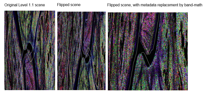
I attach some images (white lines correspond to the vector file): I had to flip the ALOS/PALSAR-1 scene (using the GraphBuilder). However, the vector was also flipped. I tried to replace the metadata of the flipped scene before re-importing the vector file. Since this not worked, I “manually” replaced the metadata using the band math trick mentioned here. Lastly, the vector was correctly oriented.
As @css said, there is a displacement of ca. 300 m (the vector should fit on the riverlines).
May be geolocation using orbit data can improve this result. For the moment, this procedure helps me to draw polygons (and find known targets) on the slant range geometry. Thanks!
1 Like