the Random Forest classifier can handle input data of different units and scales, yes.
But the distribution and size of training areas is crucial.
1 Like
I Have tried to coregister Sentinel 1A and Sentinel 2B data to implement different fusion techniques (eg. PCA, IHS, HPF, Brovery Transform). The following processes have been applied to process the datasets.
Calibration ->Deburst ->Speckle filter -> Multilooking -> Terrain correction (Range doppler) for S1A data whereas the Sentinel 2B data were resampled to match the resolution of both the datasets.
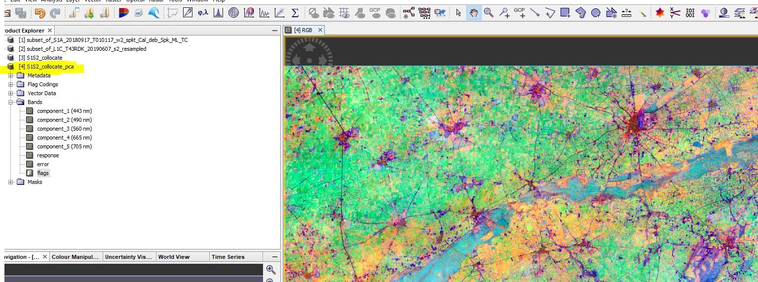
In order to coregister the data sets, I have used collocation and stack tool, and then PCA was performed (result attached) in the stacked output. Due to the unavailability of specific tools for applying other fusion techniques such as IHS, BT, HPF in the SNAP platform, the collocated/stacked data were converted into IMG format and opened in ENVI.
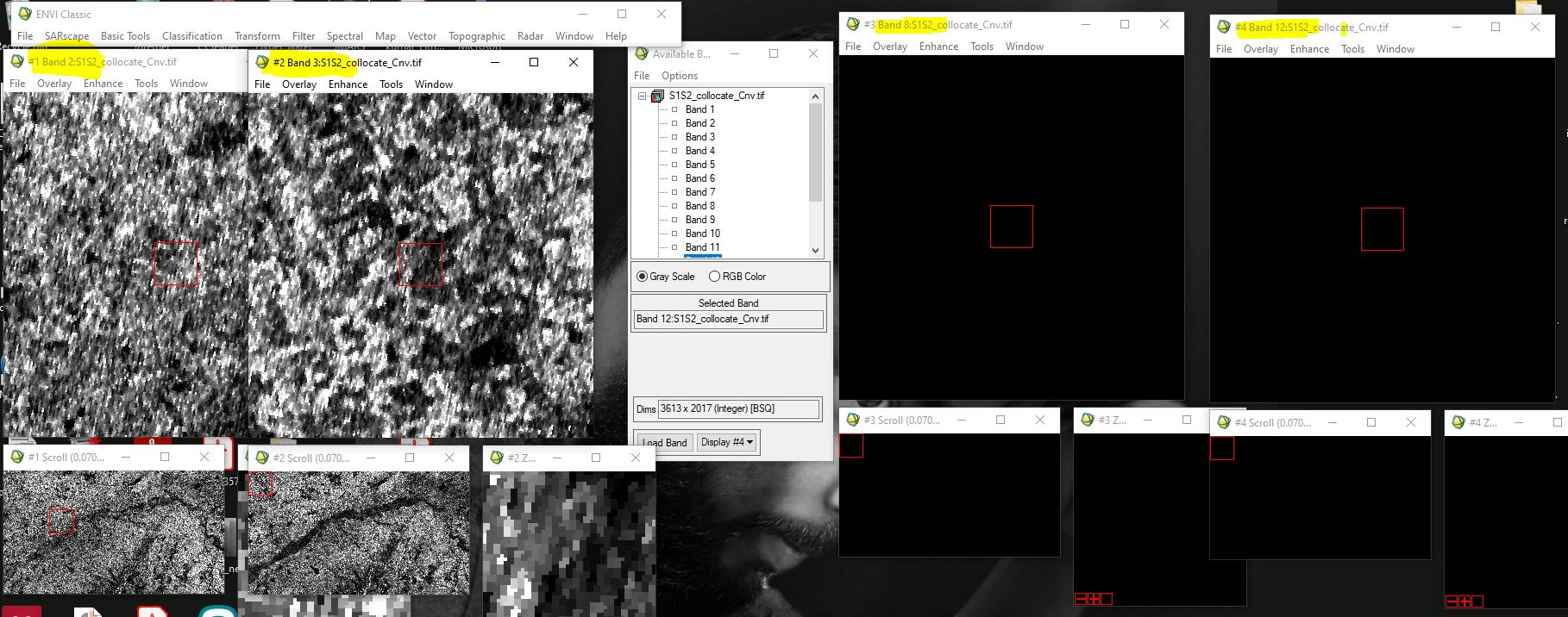
However, upon opening the image in ENVI, only the bands of Sentinel 1 data (i.e., bands 2 and 3 in stacked output) contained any data, while the rest of the bands were blank.
Therefore, my query is regarding the coregistration of Sentinel 1 and 2 data, such that:
- Why am I unable to open the remaining bands of S2A data and
- How to verify if coregistration has taken place
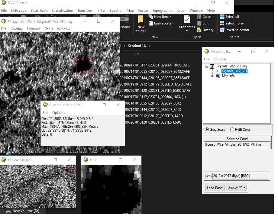
The r g b values of some pixels have become Zero after converting the S1A data into IMG or Geotiff format.
Please assist me, why this issue is occurring??
What is the bit-depth of the S1 band in SNAP and the corresponding band in ENVI? If you need to reduce the number of bits scaling the values is necessary before export.
I suggest to directly read the img/hdr files from the data folder into ENVI instead of converting the entire scene to GeoTiff.
The reasons are explained here: Export of products from SNAP
1 Like
Thank you @ABraun for your suggestion. If I read the data directly from the data folder, I need to open data as individual bands.
Please assist me on my first query…
I need to precisely co-register data of S1A and S2B for applying fusion techniques. Therefore, I have implemented collocation/stack tools available in SNAP (as per the discussion here Image Fusion Using Sentinel 1 and Sentinel 2 ) and the output product saved as stacked of all the bands.
does this mean my data are co-registered ??
collocation is fine if you select the Sentinel-1 product as the reference and we assume that its terrain correction worked well.
However, it is not a coregistration at the sub-pixel level, but only a stacking of two well geocoded products.
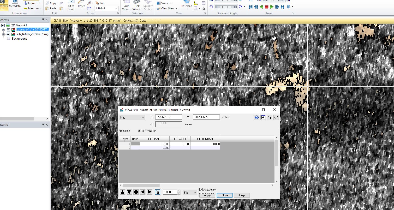
You can check with an RGB image if the information of both products is well aligned.
1 Like