hi mengdahl, I do have access to another InSAR pair to test and I will. sorry, I am pressed with a deadline and will try another set and get back as soon as possible. Thank you for the article. I did look it through and it seems that the band mode overlap problem with ALOS-2 Stripmap was solved for post 1 Jun 2015 images. The AlOS-2 images I am trying to process are post 2018. thanks mengdahl.
According to “ALOS-2/PALSAR-2 Level 1.1/1.5/2.1/3.1 CEOS SAR Product Format Description” by JAXA (2012), “L1.1 image is focused onto zero Doppler direction.” Therefore, no deskewing is needed.
2 Likes
hi mengdahl
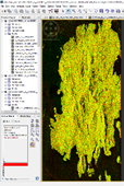
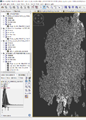
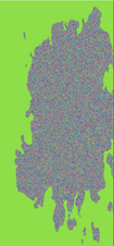
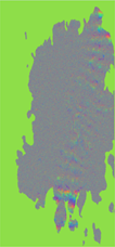
I did process another pair of ALOS-2 SM3 slc images, 15 March 2020 and 21 June 2020. the images, however, are from an orbit slightly more west but still ascending and same right look direction. The temporal separation is about the same as the images I previously posted as well. the only non default processing options I changed were the use of bilinear in the CreateStack, 10,000 gcp’s in Cross-Correlation, Cubic convolution in Warp, 1001 estimation points in the Interferogram Formation, and the 1Sec HGT in the Topographic Phase Removal. The Goldstein filter process came after the topographic phase removal.
I’ve attached four screen captures, first the red-green overlay of the mst and slv HH intensity and second the HH coherence. For the third and fourth images, I used output jpg’s for the HH phase and HH phase with Goldstein filter to highlight the filter output. From the paper you posted earlier, I believe problems with ALOS were in the 2014 to 2015 period, although banding shows up on the posted filtered phase image. Visually, the spatial alignment looks good to me, however, as ABraun suggested, the steep terrain and vegetation cover are probably the reason for the low coherence throughout most of the image even with just a 3 month time separation. The banding in the filtered phase image though seems to be more questionable, although, me being a novice at InSAR, that had to be pointed out to me.
thank you for all you help and suggestions.
Could you replace the figures above with high-resolution versions?
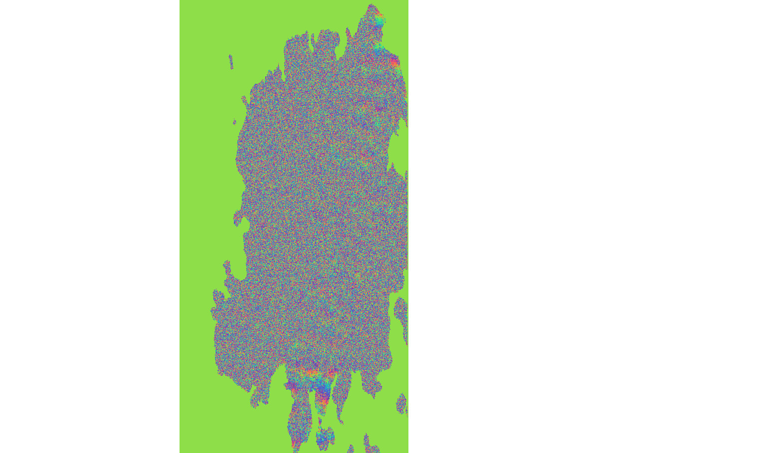
Looks like essentially zero coherence. You should try short temporal baselines first.
Unfortunately, the JAXA ALOS-2 satellite has infrequent acquisitions for most areas, especially with stripmap modes because the orbits are about 200 km apart while the stripmap swath is 70 km wide. This means they need three separate acquisitions with stripmap to cover a whole area, so even when they do stripmap acquisitions on every orbit, it would take 42 days to repeat a given stripmap beam.
This is one reason we are building the NISAR satellite to use SweepSAR and acquire full 240-km swath data at L-band every 12 days.
1 Like
thanks everyone for help on this. I agree, except for higher coherence on some coastal regions, the coherence is below 0.2 throughout. if possible, I will see if there is a higher frequency set to try. I have moved to using the SNAP utility slc to pri and a few subsequent steps to create amplitude-ellipsoid corrected products to focus on identifying landscape changes. the initial results gave a more interpretable product. again, thanks