Thanks for your insight and all of the provided materials @ABraun!
I understand that Sentinel-1 is not designed for DEM generation, so I am not interested in how to make a high accuracy DEM but to find out the error sources, and possibly quantify them.
For example, I downloaded 8 pairs of S1A data with Bperp. ranging from 96~155 meters. I processed these image pairs until phase filtering, and observe their patterns as the following figure.
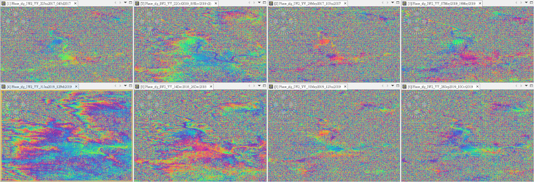
It’s quite apparent that we can see a topography ramp in the lower left corner pair but noisy in the others. I suppose most of the speckles are caused by tropospheric effect because the pairs which we can hardly see any information were taken in summer (a rainfall season of my study area).
All in all, I hope I could find out the relationship between each error source and the accuracy of DEM products. I’ll inspect the relationship pixel by pixel and apply regression analysis.
thank you very much for your kind reply as always!