Landsat 8 Mosaicking issue in SNAP

Yes, currently Collection-2 data are not readable in SNAP (that is another area to work).

Regarding WeTransfer, can you please share the Email that I will use to transfer the file?

Thanks!

The fill value was not read from the metadata and therefore not set to the bands. This will be fixed with the next release.
[SIIITBX-386] Fill value is not considered for Landsat Level-2 data - JIRA (atlassian.net)

Decimal fractions are converted to a binary representation. Many decimal fractions don’t have an exact binary representation.

No, it is not about the floating point accuracy. It is related to the raw data type.
But in general you are right.

Btw., setting -9999 as no-data value works for the Landsat data. Because of the scaling factor of 0.0001, this results in the necessary geo-physical no-data value of -0.9999.

1 Like

hello, sir how to solve the problem can you help me

I think this is because your file are still compressed. Try to extract the files from the compression .tar.gz first.

already compressed …
I need how to mosaic in Landsat 8 image in snap there’s some problem I’m facing…

I’m also facing the same problem as what I do. I’m using Landsat 8 data level 2. i need your help I have two tiles how mosaic both please tell me. i change very thing no data value -9999 but It’s not working…

Your first screenshot indicates that the no data value was not correctly assigned to the input product (black frame). Please use the Pixel Info tool to check the value which represents no data and then apply it to all bands in the band properties in both products. The mosaic operator should then ignore these pixels.

how to change please tell me sir

Right click on a band and select band properties

i used Landsat 8 data there is some problem happened

no data value -9999

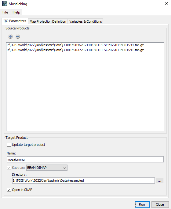
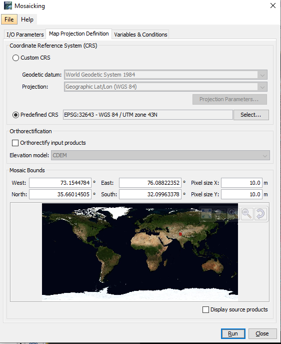
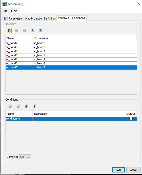
i have used Landsat data level 2 snap it’s happened mosaic error why can you help me


I’ve collected the posts from several threads here.
@SARVESHVARAN please pay attention where you post you messages and that you don’t distribute it all over the forum. :slight_smile:

According to this post, it seems that you have changed the no-data value on the resulting mosaic.
But this does bring back the missing data.
You need to set the correct no data value on the input products.
But this can be annoying.
So, it is better to modify the mosaic step.
In the Conditions section add the expression:
sr_band1.raw != -9999
If this is not yet sufficient it can be further enhanced.

The issue is that the no-data is properly set by the Landsat reader in this case.
This has been corrected in the code a while ago and it will be included in the next SNAP9 release.

3 Likes

sorry for disturbing sir now it’s working thanks a lot

but vector data is not able to add why…thanks

The error message indicates that the coordinate reference system of the vector differs from the one of the raster product. Is this possible?

Both coordinate reference system same sir

You define the CRS already within the mosaic step. There is no need to do an additional reprojection afterwards.

Is your shapefile accompanied with a prj file? Please delete it temporarily (or rename it).
Then you will be asked for the CRS when importing the shapefile. Specify the correct one in the dialog.

1 Like