hi @lveci
im using the released SNAP 2.0 64bit
thanks for the check
hi @lveci
im using the released SNAP 2.0 64bit
thanks for the check
Was there a solution of this problem? I get the same effects after terrain correction in some orbits.
MMS
in my case i used the collocation module and adjusted with a reference scene
I think I have a similar problem, I am processing GRDH files with Calibration > Terrain-Flattening > Terrain Correction. When I compare the output of this processing to images processed using Sarscape in EVNI as well as Sentinel 2 imagery these images or off by about 8 pixels SW. Originally I was using an external DEM that was MSL and tried the process again with another external DEM that was ellipsoid. The processed images was still off by about 8 pixels and even matched up the MSL DEM. Can’t figure out why this is happening. The images processed with the 2 different DEMs should show some variation but there isn’t
Which version of the software are you using and what are the products involved?
I’m using version 3.0 and using Sentinel 1A GRDH files.
What’s the file name so I could download it and process it?
the file names are:
S1A_IW_GRDH_1SDV_20150606T031215_20150606T031244_006247_0082C6_EDF7
S1A_IW_GRDH_1SDV_20150426T030402_20150426T030431_005649_0073E6_96B4
S1A_IW_GRDH_1SDV_20150405T174421_20150405T174450_005352_006C9D_7D6F
S1A_IW_GRDH_1SDV_20151026T174436_20151026T174501_008327_00BBE6_2840
S1A_IW_GRDH_1SSV_20151228T104054_20151228T104119_009241_00D548_354B
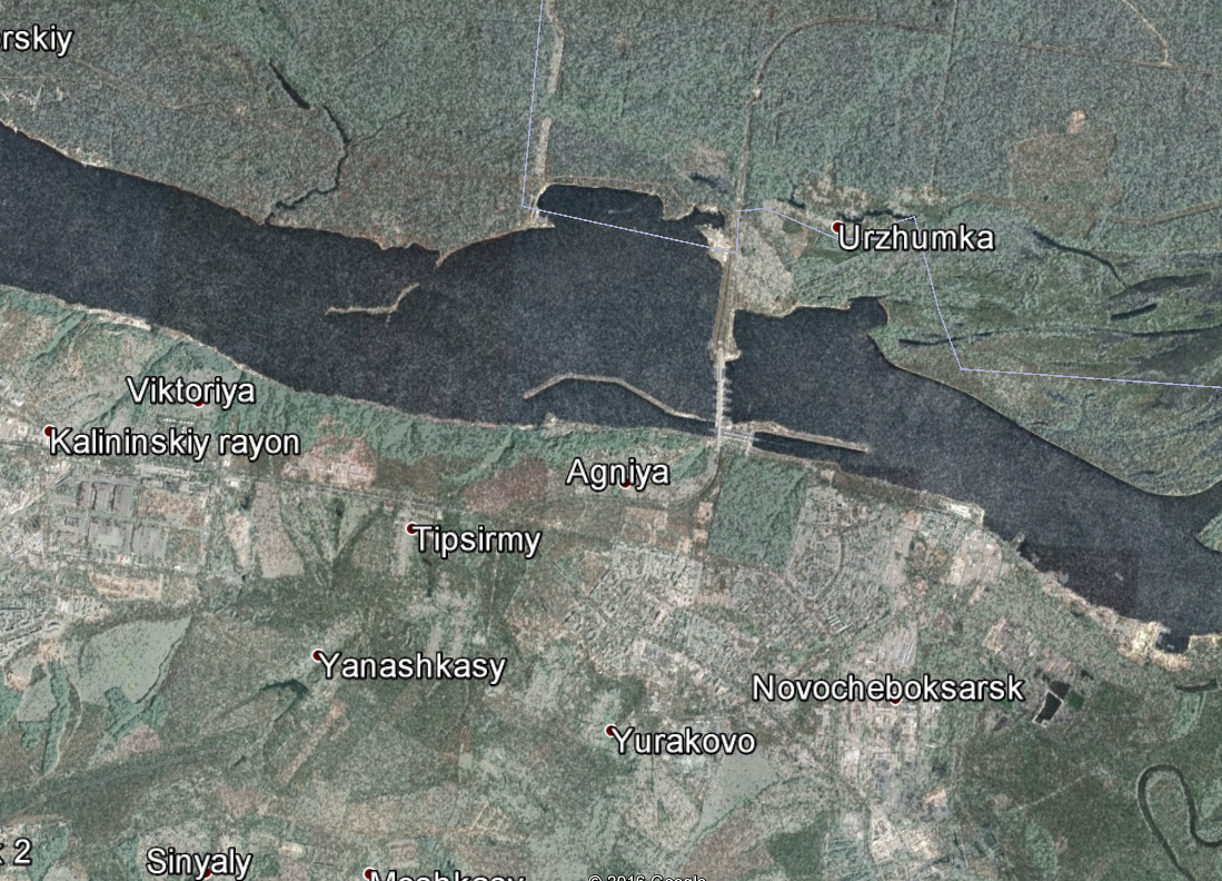
Applying terrain correction with the default SRTM and then exporting to Google Earth, provides a perfect match with the dam, airport and roads. The problem here might be the external dem you are using. Does it already apply an Earth gravitational model? In the next release (hopefully tomorrow) you will be able to set this for your external DEM.
Ok thanks! One more question, how do I export it to Google Earth? When applying terrain correction, I’m not able to save output in KML format.