Thank you both for your responses.
Yes, I tried using a variety of different parameters for the speckle filtering, but found no improvement in the results. We have 3 separate TerraSAR-X images for different dates and regions (all over open ocean) and see the same noisy data in all cases, compared to other SAR systems that are operating in similar resolution modes.
Unfortunately we don’t have access to the SLC format or any other images because this region is not part of the standard imaged regions for TerraSAR, so images are only collected when we specifically task them from Airbus.
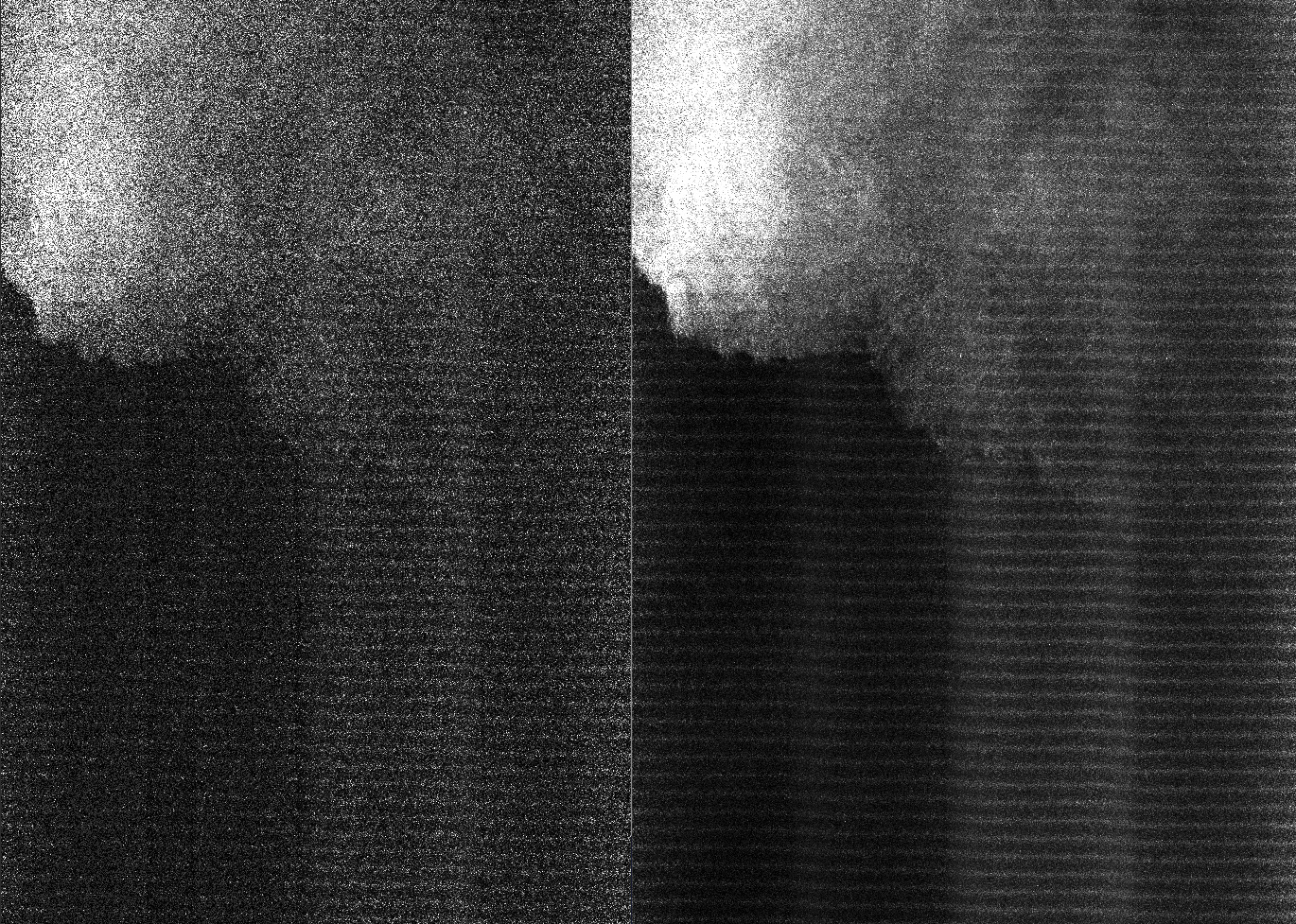
@Abraun I found a 2017 post of yours where you suggested using multi-looking after the radiometric calibration stage instead of speckle filtering (TerraSAR X image quality and building measurement). However, since the MGD product I am using is already multi-looked, I’m guessing that this SNAP mult-look processing is just smoothing the pixels by averaging over a X-by-X square, centred on each pixel. The attached image shows the original image without multi-looking (left) and after this additional multi-looking has been applied (right - using 7-by-7 GR Square Pixel settings). The resultant image is still grainy (although not as bad as before) but with the corresponding loss in spatial resolution.
I’m also curious about what the structure in the image might be. There are distinct regions of high and low backscatter but, since the dividing line is roughly diagonal across the image, this is not related to the SAR geometry. The imaged region is an area of open ocean in the Pacific with no terrain or structures to reflect the radar signals. I’m guessing that this may be a result of a rain or wind front but I am not an expert on SAR - do you think that meteorological factors could be the cause this kind of image structure?