If you want to retrieve elevations, you do not remove topographic phase. This is exactly the component you want to estimate from the InSAR data. When you remove it you have no topography left in the phase. How should a DEM then be derived from it?
The study you show is really strange.
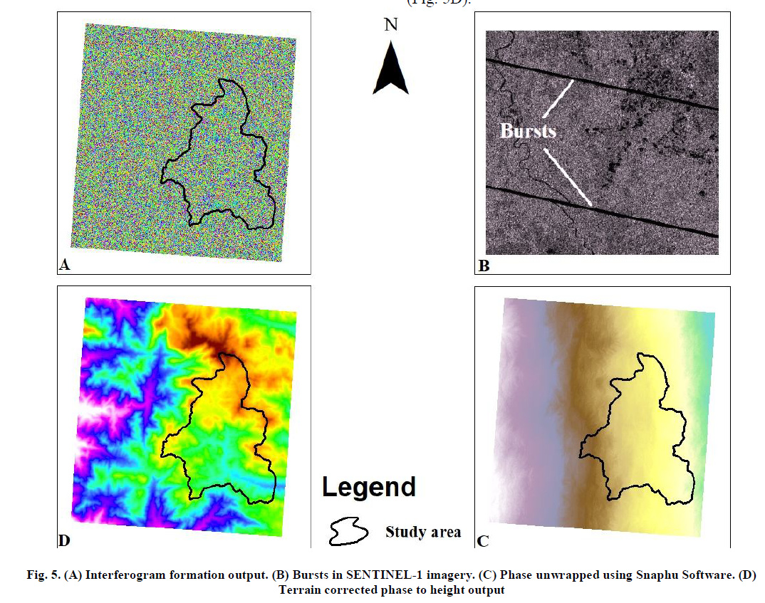
Their interferogram (5A) is pure noise and there is no chance that you get any elevation information from it. The unwrapped phase (5C) looks like in your case, simply a ramp from left to right, because there are zero fringes to unwrap. Additionally, they removed the topographic phase which makes even less sense.
What they show in (5D) can never result from (5C). I suppose (5D) is the topographic phase as it was modeled from the SRTM which is used in SNAP. This explains their high accuracy reported in Table 2. To me, this study is not scientific at all.
Please check the steps suggested in the ESA tutorials instead:
Sentinel-1 Stripmap Interferometry
Interferometry Tutorial with Radarsat-2
In other sources, the topographic phase is not removed as well, for example the tutorial from ASF:
How to create a DEM using Sentinel-1 data
also here: The Order of DEM Creating Steps