Removing land by masking

Dear all,
I want to do classification over sea ice but I have one big island in my Tandem-x image.
I also have island shape files. I opened it in QGIS. You can see it below.

I used ‘file’—’import’----’vector data’—’ESRI shapefile’----and import island shape file on image and it is completely OK. You can see it in below.

But I do not know how can I delete or mask this island from my image. Would you please guide me?

please use the search function - very helpful from time to time :smiley:

2 Likes

OK. Thanks…I found its solution:slight_smile:

1 Like

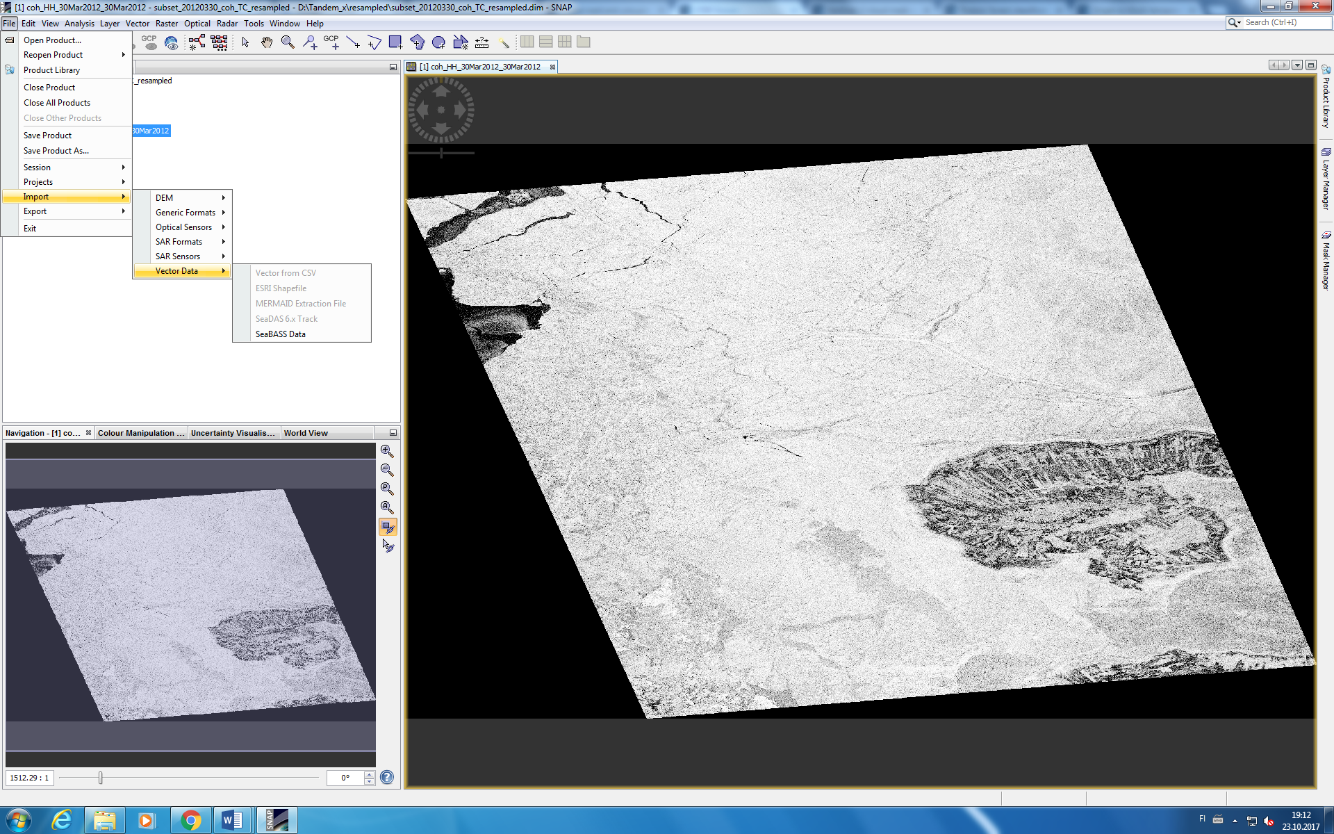
Sorry another question. When I want to import shapefile in SNAP, I do not know why ‘ESRI shapefile’ is not active. Look at below.

It is only active when you select the name of the product into which you want to import the vector. Don’t click on the bands or subfolders.

Thanks!!! This solve 2 days of struggle…

1 Like

When trying to perform an extract by mask command I can successfully get this operation to work. My question is can the areas outside the Area of interest of the polygon be assigned a Invalid pixel value. As when trying to create an interferogram if the the master and slave image were both masked areas it would significantly reduce the lenght of time it would take to complete this graph.

you can mask after coregistration and then apply interferogram formation, it should take less time then.