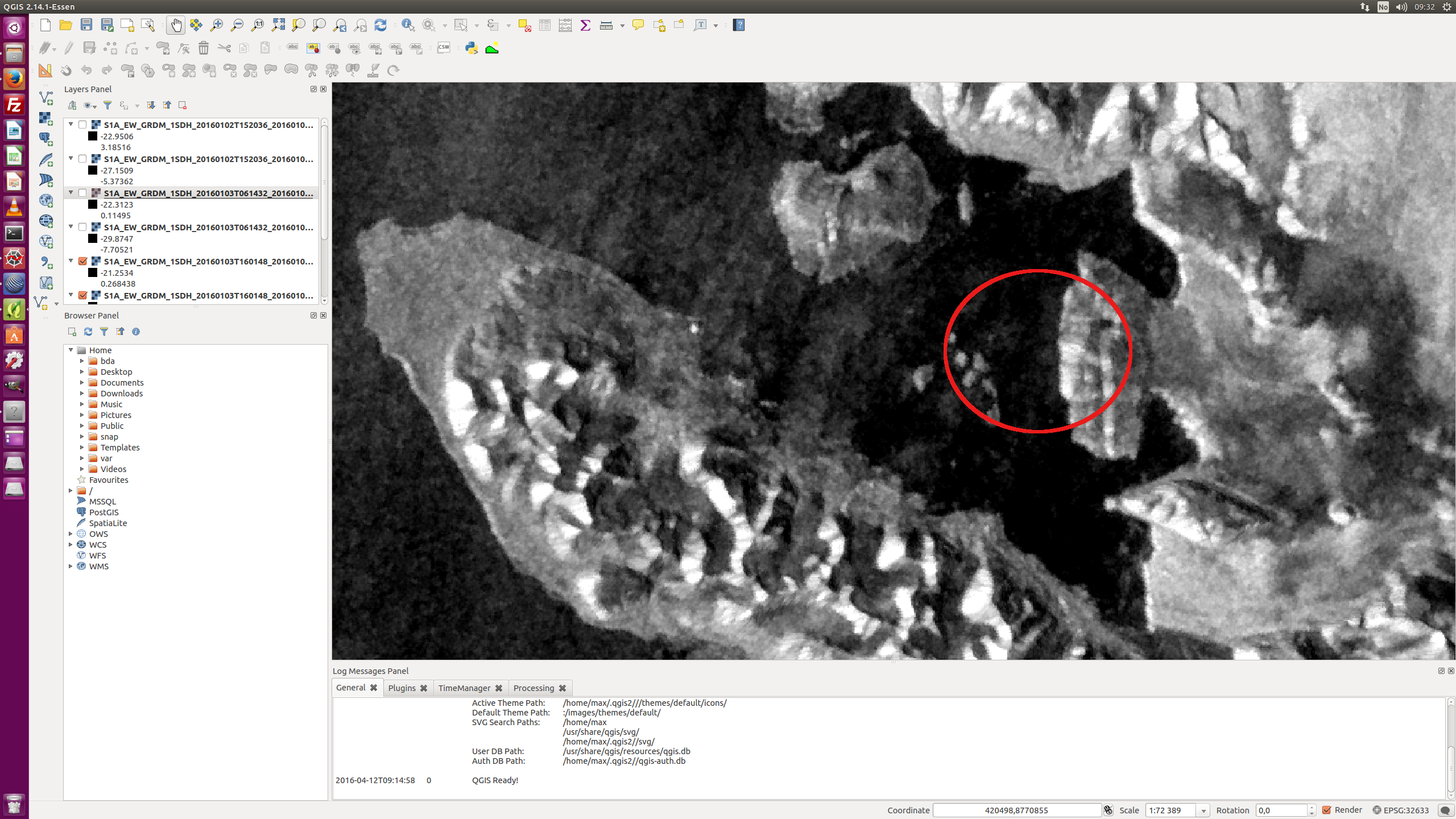
I just tried with the Precise Orbits, but it is the same … the coast line is at some places displaced by 250meters.
Since this issue does not exist with Radarsat images using the exactly same script, it appears to be an issue with Sentinel-1 data …
I just tried with the Precise Orbits, but it is the same … the coast line is at some places displaced by 250meters.
Since this issue does not exist with Radarsat images using the exactly same script, it appears to be an issue with Sentinel-1 data …
The orbit errors are about three orders of magnitude smaller than the reported jumps so the problem is not with S-1 data. Sounds like this is somehow related to your DEM and how it’s used in SNAP as similar issues have not been reported with SRTM-DEMs for example.
But then why would Radarsat-2 images process completely fine with SNAP in exactly the same script? I cannot see how it then could be an issue with the DEM … that makes it so hard to find the reason for this (and to fix it) …
Terrain correction of S-1 images in SNAP is well tested and works well, so the issue is probably in your processing chain or SNAP installation. What are your processing steps?
that is the steps I am using, I also tried with “Apply Orbit File” as first step, but no difference using a PreciseOrbit. Again it is curious that for Radarsat, Envisat data this all works completely fine …
Max, it’s strange that the shifting seems to happen at every other image. In the second video there are no shifts so then it’s not the graph, processing or DEM. Is the second video over the same time and using the same IPF versions?
Could you list 3 of the products with the problem.
Also, note in your graph that in version 3 the parameters for Refined Lee have changed and the LinearTodB has been renamed.
Hallo Luis,
I have put four scenes including my processed GeoTIFF subsets here on ftp:
ftp://158.39.97.59:21/Out/max/SentinelJitter.zip
They were processed with this script https://github.com/npolar/RemoteSensing/blob/master/RoutineProcessing/ProcessSAR.py
using in that case this graph file: https://github.com/npolar/RemoteSensing/blob/master/SNAP/Calib_Spk_TC50m_LinDB_EPSG32633.xml
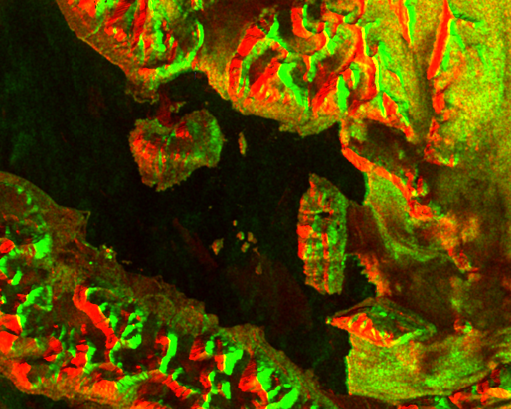
You can see the issue quite clearly by looking at the islands and the coast line here, that one moves quite a bit from one image to the next. As mentioned, the same script does fine with Radarsat and Envisat … :
I use SNAP 2.0-rc1 still since all those scripts are quite operational running – the update to that version did not work with TerrainCorrection. That may be solved by now, but as long as that version is doing fine I meant to keep it — in any case that Sentinel issue should be version-independenet, shouldn’t it?
Max, I terrain corrected the products with ASTER and UTM 33N and did not see a shift like what is in your tif files.
Could you try with version 3?
I will try this now, I am just installing version 3 and recreating all Graph Files … I see that LinearToDB is now LinearToFromDB but somehow it is not selectable in the Graph Builder Menue?
Any other things beside Refined Lee that needs change in my graph set up for version 3?
Greetings
max
I just checked now — the transition to Snap 3 went very well this time – and looking at the first images, it seems indeed that this shift does not appear when using SNAP 3.
Not clear why it was like that in SNAP 2, but anyway it seems to be fine in SNAP 3
thanks for the help!