I have been attempting to do Psinsar using the snap2Stemp workflow. Following the steps mentioned in the manual, I got to the StaMPS export step, and as a result, a project folder contains the final output structure in four folders: rslc, diff0, geo, and dem. Please, if you could help me, I have some issues.
in order to prepare data before running data, but I have an error when I run mt_prep_snap: command not found.
I installed Stamps-4.1-beta, and I know I need to make some changes to the configuration. My question is: in which lines should I give a path in StaMPS? CONFIG.bash?
I have installed Triangle and Snaphu and made the configuration in StaMPSCONFIG.bash as mentioned in the links that you shared with me. But unfortunately,
I still face the same error when I try to run mt_prep_snap: command not found.
sorry I don’t understand really your point
do you mean that I should add this line “export PATH=/home/shadi/StamPS/bin:$PATH
source .bashrc” to StaMPS_CONFIG.bash?
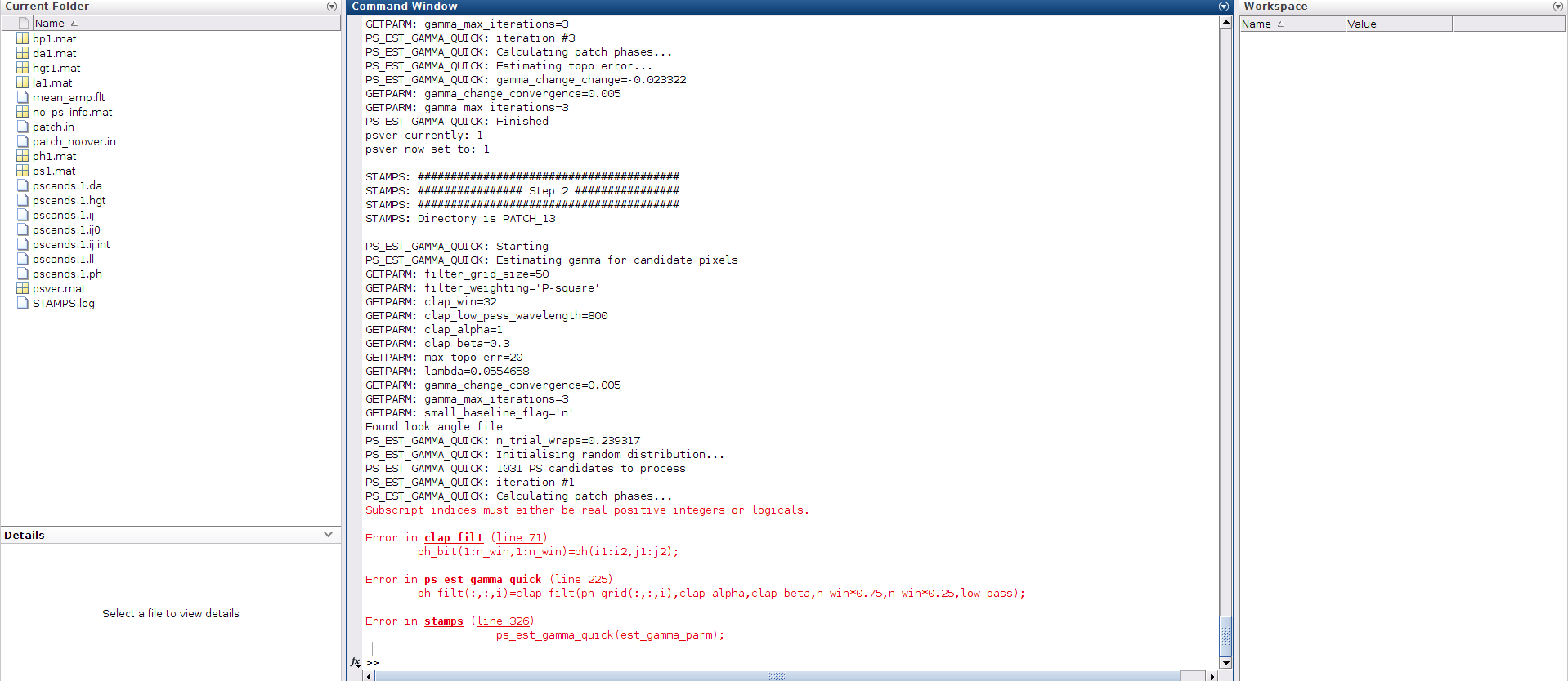
I am also encountering an error in step 2
I’m using StaMPS-4.1-beta and the previous step was completed successfully but this error appeared in the stamps (2
Dear mdelgado, I can share yes. I’ve made slight advances since I posted this question here on the forum, I still have some doubts about how to better calibrate the K2q.m. On GitHub, you can see in greater detail.
@Edwardo@Hebaabouzied
Try to crate a directory names in internal or external hard_disk without any space
example proyecto psi to proyecto_psi
Try it, it will work.
thank you so much, I finished my work with no problems, but now i wonder if @mdelgado has developed an update for the scripts on python, so we can use recent linux distros to perform stamps properly.
Is there a way to export the figures created by the ps_plot command as georeferenced tiff files so I can plot them into their proper geo-locations on other softwares? instead of having plain images without any digital reference coordinate system
Well… the original idea of those plots is that you can see in radar coordinates what is being produced so you can identify possible issues happening on any of them. Additionally, the TC step was not included in purpose, as it may add a non neglectable time, specially when working with very large time series data.
However, if desired, you can add the TC operator and it shall work, as the Multilook is also quite high, so if you specify a spatial resolution in correspondence with the ML factor, you can get what you are looking for.
I can add it to the wish list for the next release, but I guess you can also easily add the TC operator.