Hi, I have the same problem: Unexpected or abnormal exit of child process for unwrapping Sentinel-1. I did it with 20 also but it didn’t work for me. How did you overcome that problem? As you mentioned above that you tried it with 30 40 and so on but nothing works.
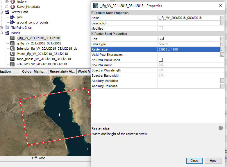
How may I calculate the overlap in this case? the size of a single tile if I the image was segmented into 10 tiles, would be 2595 columns and 419 rows.
Are you processing an entire Sentinel-1 image? The water in the middle will surely interrupt the unwrapping, so could it make sense to process each part of both sides separately.
Maybe you first show an image of the interferogram before unwrapping.
This is only three bursts of IW3 subswath, I believe the interferogram quality is diminished, no visible fringes but I Thought I could see if there’s any minimal deformation of this area through phase to displacement, based on the earthquake locations I received.
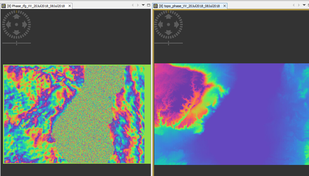
oh, sorry, then it’s allright. The interferogram looks alright regarding temporal decorrelation but the patterns probably have some atmospheric effects. So it would be good to compute some more pairs to check if the same patterns persist.
How does the unwrapped interferogram look like? If there are no sharp borders between the tiles, you shouldn’t worry too much about the tile size.
I can’t figure out any information form this unwrapped ifg, does it look like that because the tile size? or LOS displacement isn’t pronounced relative to the wavelength used. That color grade is only caused by the water body. I am sorry If I were asking a lot, my supervisor isn’t particularly specialized in interferometric processing so my results aren’t validated.
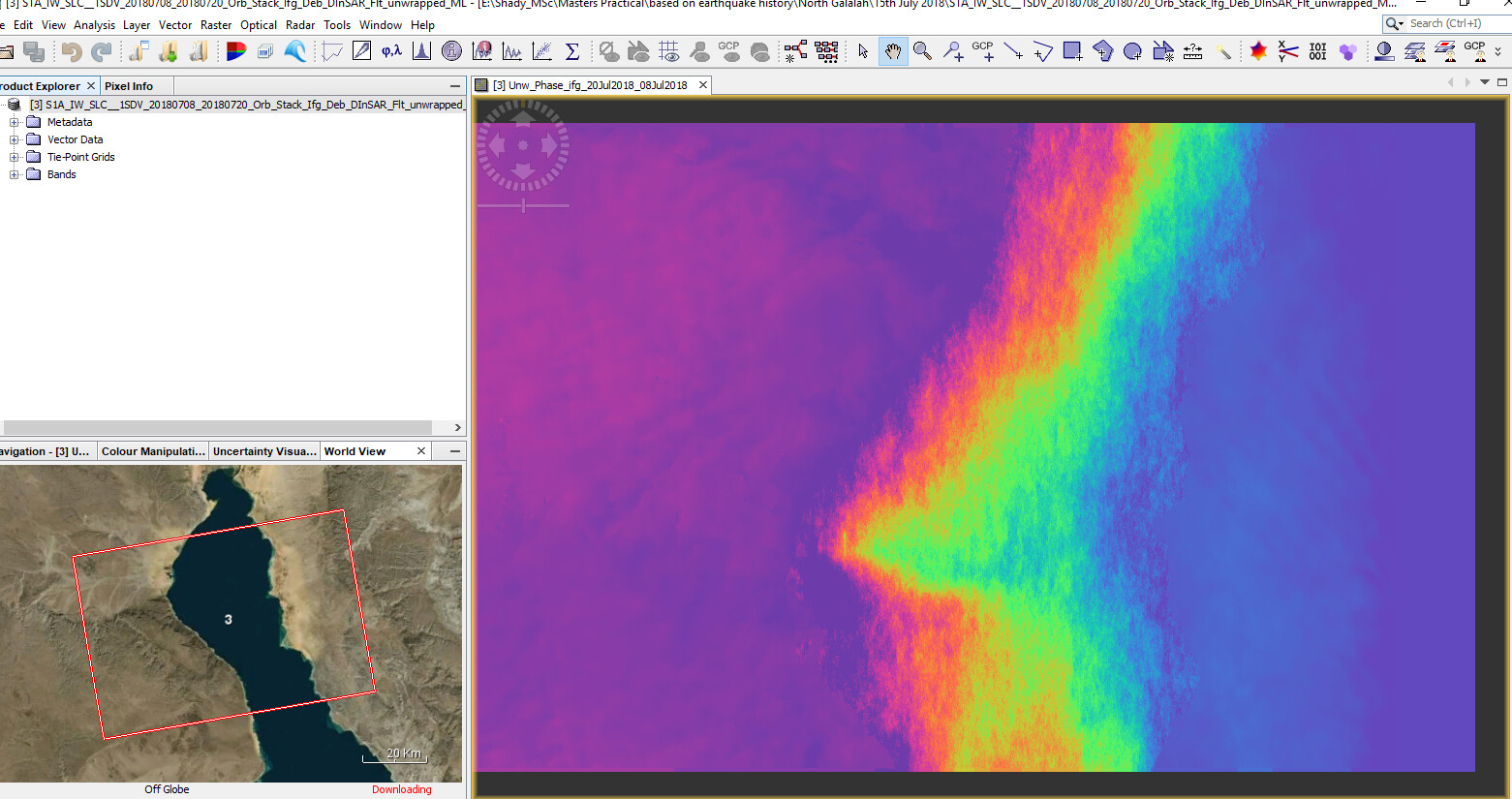
As expected, the lake introduced a ramp which makes it impossible to compare the values of the left side with those of the right side. Please consider to Filter out low coherence pixels before phase unwrapping
But by now I don’t see tiling errors in your data. You can play with the color manipulation to check the areas with less contrast.
I currently don’t posses enough data for further investigating the right side region, so Is it ok if I subset the image after Enhanced spectral diversity step to take out a significant part of the water body? Hopefully the left terrestrial side becomes clearer so I can reduce unwrapping interruptions as much as possible
If you don’t need the right side, I would clip as much as you can (including the water areas) before the unwrapping, yes.
1 Like
I have tried 2 image pairs to compare the resultant interferograms to check for any patterns similarities and if any atmospheric effect exist. I noticed a drastic difference while I am sure there’s only one recorded earthquake in the area 16th August. Does the larger temporal baseline completely change the pattern?
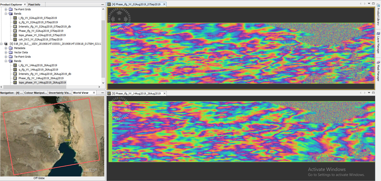
Is there a chance to use a pair with shorter temporal baseline?
Please check for rain events during the image aqcuisition dates, the patterns are very likely atmospheric. For comparison, please compute a 6 or 12 day interferogram from the dry period (without the earthquake incident). It should look comparably smooth.
Did you apply ESD after BackGeocoding by the way?
leave the number of tiles. If the number is too high, the single tiles become too small.
You can try to remove the - in the conf file at RANGERES and AZRES and run again.
I generally advise to only use VV for InSAR, there is no need to calculate the interferogram for both polarizations. It only takes the double time and introduces possible errors.
1 Like
Does the atmospheric effect cause low coherence ?
I used the shortest temporal baseline 12 days for the interferogram below and decided to compare it to another one using different pairs with larger base line.
Which satellite offers free SAR data with 6 day-temporal resolution?
yes, I add this step into the graph builder
but every process should be automatically added to the product file name in the graph builder except for the ESD, does that mean the graph has skipped the ESD step?
if not, is there some parameters I should change in ESD?
The atmospheric effects have a rather long wavelength so they do not really cause low coherence which is a local effect (inside coherence-window).
Areas which are covered by Sentinel-1A and B can have repeat cycles of 6 days, but unfortunately not in all parts of the world.
I have learned from “Echoes in Space” course from ESA that Radar can capture an area regardless of the Atmospheric conditions, so if I may ask, based on your practical experience. Why does atmospheric effect cause certain patterns (with image pairs away from earthquake incidence) ? my study area is mostly bare rocky substrate with very little rain events, so which atmospheric effect could produce those patterns?
Well, the backscatter intensity is quite robust to clouds and water vapor in the atmosphere. However, the phase of the signal (used for InSAR) is more sensitive.
An example on how this can affect the result is given here: Accurate DEM Reconstruction from Permanent Scatterers and Multi-baseline Interferometry
Maybe this also helps you: How to avoid false interpretations of Sentinel-1A TOPSAR interferometric data in landslide mapping? A case study: recent landslides in Transdanubia, Hungary
3 Likes
Hello Gabriela,
I would like to know how did you solved your problem ( ***Unexpected or abnormal exit of child process) because I have the same problem.
Thank you
Hi!
I have a question about the phase unwrapping results.
I processed 2 Sentinel-1 images according to the SNAP S1 TOPS interferometry guidelines .
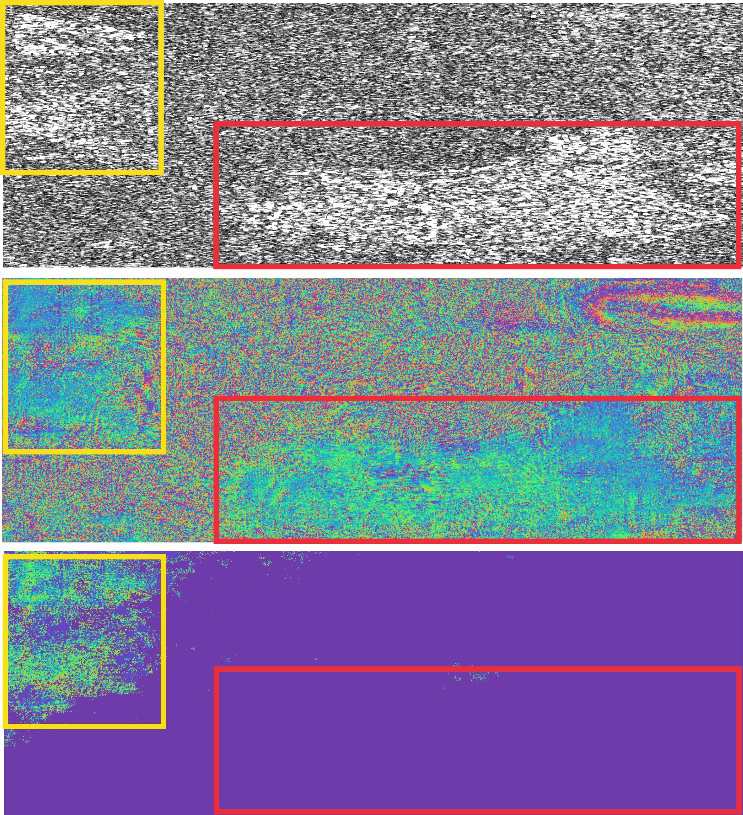
Even though the used images have significant temporal baseline (27.09.2019-12.05.2020), the coherence for AOI seems to be fine. This AOI (subset, not the whole image) was used for the unwrapping.
But unfortunately the results looks strange.
I try to understand why for the area in the left part (yellow) the unwrapped phase seems to be OK, but the area at the bottom right (red) where the coherence is high (0.9 for some pixels in urban areas) the unwrapped phase is completely 0 (which can’t be true according to ground based data).
I’ll be very grateful for any ideas and recommendations!
it’s a bit unfortunate that the high coherence areas are separated by low coherence. Unwrapping will probably not be consistent between these two areas (yellow and red). Yet, the red area should at least produce some data. Is it a matter of color stretching?
I would test some unwapping parameters - have you defined an overlap?