I’ll try to clarify some points.
The applicability of PS or DInSAR in general is mostly limited by vegetation. If there are not enough surfaces which are characterized by coherent scattering (bare soil, urban areas, low vegetation) results will probably not be reliable.
I cannot telll for your study area, but it might be worth a test.
PSI and SBAS are based on the same technique, but different principles.
PSI uses one reference image (mostly in the middle of the time series) and computes one interferogram to each of the other images (figure on the left), you get n-1 interferograms. In your case 23 images will result in 22 interferograms. Each of them calculates the phase difference and these are then corrected for systematic errors (topographic, orbital and atmospherical) and summarized to an average displacement over the entire period and often also a time series of displacement for specific locations. You can do this with StaMPS, for example. The interferograms would be AB, AC, AD, AE,…
SBAS allows to calculate interferograms between all image pairs, based on thresholds of perpendicular and temporal baseline (e.g. separated by maximum 48 days and 160 meters). This is displayed in the image in the middle. This allows you to analyse more pairs, so 23 images can easily lead to 50 to 80 interferograms. This allows the retrieval of more stable information on deformation with less noise, but of course requires more processing time. The interferograms could be AB, BC, AC, BD, CE…
The third example is based on even more image links (explanation in source). Currently, their preparation cannot be done with SNAP.
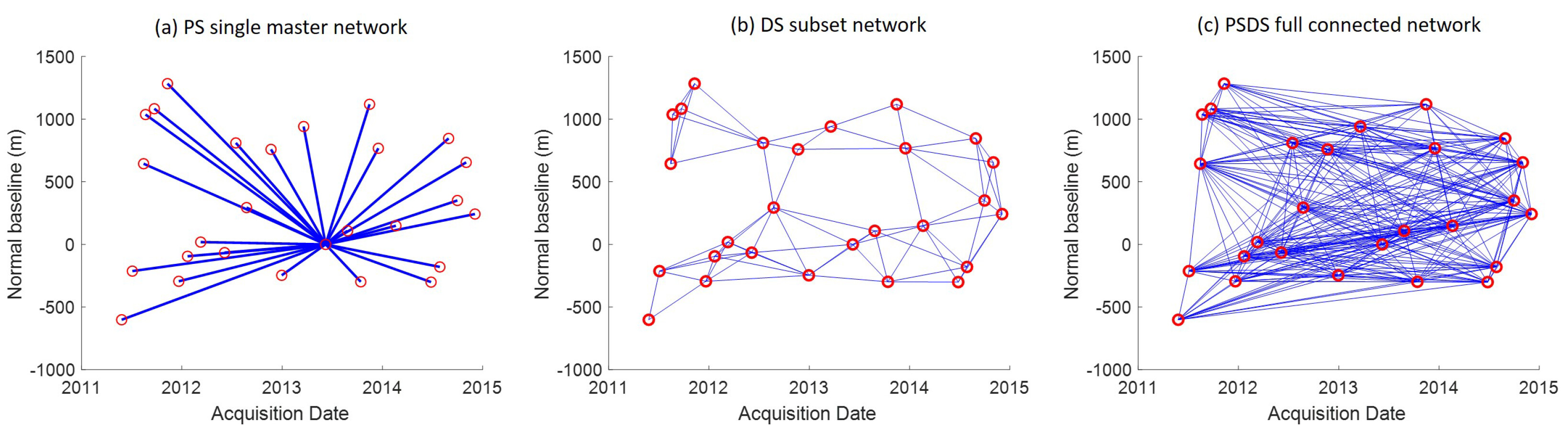
image source: https://www.mdpi.com/2072-4292/12/9/1364/htm
If you want to understand the principles and the technical processing, please go throught he list provided in this topic: StaMPS - Detailled instructions
especially the first two points (by @Gijs and @m477h145) give excellent instructions on how to pre-process and analyze the data based on PSI.