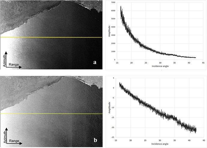
the incidence angle of the pixels within a product varies across the range. You can see it in this figure
Source: Incidence angle normalization of Wide Swath SAR data for oceanographic applications
Additionally, you can distinguish between the global and the local incidence angle. The first refers to the flat surface of the earth and the second includes topography (more on this here)
So you have to decide which one you want to use. But if all images are from the same track you can use the incidence angles of the reference images.
