You should remove those pixels where coordinates are Inf / NaN or 0. Not the entire patches. I hope you did the former and not the latter.
I did the latter, the issue seems to not have been that I had bad pixels in the patches but rather that I had none. So I sorted the patches by folder size and removed all patches that had empty pscands files. I think the issue was that I used too many patches so areas of low coherence had no pixels selected. I’m working on 98 scenes over a full subswath so i was concerned about memory issues.
As far as I can tell my results look good. Although I would have liked more PSs in the rural areas but without infrastructure it’s pretty much what i was expecting for the PSI results.
2 Likes
good job!
You can try to get more PS you have the following options
-
run mt_prep_snap again but with an amplitude dispersion 0.41
-
step 3
change the parameter
select_methodtoPERCENT
and increase
percent_randa bit -
step 4
increase
weed_standard_deva bit, e.g. to 1.25
I don’t recommend applying all at once because each of them leads to more PS left for the subsequent processing steps. I’d probably start with the weeding and if that does not work, go back to step 3 and run again.
In the end you are right, if there are no permanent targets in the rural areas, you are just statistically increase the number of PS, possibly just introducing more noise and uncertainty in your interferogram.
2 Likes
Hello every one,
Does “Stamps Export” support CSK data processed with SNAP ?
I just tested that with 4 interferograms comming from 5 CSK images. This is my workflow :
*Topographic phase is subtracted in “Interferogram” Step
*Elevetion and Orthorectified Lon Lat are also created in this step.
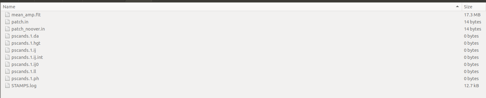
Every thing look good. Then the Stack of images and interferograms are passed to “Stamps Export”. The folders are created as result of this step : dem, diff0, geo, rslc.
Then i execute : mt_prep_snap yyyymmdd datadir da_thresh
Matlab files are created BUT : This files are empty : master_day.1.in, heading.1.in, day.1.in, bperp.1.in !
Is this normal ?
I continue to process data on Matlab using stamps(1,1), stamps(2,2) with default parameters , then in stamps(3,3) no PS was selected !
Any one have tried to process CSK data with snap-stamps ?
have you checked if all slave products contain data in the stack (and if the interferograms look alright)?
Yes. I have checked that :
- All 5 SLCs contain data.
- All ifg look good.
Just noticed : Not all slaves cover the same area as the master. My AOI located on the edge of the images. (I have handled this case with S1 data with no problem. We will not have PS just on the missed area) . I think this is not the cause behind my probmel now.
Zoom
I’m not sure but I don’t know if PS can be initally selected based on only 5 images. I don’t know what is the minimum amount to estimate the amplitude dispersion.
There is not real minimum, but obviously the selected PS candidates are less reliable, and the final results will be noisier.
Most of the candidates will be potentially removed/filtered in step 2 & 3
The number of PSC was about 1000000 after mt_prep_snap.
But during step 3 all PSC was dropped.
I will try with more images and let you know.
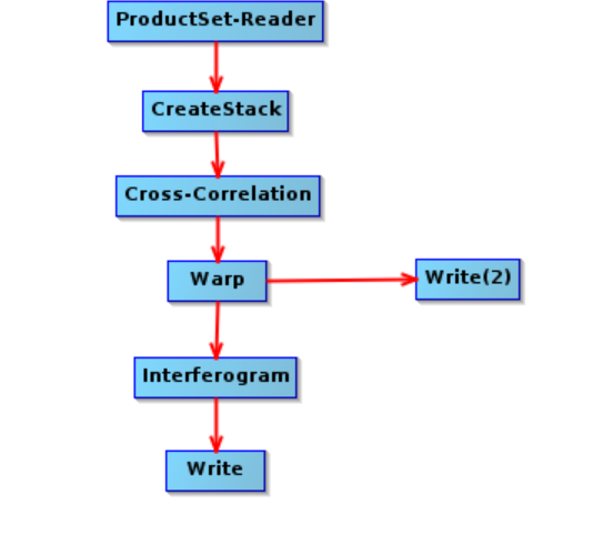
Regarding the graph is this the normal processing workflow for StripMap data on snap ?
Read ->CreatStack->Cross-Correlation->Warp->Interferogram->Write
There is also “DEM-Assisted co-registration” it is required for StripMap data or not ?
Hi everyone!
Could anyone please help me here:
I was able to do StaMPS export from SNAP(7.0) for 24 interferograms of S1 Tops IW data successfully using these steps:
1/ 25 S-1 images: Split and Apply_Orbit_File.
2/Create 2 stacks using (S1Tops Coregistration-Backgeocoding) (Master should be the first in the ProductSetReader)
3/Deburst the result of 2/
4/ Subset the result of 3/ (Raster-Subset).
5/ Result of 4/ - Interferogram formation. (subtract topographic phase and output Elevation and Orthorectified Lat/Lon).
6 / Range Doppler Terrain Correction for both of 4/ and 5/ results (I used UTM for map projection, and output complex data and Latitude & longitude).
6/ The last step (Radar-Interferometric-PSI/SBAS-StaMPS export)
I exported to StaMPS the two files: (The first: subset_master_Stack_Deb_TC / and the second: subset_master_Stack_Deb_ifg_TC)
So, I got the 4 folders for each stack (dem ,diff0, geo, rslc) and I have combined them.
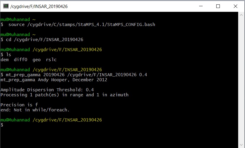
But when I try to run <mt_prep_gamma> in Windows under cygwin64 2.877 and StaMPS 4.1 , it did not work, and I got this:
Precision is f
end: Not in while/foreach
Does anyone knows what is the problem here?
Thanks in advance.
Easy…use the mt_prep_snap instead. It will work
1 Like
I repeated the test with more scenes (20 image) this is my results after these steps :
- mt_prep_snap
- stamps(1,5)
PS_SELECT: 260789 PS selected initially
…
PS_SELECT: 254438 ps selected after re-estimation of coherence
…
PS_WEED: 250452 PS kept after dropping noisy pixels
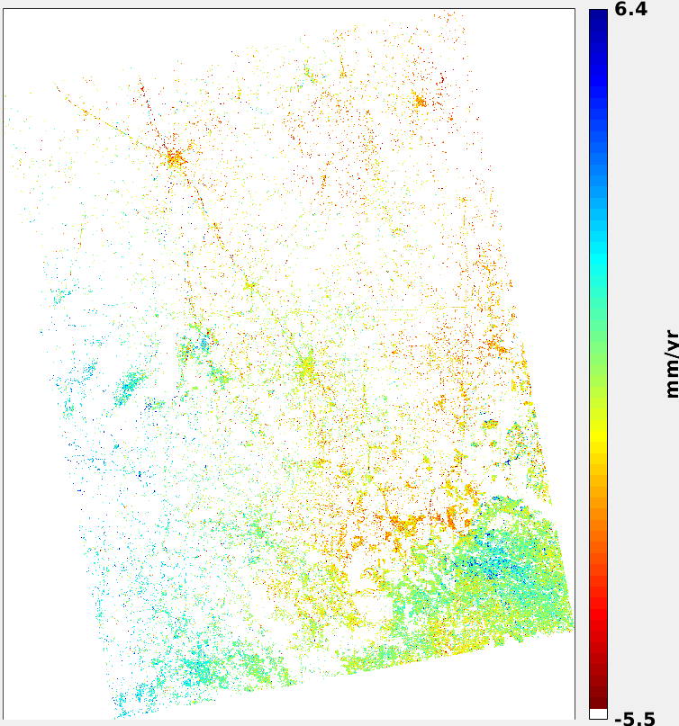
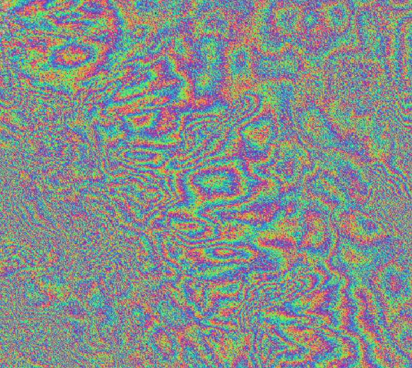
Then when i plot wrapped phase of selected PS on mean amplitude background. This is what it looks like…
I verified all the the SLCs and IFGs before exporting theme to stamps, they look normal no artifacts like that we see after the export.
@mdelgado have you any idea about the workflow to use in the case of StripMap data ?
i used this graph :
If this is the right graph to use, i think there is a problem in on of this steps :
- Stamps export
- mt_prep_snap
Any one can confirme us that StripMap mode or CSK sensor data are supported for stamps exporting/preparation ?
Thanks a lot @mdelgado!
It works now 
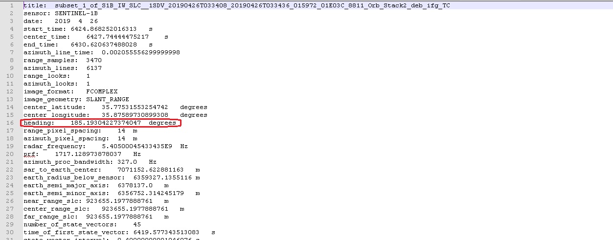
But what about the (heading) value in the (*.par) files, Should I correct it or I should leave it as it is?
Not sure why you want to change the nominal heading…
It works! Confirmed.
You probably should pay attention to the different parameters employed.
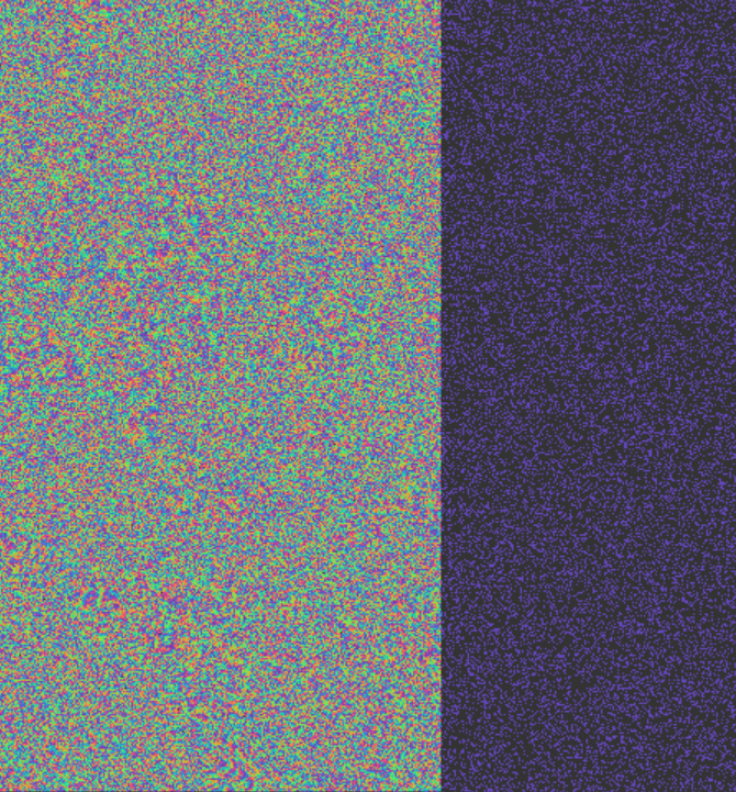
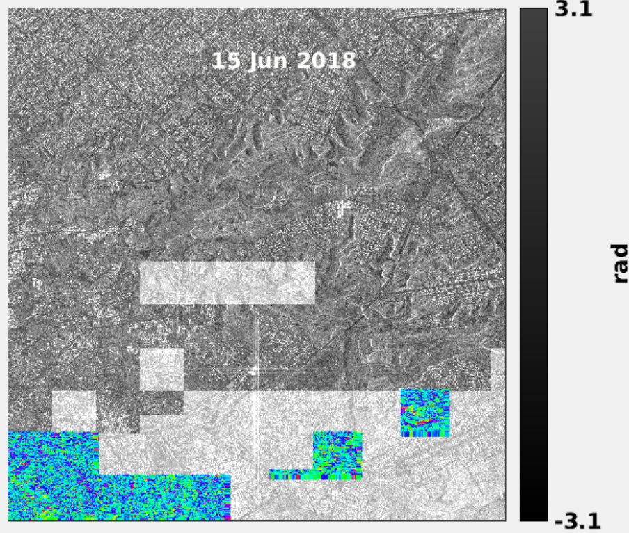
For the plot…
The average amplitude already shows that some patches work different than others, so could you please confirm that is all fine? resampled, interferogram, exported and after the mt_prep_snap step?
You are right, since I will not use multiple patches, so I do not need to correct the heading value to PlatformHeading value which could be found in <Original_Product_Metadata / annotation / productInformation>.
Thanks again for your help!
For the workflow, please check the trainings and manuals on advance training courses of ESA (for example). There is one as example of mapping the Napa Earthquake using S1 stripmap. The workflow should be similar, just without apply orbits step
1 Like
Still not clear what you say about the heading.
You mean that the heading on S1 metadata is incorrect? I have never heard of manually changing the nominal valies
It seems that there is always a small difference between the PlatformHeading value of data (before the StaMPS_export process) and the heading value in the data (after the StaMPS_export process).
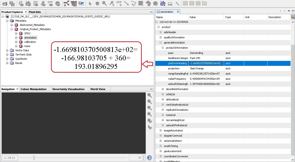
Please check after the apply orbit step. I am curious.