Hello! I build a displacement map for the Fogo volcano for 2017. I took a picture for January and build compared to this image for the following months. Here is an example of pairs of pictures on my models:
20170115_20170208
20170115_20170316
20170115_20170421
20170115_20170527
20170115_20170620
and so on.
Snap defines the master image for example 20170620, and not 20170115. When I build a blend map and take as master the image first 20170620, and then build another model where as the master image I take 20170115, the displacement map in each case turns out different.
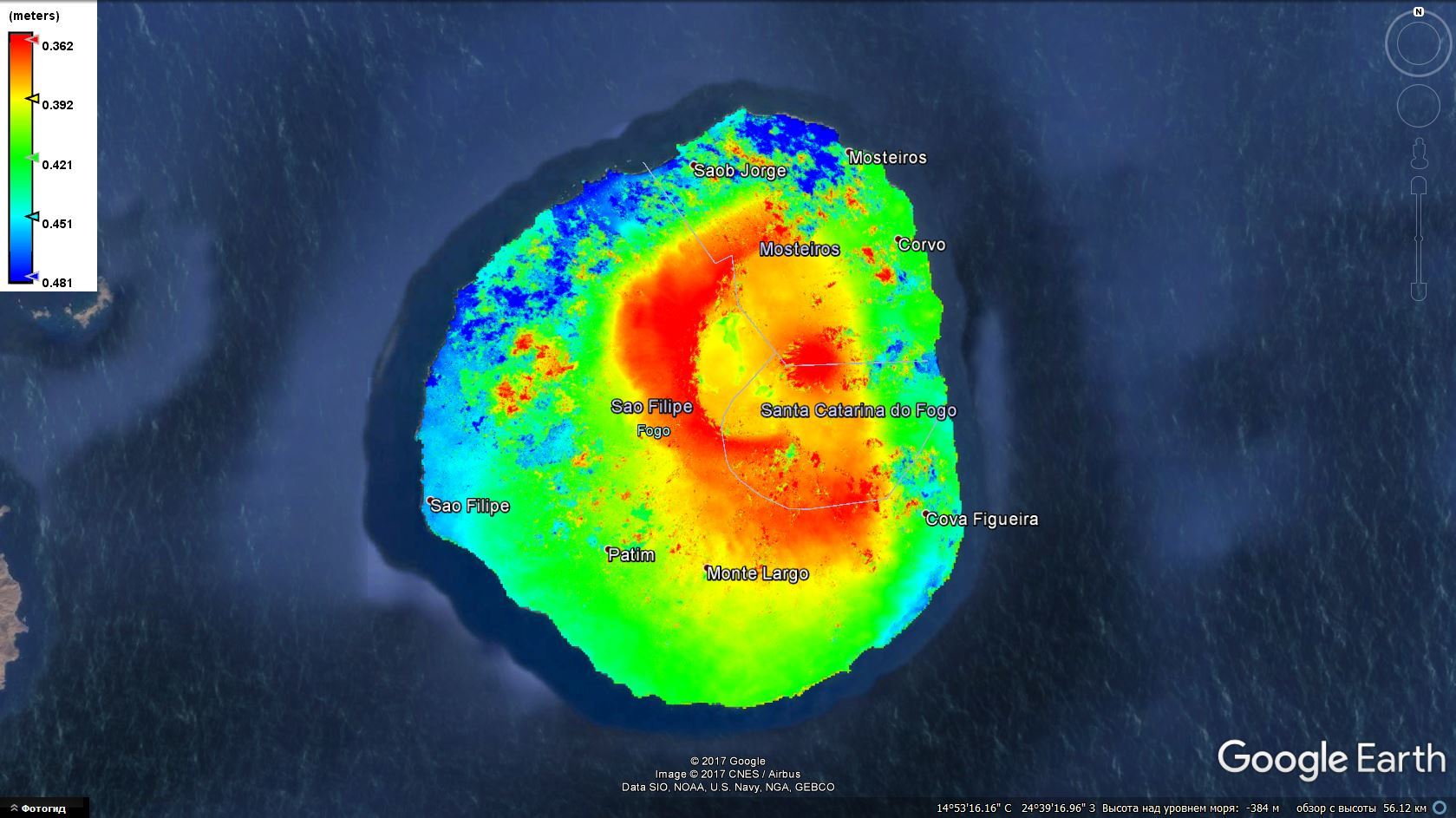
In this case master 20170620
@Anton_Gorshkov these two are interferograms with different masters but the slave image is the same? when was the eruption?
Remember that interferogram is showing the relative displacement based on the phase difference between two dates/images so the final result will differ for different image pairs.
If I drive the dynamics of the volcano and compare the image for January with the following months, the main image should always be, which was received in January?
referring to your previous question "Which image should I take as the master?The one that defines a snap using a function “InSAR Stack Overview” : in general if you want to do it manually you can choose your master image. The optimal master image selection is based on the metadata (like temporal and perpendicular baseline) and it should provide you the best performance in terms of coherence and provide improved visual interpretation of your results.
in the first case: 20170620 - master; 20170115 - slave.
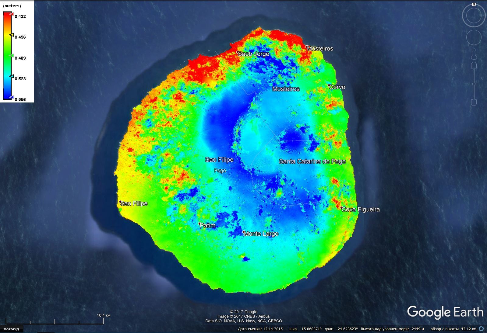
in the second case: 20170115 - master; 20170620 - slave.
The “InSAR Stack Overview” offered me as the master image 20170620. All dates are in the title of the images.
20170620 - June 20, 2017
20170115 - January 15, 2017
in the first case: 20170620 - master; 20170115 - slave.
in the second case: 20170115 - master; 20170620 - slave.
The “InSAR Stack Overview” offered me as the master image 20170620. All dates are in the title of the images.
20170620 - June 20, 2017
20170115 - January 15, 2017
its may be late as answer but it can help. when looking for displacements, you are comparing two phases acquired from different periods and you have to have a reference from where you do your comparison and this reference is the first image acquired (or the previous in case you are dealing with multi temporal INSAR). in this way you will have negative values that represent movement away of the satellite in the LOS (subsidence) and positive values which represent uplifts (towards the satellite). if the other of the images is inverted somehow you should have similar results but inverted and in this case the interpretation also have to be inverted.