In case not already aware, since Tuesday the 2nd of May ESA have started publishing the Sentinel-2 Level-2A products over Europe on the Open Access Hub (https://scihub.copernicus.eu).
L2A products are now searchable via the GUI either through the advance search panel by selecting S2MSI2Ap from the Product Type drop down menu, or by typing in the full text search bar producttype:S2MSI2Ap
Is there any documentation on the product specifications? I downloaded sample datasets from the Open Access Hub and wanted to know what do the acronyms AOT, TCI, WVP in the file names mean?
Hi,
That’s Sen2cor, not MACCS (or MAJA according to its new name). But, as you are asking :
MAJA products are available here : https://theia.cnes.fr. France, Spain, Tunisia, Morocco, Belgium, Madagascar, Senegal, Mali-Burkina transect, from December 2015 to yesterday. Other zones to be added soon (Portugal, parts of China and Niger…)
Thank you very much for your quick response @OHagolle ,
Yes fortunately my study area is located in the plains of Tadla in Morocco, so I will have the images correct with two algorithms Sen2cor and MACCS and this is very important, thanks to you and thanks to the sentinel team and good continuation.
Good afternoon Fabrizio, at the moment at the SciHub I’ve seen the S2-A L2A datasets have been processed from April 2017. Do you have any calendar when the previous datasets since September 2015 will be available?
I would like to ask if Level 2A product available on sci-hub is the same product as the result of processing Level 1C product with Sen2Cor in SNAP. I just would like to know if there is some meaning for me to process Level 1C with Sen2Cor (e.g. more output products which are not included in scihub product or if there is more options how to control processing) or there is no reason to do that now with Level 2A available on scihub. I am new to these products so I would like to know if there is reason for me to learn about Sen2cor or I could just download Level 2A . Thanks
The Sentinel-2 L2A product available on SciHub have been processed by Sen2Cor with the default parameters.
In addition, please be informed that you will find on SciHub only S2 L2A data acquired since April 2017 over Europe, therefore you will need to process L1C data using Sen2Cor only if your area of interest is outside Europe or if you are interested in S2 data acquired before April 2017.
The data from December 2016 are available at https://theia.cnes.fr
We intend to process data from December 2015, which will be available in a few weeks, it is already the case for the Ebro basin and the Pyreneos.
Hello!
I downloaded an image of the Sentinel 2A satellite, on a level 2A. Should this image be corrected atmospherically to calculate the NDVI?
Thank you very much for the help
Dear Fabrizio,
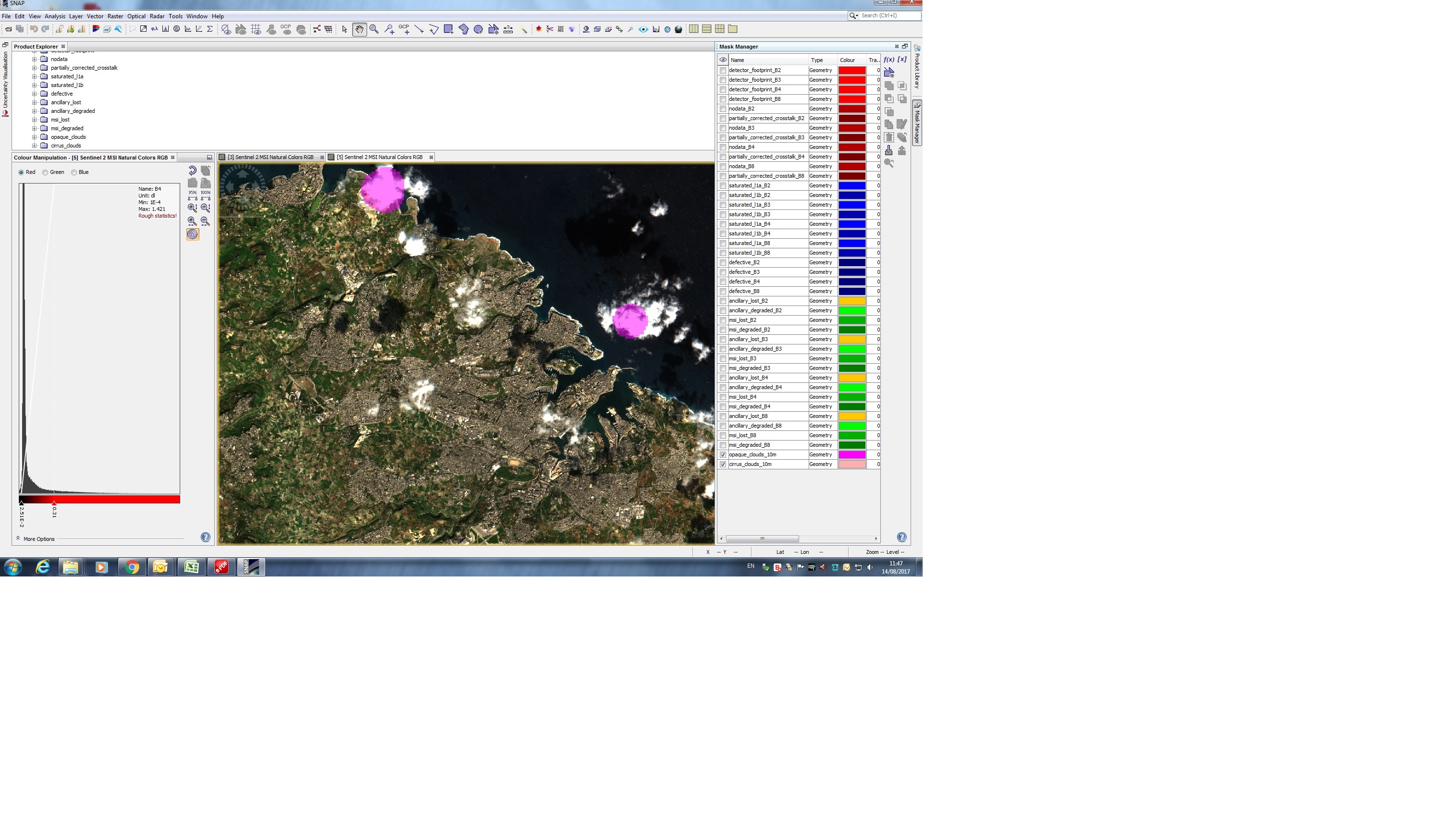
I’ve downloaded a couple of S2A images for an AOI in Europe. There are a few dense clouds over the terrain. The Cloud mask from SNAP’s Mask Manager does not identify all these clouds (see image). Do you recommend to manually digitise mask areas over these clouds and mask them ? Thanks.