I have been working with the sentinel-1 GRD data in the SNAP tool for the last month.
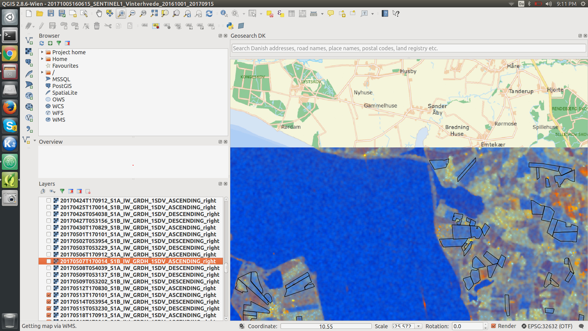
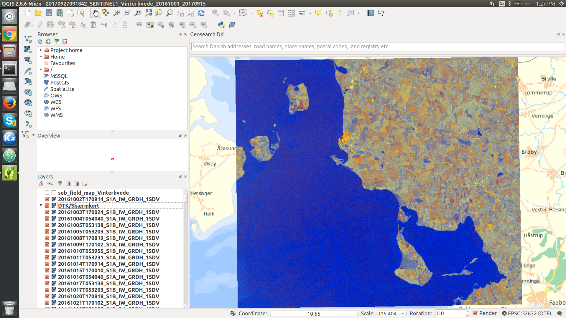
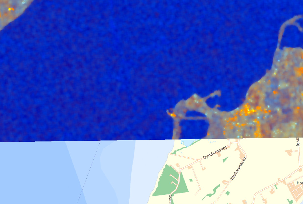
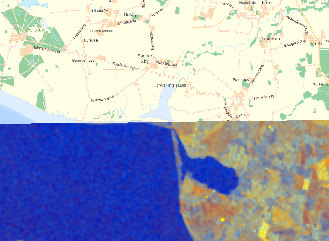
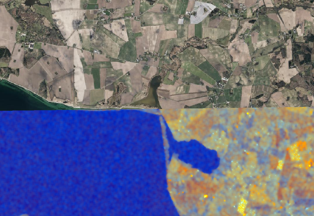
My problem is that my output in geotiff format is unaligned with external GIS maps,
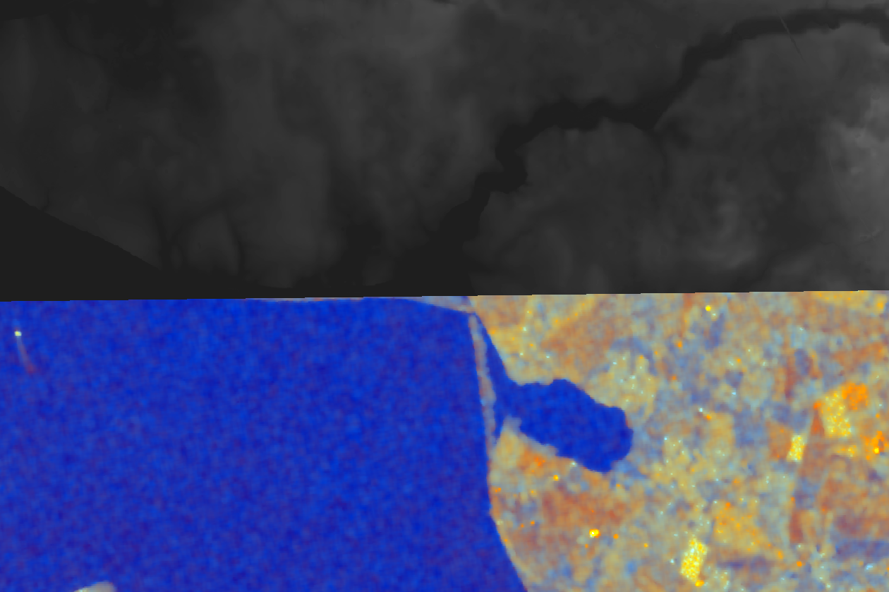
when I compare them in QGIS:
I am able to run a small script, so I can compensate for the difference manually in the SNAP created Geotiffs, but I have been looking for at more automatic method to perform the same task.
The best candidates I found was :
But the goal here seems to be DEM based co-registration of multiple GRD data-sets and not alignment with GIS data for an external source. All solutions seem to be using one of the GRD data-sets as the master unit for alignment.
I would instead like to use an external source, but I am not sure what input format would work and what the best procedure forward would be. We also have an external DEM model for the same area:
This DEM model is aligned correctly with all the other GIS information we are using. But I am unsure if it would be better to use this DEM model compared to ones in SNAP. I tried to load the external DEM it into SNAP as a GEOtiff and do co-registration, but the result seems to be an empty map. I might be doing the alignment to early/late in the process,
but I have been unable to find a guide telling me the correct procedure.
I am using SNAP 5.08 on Ubuntu 16.04
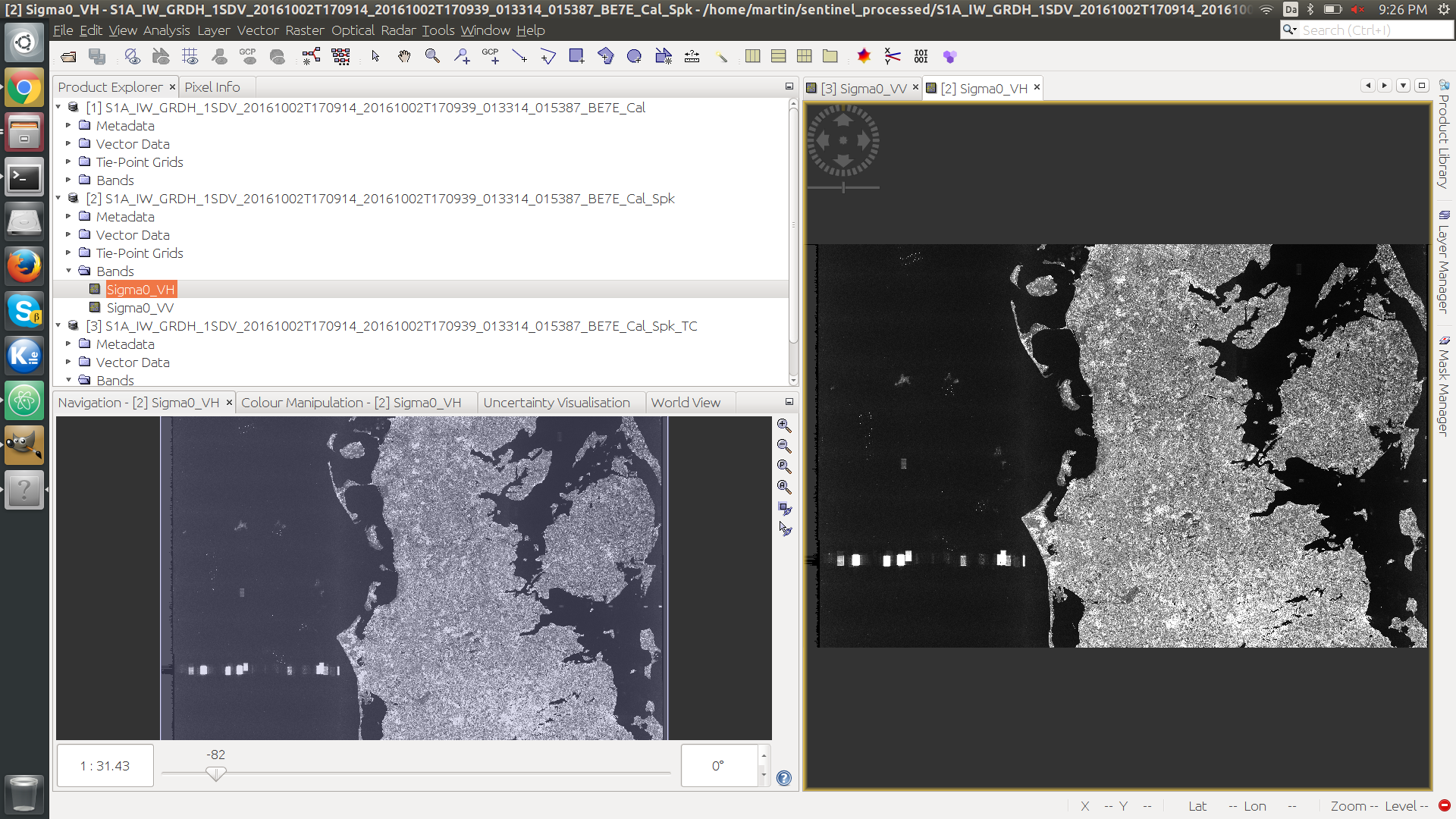
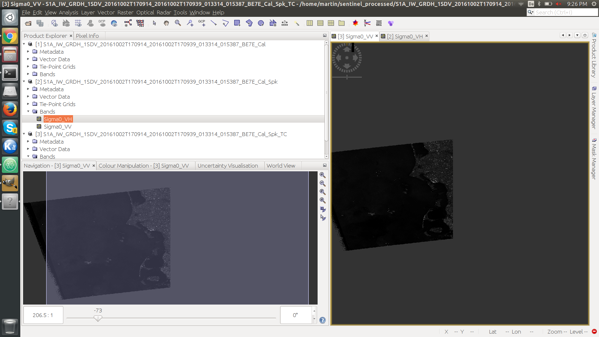
The current steps I am using are:
- Load GRD scan into SNAP (example: S1A_IW_GRDH_1SDV_20161002T170914_20161002T170939_013314_015387_BE7E.zip)
- Radar → Radiometric → Calibration
- Radar → Speckle Filtering → Single Product Speckle Filter (Lee sigma, 7x7, sigma: 0.9, 3x3).
- Radar → Geometric-> Ellipsoide Correction → Ellipsoid-Correction-GG (BILINEAR_INTERPOLATION)
Then I attempt to do the co-registration with the external DEM model, but the output seems to be empty.
My main goal is to recreate a paper on determining winterwheat height in agriculture:
http://www.tandfonline.com/doi/full/10.1080/10106049.2017.1316781

But if the RADAR data does not match in global position, I cannot match it correctly to field information as illustrated in the image above.
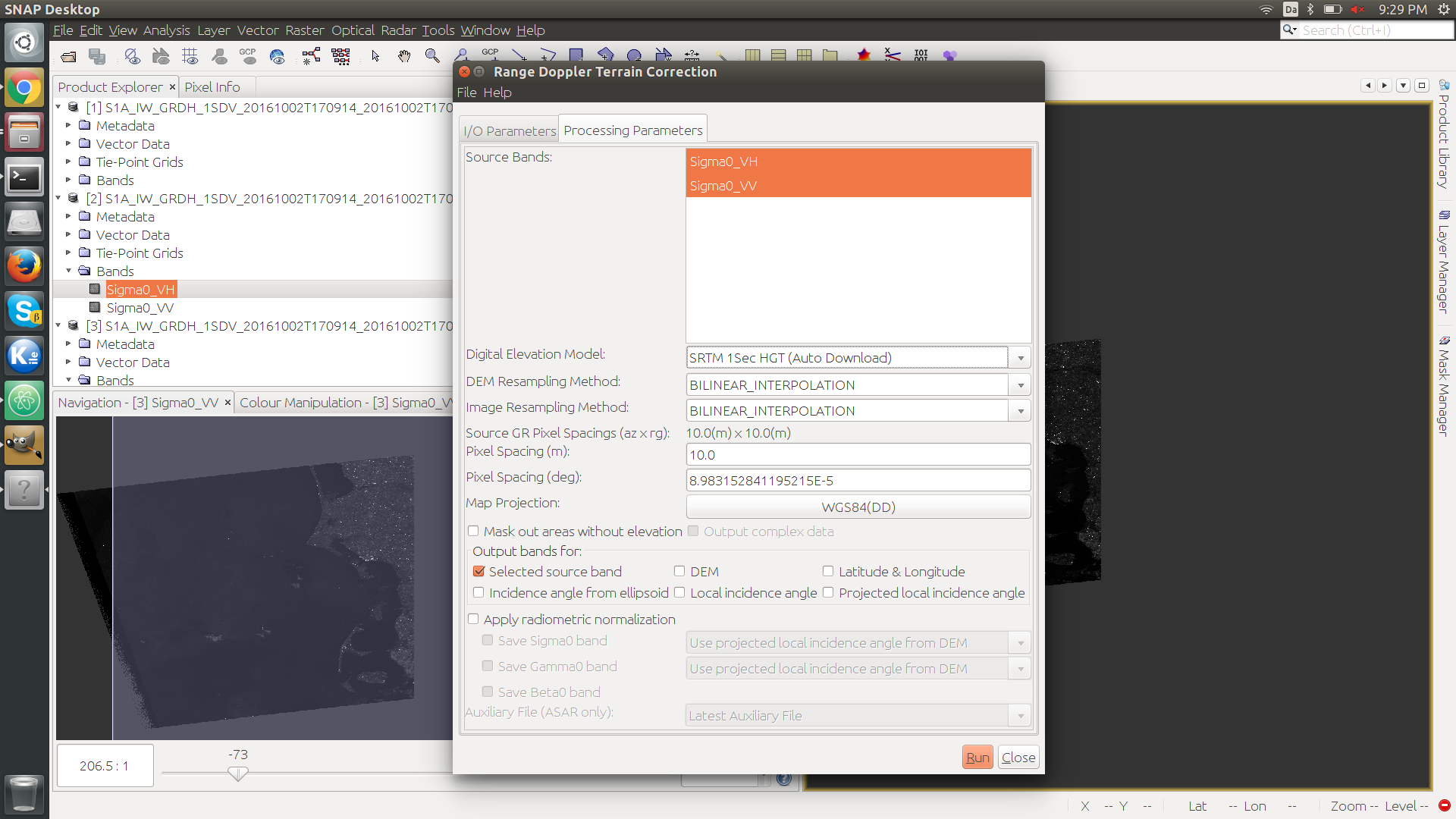
I have also tried to switch step 4 out with :
Radar → Terrain Correction → Range Doppler Terrain Correction and use different internal DEM models,
but the misalignment between GRD and external GIS data still exsist.
What am I doing wrong, or what is the recommended workflow for aligmment with external GIS data using SNAP with Sentinel 1 GRD data ?
Thank you for your help!