Thank you!
The Google Earth elevations (and their horizontal offset to your DEM) are not a very good reference, to be honest. What matters is if your SAR image is located correctly. Can you show an example of the vertical offset you experience?
Hello, yes!
Here follows a screenshot in which the (transparent) SAR image is overlaid on top of OpenStreetMap.
The orthorectified product is of:
- SRTM 1sec (Autodownloded)
- Bilinear DEM interpolation
- Ground Range pixel as suggested by SNAP.
- Projection used * EPSG:4326 - WGS 84
considering that the coordinate system of the basemap is
GCS_WGS_1984 / WKID: 4326 Authority: EPSG
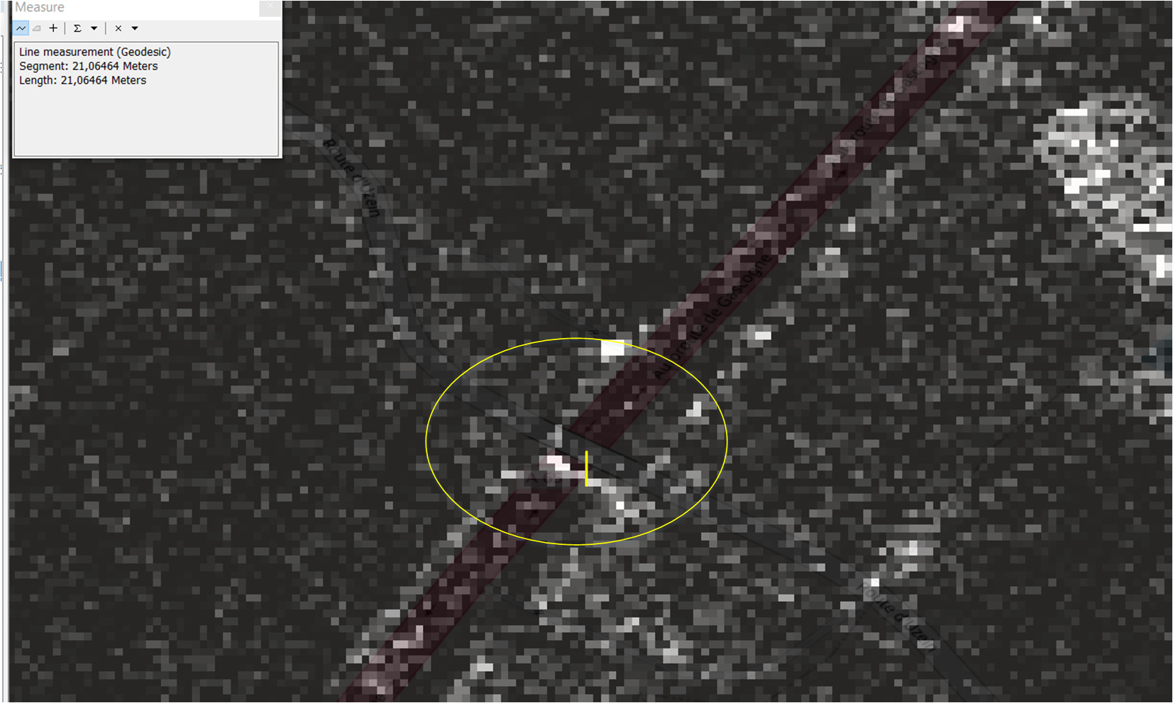
bellow follows an example of the Sentinel 1 orthorectified product.
Pixel size 14m x 14m.
(Images are not scaled whith each other.)
Thank you very much!
Any thoughts?
What type of ALOS-2 aquisition mode are you using? Stripmap, Scan SAR?
Strip map: high sensitive quad pol 1.1
Any thoughts?
You can try the SAR Simulation Terrain Correction and check if it provides higher geo-accuracy
Are there any specific parameters to put to “ensure” good geo-accuracy?
more GCPs, smaller registration windows, more iterations, smaller GCP tolerance…
alright! i will test these based on your guidance!
Thank you very much! 
I have issues with orthorectifying ALOS-2 PALSAR-2 (Level 1.1) CEOS data in ERDAS Imagine 2018 (v 16.5.0 Build 1051) using a 1/3 arc second DEM . The DEM data is NAD83 (GRS80) with the vertical datum North American Vertical Datum of 1988 (meters) – NAVD88.) shareit app vidmate
What kind of issues? Can you please elaborate ?
However, I have not worked with the aforementioned software.
Can anyone share how I can download the ALOS L1.1 data product over Mt. Fuji, Japan?
Here are the instructions to download L1.1
Thank you so much.