ALOS-2 ScanSAR data to be made freely available

The JAXA G-Portal seems to be queryable, and will produce results that link to https://satpf.jp/spf/ for download. From what I can tell, all PALSAR-2 data has the “Get Data” button disabled for resampled data, and links to https://satpf.jp/spf/ to download the original data, but I have been unable to get this site to load.

If anyone has any insight it would certainly be welcome. It seems like the only option right now is to use Google Earth Engine.

Make sure it is only ScanSAR imagery that you are trying to download. When you’ve searched for imagery over an AOI for your specific time period, images that you can download will have a “Download” button in the data manipulation column. The scenes should then end up in the Production status tab once you click the download button. In my experience, ordering the data is done entirely through the gportal website. Also, it seems very recent ScanSAR images aren’t available for order.

2 Likes

Just following up with an update on this, JAXA has recently announced they have also made L1.1 data from 2014 to 2023. Thus far I have downloaded some L1.1 data but am noticing they are failing to open in SNAP unfortunately due to a reading issue.

How do you download the L1.1 data? It says to download it from the G-Portal but when I try to get it it just links me to https://satpf.jp. The “Get Data” button is still greyed out.

To my understanding, only Level 2.1 is openly available while 1.1 is still commercial only.

I think I got it working but my internet speed right now is very slow. So I cannot verify the output yet. Let me know if there is any wrong steps.

  1. Go to GPortal Search
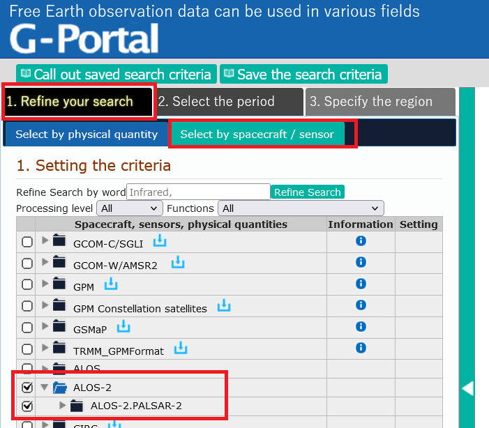
  2. Select ALOS-2 Spacecraft
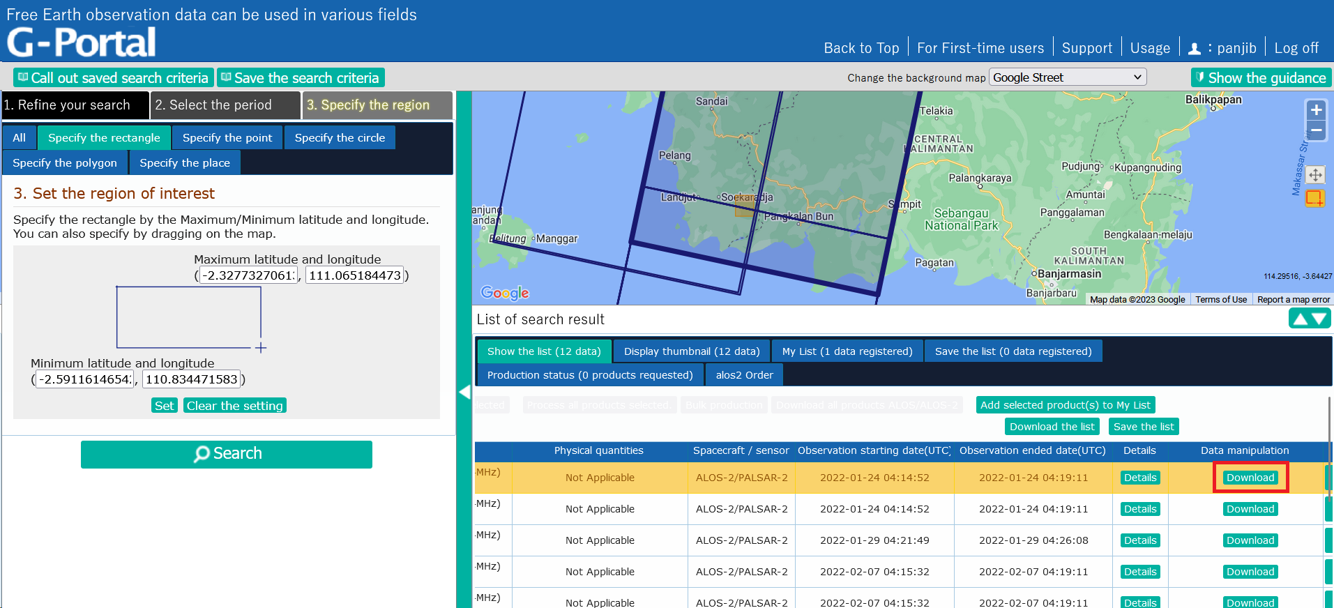
  3. Set date and AOI filter
  4. In the “List of search results”, you have to scroll the window to the right to be able to see the download button. This is not very obvious and it is easy to miss this.
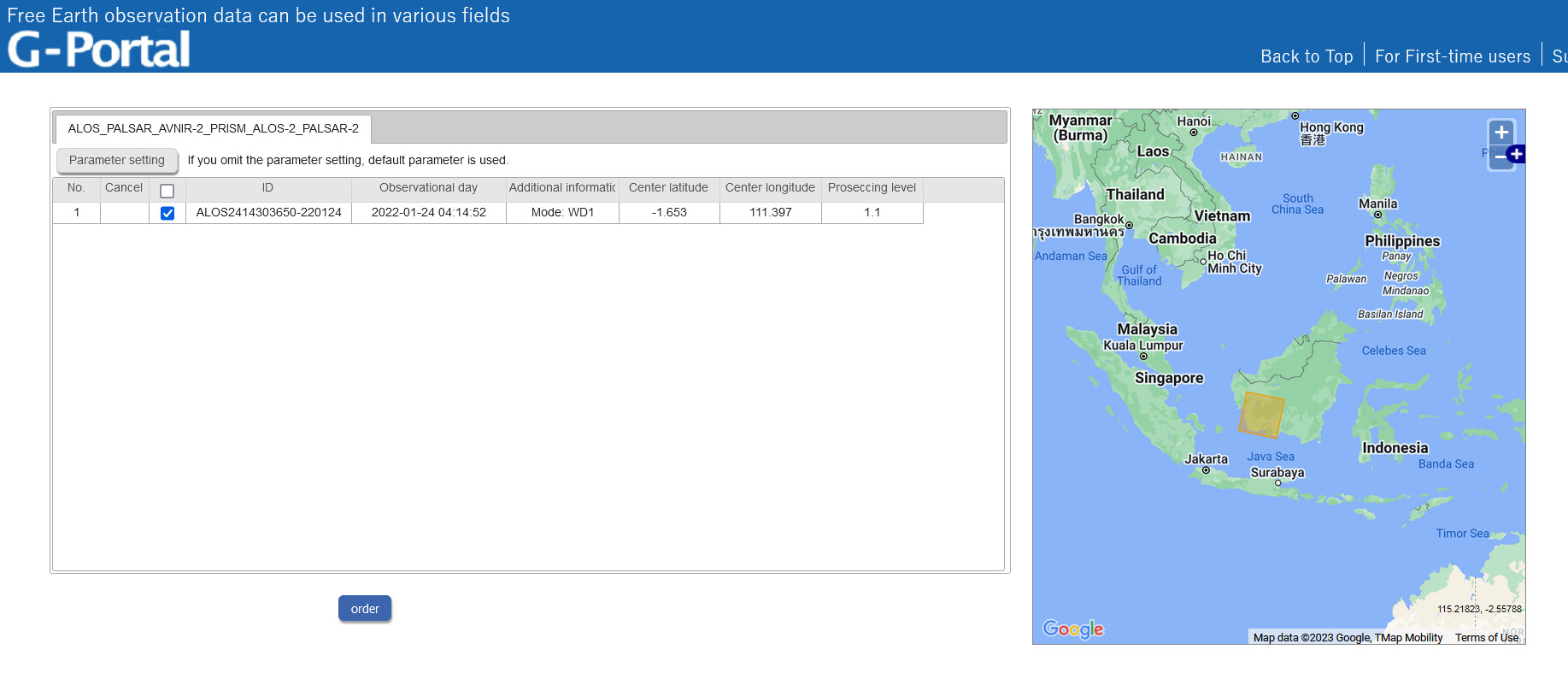
  5. In the download page, press “Order” to finalize
  6. Once it is done. You will get an e-mail on the access details via SFTP. You can use the terminal in Windows. Here is a sample of an e-mail.

Dear USERNAME,

We would like to inform you that the following products are ready to be
provided.

order number
s000003292

ALOS-2 order scene ID
ALOS2415633650-220202[1.1]

SFTP download
Connection protocol: SFTP
Destination: ftp.gportal.jaxa.jp
Connection port: PORT_NUMBER
Connection account: USERNAME
Product path (directory): /process/scandl2/PRODUCT_ID

  1. Type this in the Windows terminal: sftp -oPort=PORT_NUMBER USERNAME@ftp.gportal.jaxa.jp

  2. The SFTP is like a standard terminal so
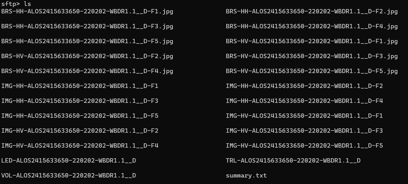
 cd into the product path directory by typing cd process/scandl2/PRODUCT_ID. Type ls to view available files in the directory.

  3. Download files using get FILENAME your_output_directory. your_output_directory is where you want to save the downloaded files in your computer. For example, get IMG-HH-ALOS2415633650-220202-WBDR1.1__D-F2 D:/MyData

2 Likes

Thank you for sharing, I am interested how the data will look. So you downloaded ScanSAR(WBDR) in Level-1.1?

I haven’t been able to download it since my internet speed right now is very slow. I was only able to download the JPG files.

Here is BRS-HH-ALOS2415633650-220202-WBDR1.1__D-F1.jpg

As of April 11th, JAXA announced they will also be making their L1.1 archive open access in addition to the L2.2 collection: ALOS series Open and Free Data|ALOS@EORC

I’ve managed to download a few scenes (approx 60 gb per scansar scene) however they fail to open, producing a java.NullPointerException. It seems to be the same error that I’ve seen other people having in other threads with PALSAR-2 L1.1 data.
image

Any thoughts on what may be causing the error or any possible solution?

Hello, have any of the senhroes ever found a way to enter the WBDR data into SNAP?

Can this WDBR data be opened in POLSARPRO?

Hello, have any of the senhroes ever found a way to enter the WBDR data into SNAP?

Can this WDBR data be opened in POLSARPRO?
?

I reached out to JAXA about alternative software. They noted open-source GMTSAR supports the ScanSAR WBDR L1.1 data, additionally, the commercial GAMMA software supports it though is quite expensive to license.

The Open Source InSAR Scientific Computing Environment (ISCE) software supports ALOS-2 ScanSAR data with its alos2App.py

Login to Google Earth Engine, copy and paste the following link:

https://code.earthengine.google.com/25a0342cec75abb8811719778d9cd291?hideCode=true

to open the tool to access ALOS-2 PALSAR-2 ScanSAR Level 2.2. No coding skills required. Just select the area of interest and set some options.

The image will be downloaded to our Google Drive, then we can download it from our Google Drive to our local drive in GeoTIFF format.

I could get data only for Japan :disappointed:

It is just showing a specific area which you have selected, I am selecting my aoi but nothing is showing. Can you please tell me, What is the problem?

Hi,

It seems that only limited data is available for free download of ALOS 2 SAR data.

I am using these search filters to find free to download data, am I doing anything wrong ?

yes, this only applies for ScanSAR data at product level 2, and the access is not via this official portal.

Thanks for your reply. If it is not available via official portal, where can I find the data?

You can get it over Amazon Web Service or Google Earth Engine: https://www.eorc.jaxa.jp/ALOS/en/dataset/alos_open_and_free_e.htm

1 Like