At GEO Week 2019, Ms. Sasaki, Parliamentary Vice-Minister of Education, Culture, Sports, Science and Technology of Japan announced that the Japan Aerospace Exploration Agency (JAXA) will be providing open access to information and data from a suite of their radar satellites.
“Japan will provide free and open access to the wide-swathe observation data from the L-band radar satellites, such as ALOS (ALOS/AVINIR-2, PALSAR) and ALOS-2 (ALOS-2/ScanSAR),” stated Ms. Sasaki.
I just created this topic to keep us updated and exchange experiences.
Although the spatial resolution of ScanSAR products is not very high, its coverage makes it interesting for studies at the regional, national and global level.
Obviously, there are things to watch out for regarding ScanSAR interferometry
I saw the post. These are incredible news considering the current cost of these images (650 EUR per SCANSAR image for archive, double for new acquisition).
It is quoted :
More details about the open data sharing announcement will follow shortly.
@SMJ.Mirzadeh I’ve used SNAP to process ALOS data. Works fine. @ABraun Please keep this topic live - I’d like to chek how it will work for detection of ground motions in mountainous area with significant share of forests.
@mengdahl I think that the current support of ESA in terms of services such as RUS and RSS cloudtoolbox with SNAP software are the best situations for remote sensing society especially in the InSAR field
I need to make a study in a densely vegetated area in Mexico, I think ALOS-2 L-band is the correct data to obtain good results. Where can I order new acquisitions over an AOI in México? and where can I check the cost?
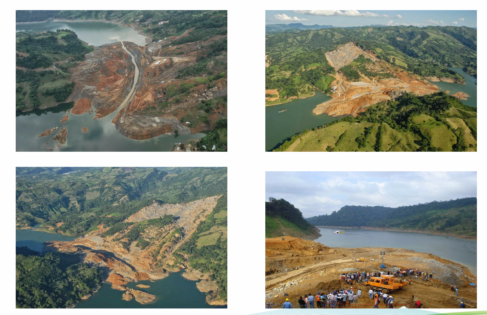
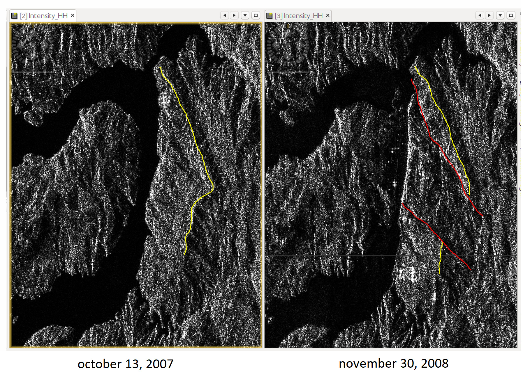
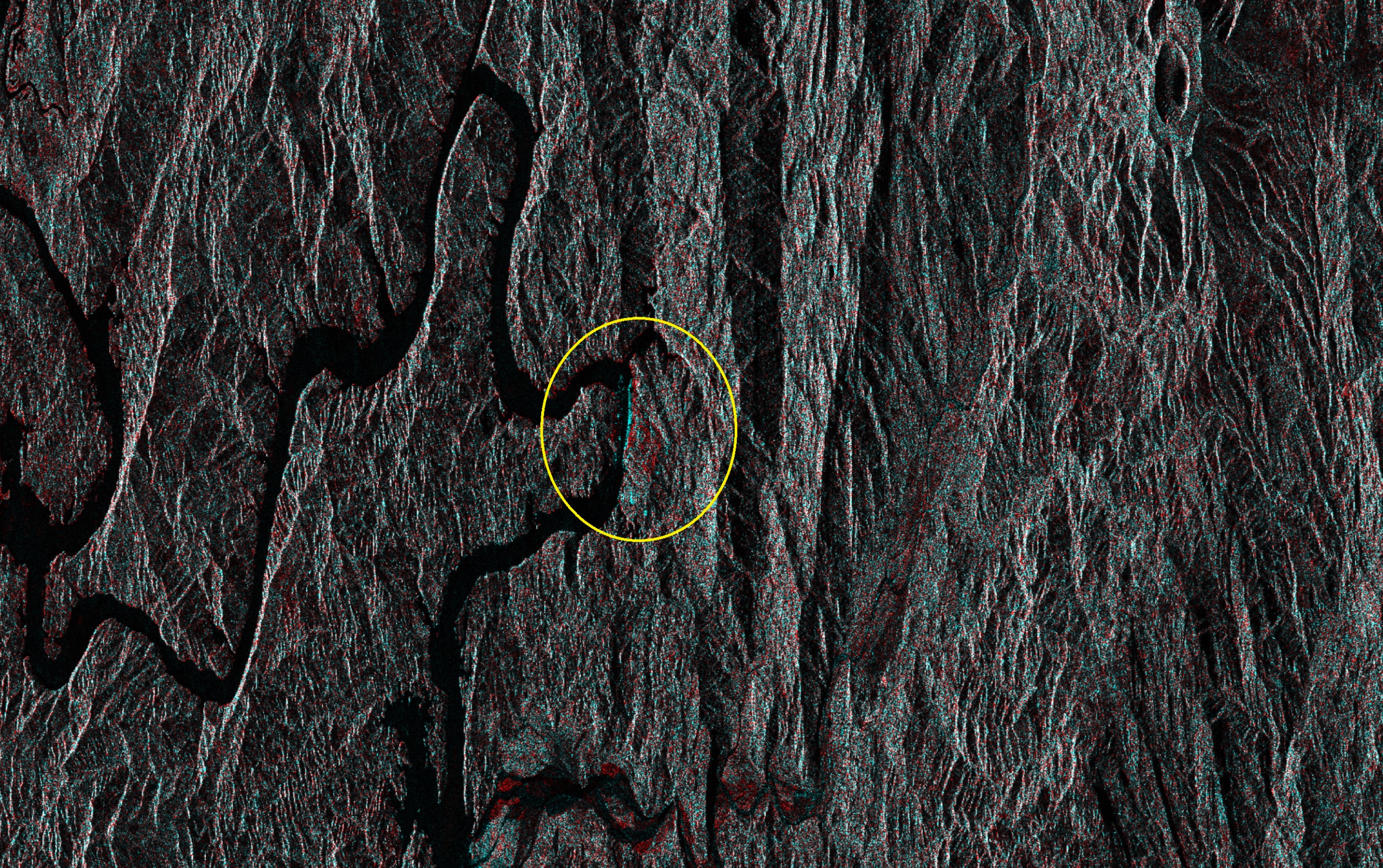
No, it was an abrupt landslide but we didn’t monitoring in 2007, we don’t know if it was moving slowly before the landslide, the geology department in my work wants to monitoring and identify possible risk along the river and dam. I attempted to do DinSAR with ALOS-PALSAR but I get an IFG noisy. At first, I thought the coregistration was failed, but I can Identify the landslide in the coregistered image:
@ABraun thank you for your advice, I’ll try with sample data from the links that you share me before to order any ALOS image. I can see that somebody have complications with ALOS processing in other topics related to ALOS processing, especially to get coherent interferogram or ionospheric fringe corrections.
I have seen a study using ALOS-2 data to explore unstable areas in the slopes of the mountains in Ituango dam in Colombia and they have excellent results. The Ituango mountains have dense vegetation and they could identify 10 unstable regions despite dense vegetation, I need to do that and the landslide image I shared above corresponds to Peñitas dam.
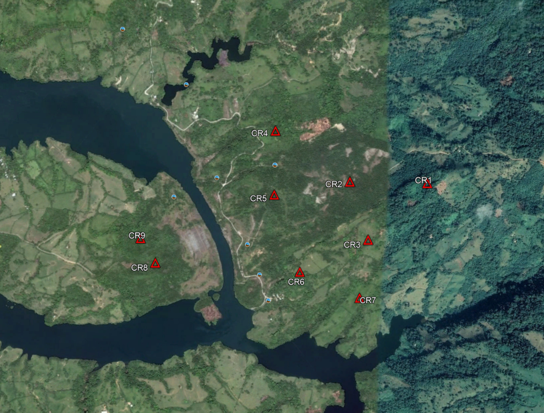
Due I could not get good results with ALOS, I’m thinking monitoring using Corner Reflector grid and C-band like Sentinel as I show in the following image:
Corner reflectors are a good thing because they produce a comparably reliable signal return. I am however no expert in this. There are some discussions in this forum on corner reflectors.