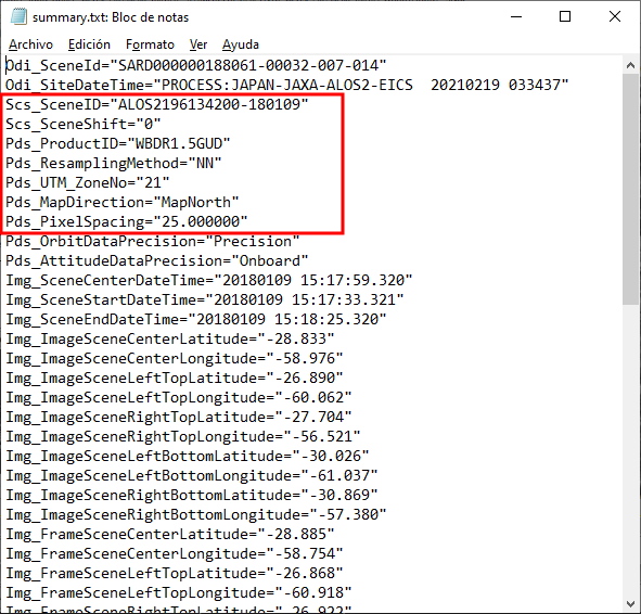
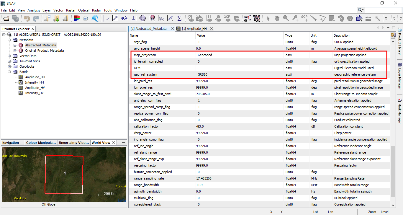
Hello, I have a set of ALOS PALSAR 2 ScanSAR images, ordered in level 1.5 (GRD) Geocoded with UTM map projection (summary.txt file confirms that in mao projection item). However, SNAP shows “geocoded” in the map projection item of Abstracted metadata, and it seems to be assuming that images are in geographic coordinates, since exported geotifs are read as having geographic coordinates by envi. This creates problems with geolocation and shapefile matching. Is there any way to correct the abstracted metadata so SNAP takes in the right projection?
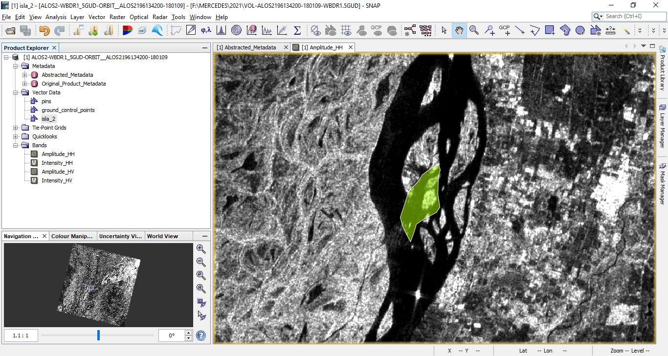
Here I show you a detail of a mismatch between the image and the shapefiles, in this case, a polygon of an island that shows the image is displaced northward and westward.
I think the problem is not the definition of the coordinate refernce, but that the data is geocoded but not terrain corrected. That means it is placed at the correct location and extent, but foreshortening causes the data to be imprecise at the local level.
If you want to have precisely geolocated data in rather mountainous topography, you have to apply Terrain Correction.
Thaks ABraun for your input. However, the imaged area is quite flat, so we don´t ussualy use terrain correction but only ellipsoid correction (which I can´t do either in these images because SNAP says image should not be map projected). I also tried using the single image mosaic that I found as a solution in another post for ALOS2 level 1.5 georref images, but it gives an image in geographic coordinates, with more error than the one I get without the mosaic option.
This is why I thought that if I could edit the metadata to assign UTM projection to the image, maybe I could use the single image mosaic approach to obtain a better geocoding.
Have you tested to overlay the data with the polygon in a traditional GIS software to test if it looks better?
The downsides of Level 1.5 data is that you lost control over what happenened during the preprocessing.
You can try the “Update Geo Reference” operator under Radar > Geometric.