Hi,
I am currently working on DEM 12.5 Alos Polsar Terrain Corrected. I would like to know the steps on producing contour lines. Is it possible if I am using arcgis pro?
Just a comment: For most parts of the world, the actual quality of the DEM is below 12.5 meters. The elevation data provided with ALOS RTC is not retrieved by the radar data itself, but in most cases up-sampled SRTM data at 30 m resolution.
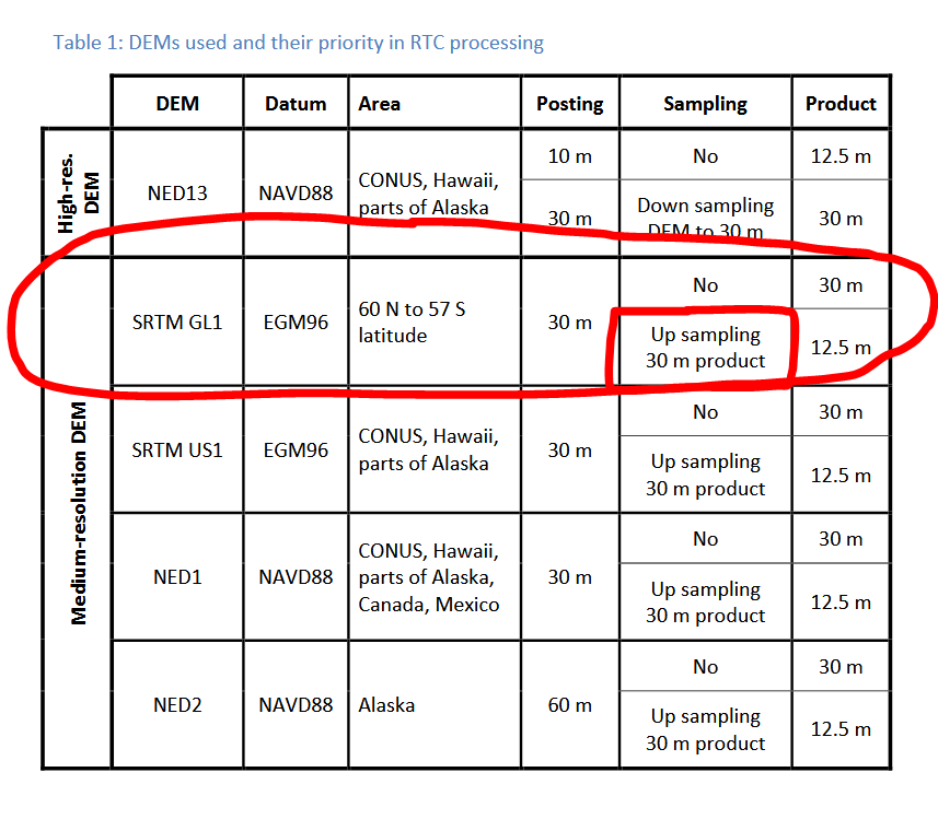
Source: https://media.asf.alaska.edu/uploads/RTC/rtc_product_guide_v1.2.pdf
So, basically, you are generating contour lines based on SRTM data. You can find instructions for ArcGIS pro here:
I will explore this! yes thank you!!