EDIT: Sorry if this post seems longer than necessary, I have just tried to be comprehensive to help others with the same issue!
Hi,
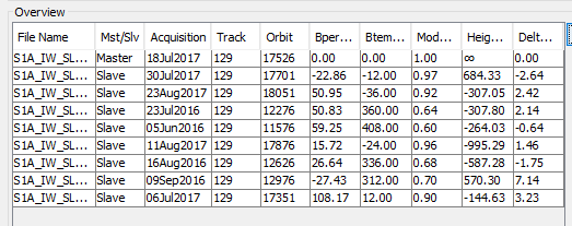
I am trying to use DInSAR based on Sentinel 1 images to look at the displacements of rock glaciers in Kyrgyzstan. I’ve been reading about the methods as much as possible. I read on this forum and in the ESA InSAR principles that the perpendicular baseline should be less than 300 m, for me they are all under 110 m.
From papers that have addressed similar topics such as this and this the temporal baseline is typically around 45 days, but in some cases around 90 days or greater.
Based on this I have tried using the following InSAR pairs:
16/08/2016 - 11/08/2017 (360 days)
05/06/2016 - 09/09/2016 (96 days)
18/07/2017 - 23/08/2017 (36 days)
06/07/2017 - 23/08/2017 (48 days)
23/07/2016 - 09/09/2016 (48 days)
I then used the following methods, batching 1- 7:
Deburst
Subset to a very small area for testing
Compute Interferogram
Topographic Phase Removal
Goldstein Phase Filtering
Multilook
Snaphu Export
Unwrap
Snaphu Import
Phase to Displacement
Terrain Correction
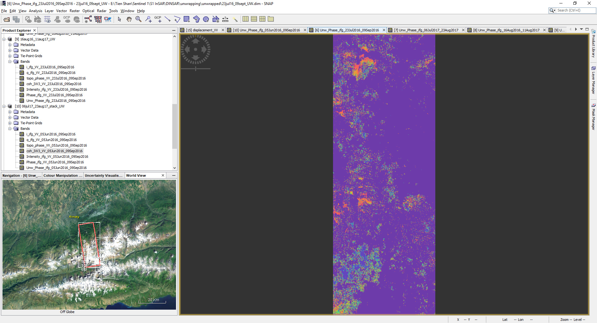
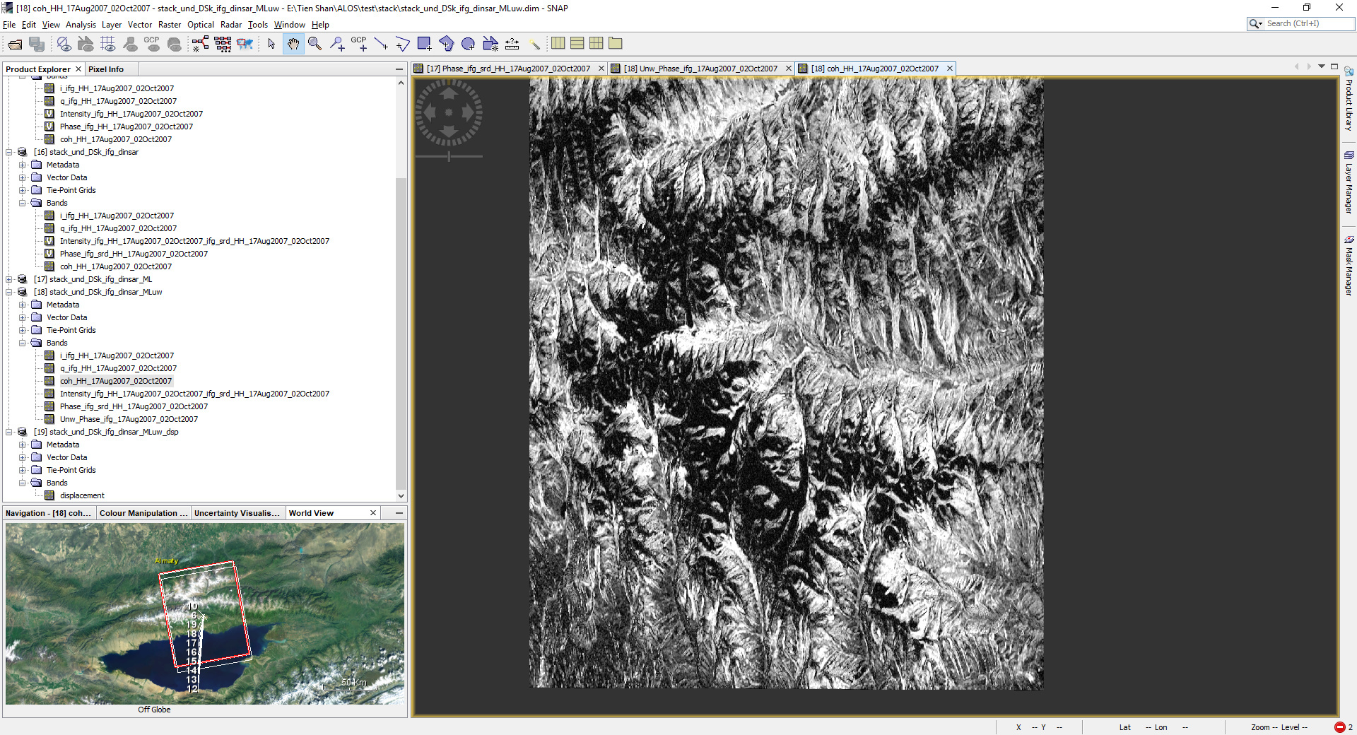
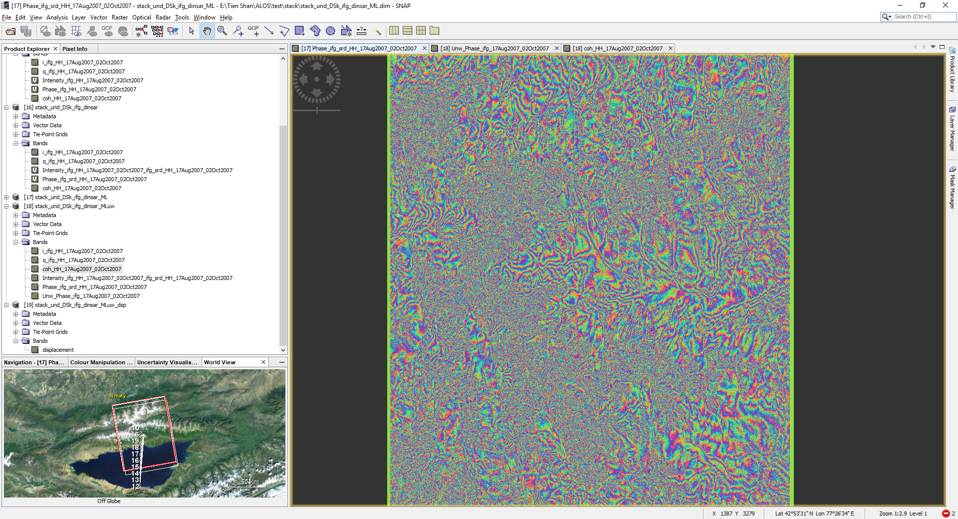
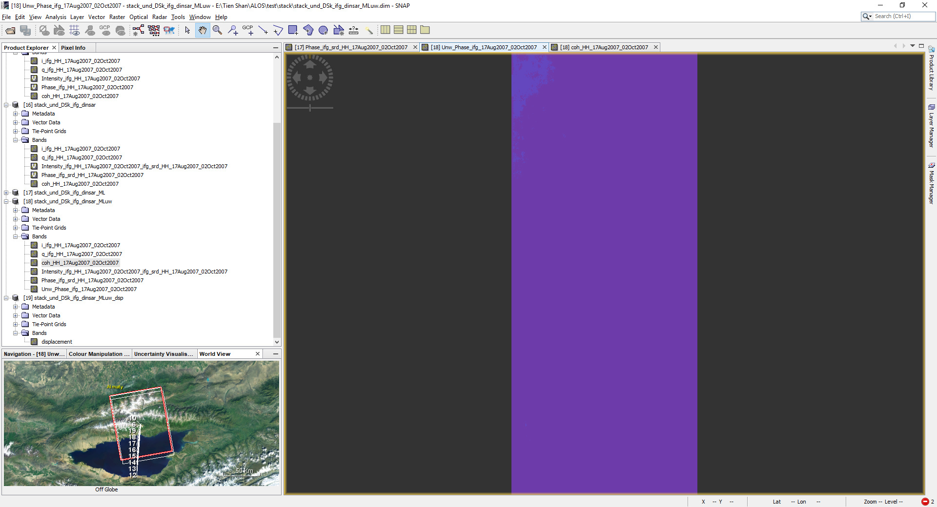
All but one of the unwrapped phases show little data, for example this is the unwrapped phase between the 23/07/2016 and 09/09/2016
While it would be supposed that the valley bottom would be most inactive, I was wondering if what I am seeing instead is elements of the topography still in the data?
So I have the following questions:
do these unwrapped phases look OK, or has something gone wrong?
are there any settings that should be tweaked in the methods? (since I just used the default values)
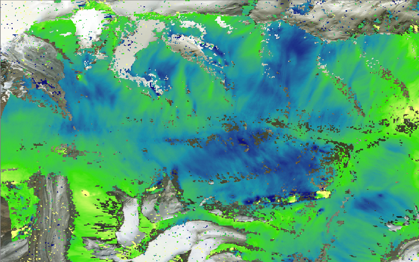
What are the coherences of those pairs? Probably very low. You need to have high enough coherence so that unwrapping can work well.
In the reference articles L-band data is used, which enables their use of longer temporal baselines (targets tend to decorrelate a lot slower in L-band than with C-band). With Sentinel-1 C-band I would start looking at 12-day pairs and see if any of them shows a signal.
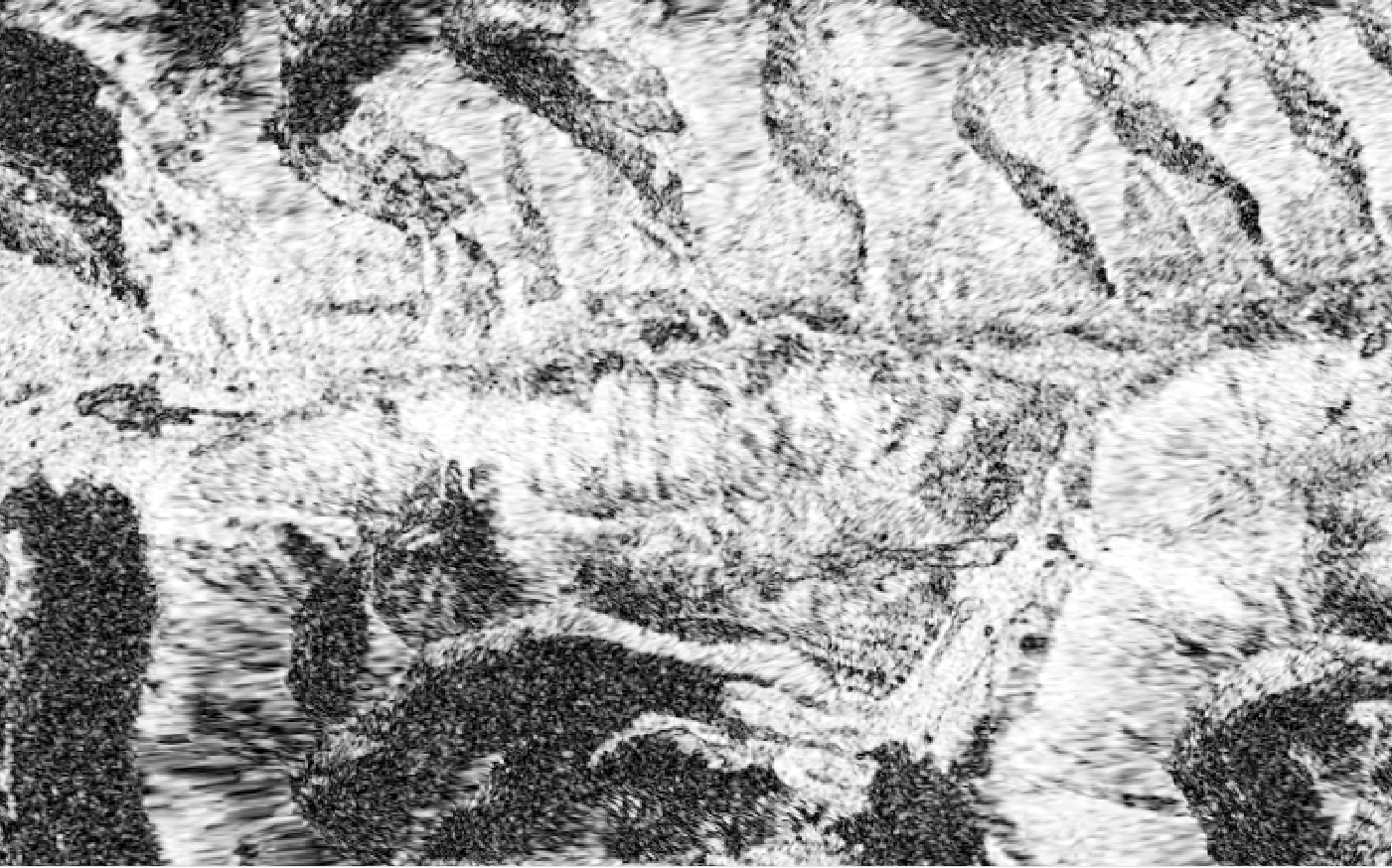
One cannot meaningfully unwrap noise, and in that pair there are large decorrelated areas (snowfall perhaps?). If the terrain-caused fringes are too dense for unwrapping you could try finding a pair with a shorter baseline.
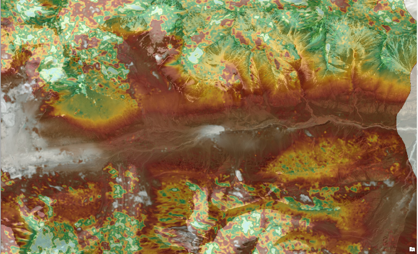
Towards the centre of the image are some glaciers, but in the valleys there is good coherence. Can that not be used to unwrap the phase? The temporal baseline for my ALOS pair is around a month, so less than the papers I originally linked to that used 46 days.