I can’t find any documentation, metadata, any basic information about bands stored in Sentinel-1 products.
I’ve tried to use gdalinfo tool, but it says that it is unable to open .safe file.
I can’t find proper information at http://step.esa.int/main/doc/tutorials/sentinel-1-toolbox-tutorials/
Could you tell me:
what are the i, q and intensity and their units, please?
how can I obtain sigma (backscatter)? Am I able to receive it from all Sentinel products (SLC, GRD and RAW)?
why backscatter is not just simply available after opening Sentinel 1 products? I thought that it is directly measured by the radar
See the Sentinel-1 User Guide for a description of the Sentinel-1 products and bands.
You can’t do much of anything with the Level-0 RAW products in SNAP. You need focusing software to turn the L0 to a L1 product.
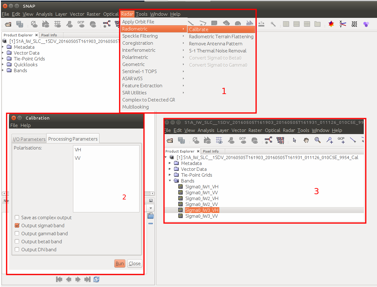
Level-1 SLC and GRD products can be converted to Sigma0 using the calibration operator in SNAP.
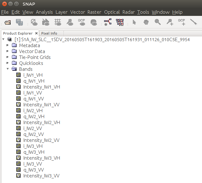
The IW SLCs contain burst data. You will have bands for three subswaths IW1, IW2, IW3. The data is complex so you will have the real (i) and imaginary (q) parts and a virtual intensity band for convenience.
neither the SLC nor the GRD are geocoded. They store geo-location information but are not yet projected to a coordinate system. But if you completely convert a SLC to a GRD you can download the latter instead. At least I see no benefit in doing the extra work if you don’t want to use the phase information (only in SLC), for example.
I just share my opinion. I had a large data base with SLC’s and it was faster to process GRD’s from SLC than downloading them from data hub especially if you need only smaller subset of SAR image.
I selected complex data on Calibration but I did not select the output complex data in Terrain-Correction, that is why cost the error -3.
I just do:
Read -> Calibration ->Thermal Noise Removal -> TOPSAR-Deburst -> Terrain Correction ->write.