Thank you for your reply!
now I got a better idea how to assess the coregistration.
Regarding the elevation band I did not mean that the interferogram should look like the elevation band.
Perhaps I miss communicated this part. What I mean is the following:
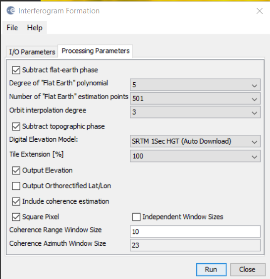
In the parameters of the interferogram generation, after one selects to remove topographic phase he can elect to create 2 output bands
- Output elevation Lets call that elevation_ifg
- Output orthorectified lat/lon.
like in this screenshot (do not mind the parameters, they are just the default ones)
I output both of them.
We can also get the elevation band directly from the product itself with right click on the product name + add elevation band as show here. Lets call that elevation_add
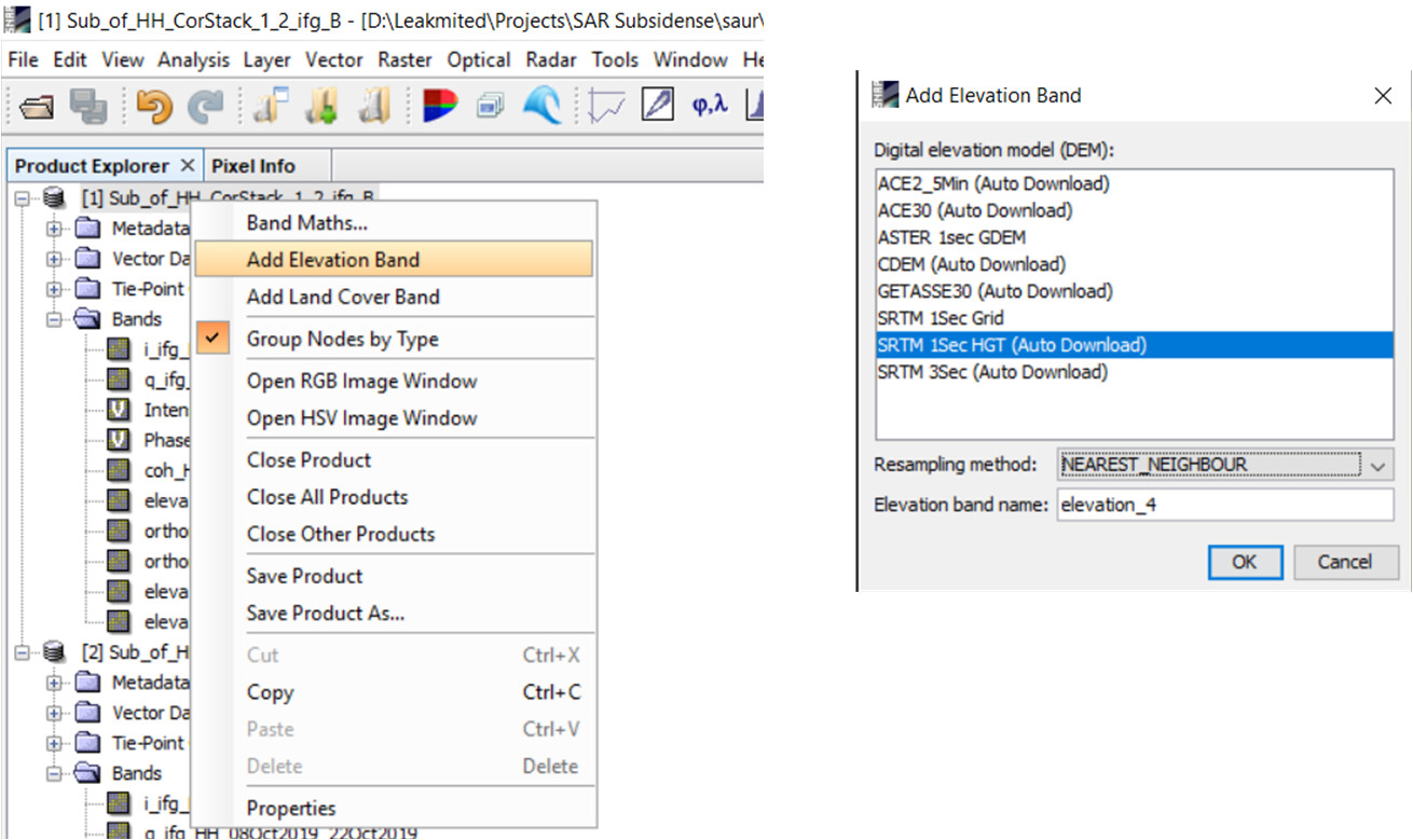
Hence I have 2 elevation bands for the same product!
here follows the 2 elevations bands:
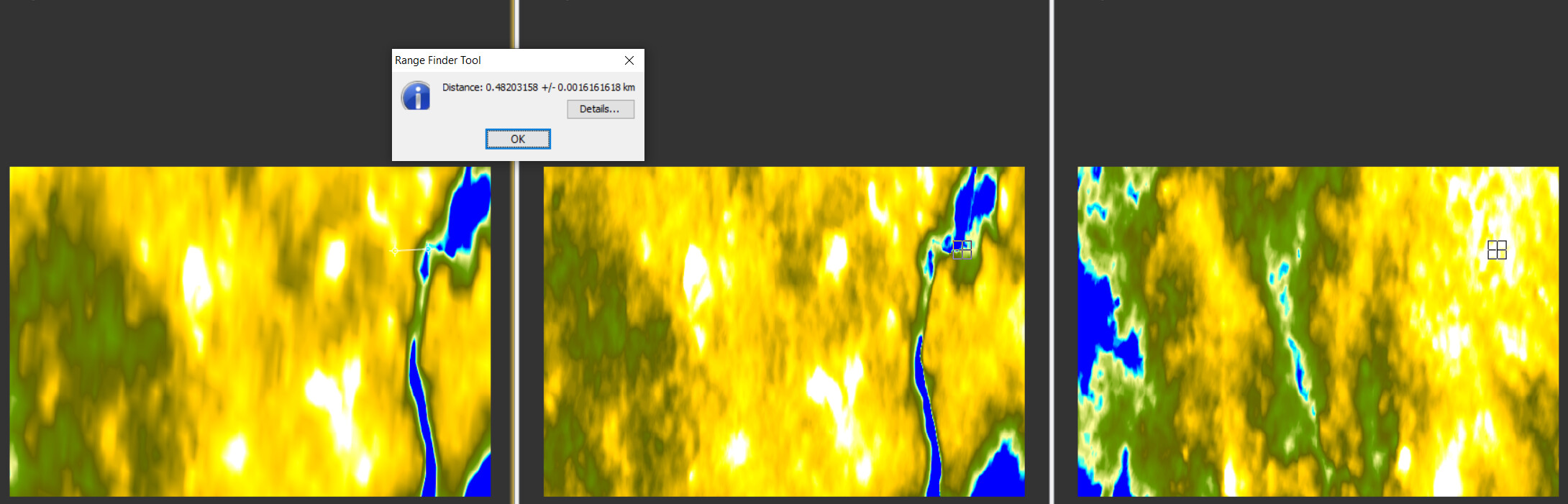
On the left we have the elevation_add while in the middle we have elevation_ifg. Comparing these two it seems that the elevation_ifg is shifted to the left by almost 500m.
The elevation band on the right has been created in the same manner as elevation_ifg but with using the default coregistration/interferogram parameters and it seems totally off. Presumably due to bad coregistration or bad topographic phase removal. I thought to present it here just for display and comparison purposes. i will disregard it from further processing.
Next, I thought to orthorectify the product, along with its two elevation bands, to see if any of both would match the topography of the scene. Of course, I also saved the output band DEM during range doppler t.c., lets call this one elevation_DEM. Below you can see these images:
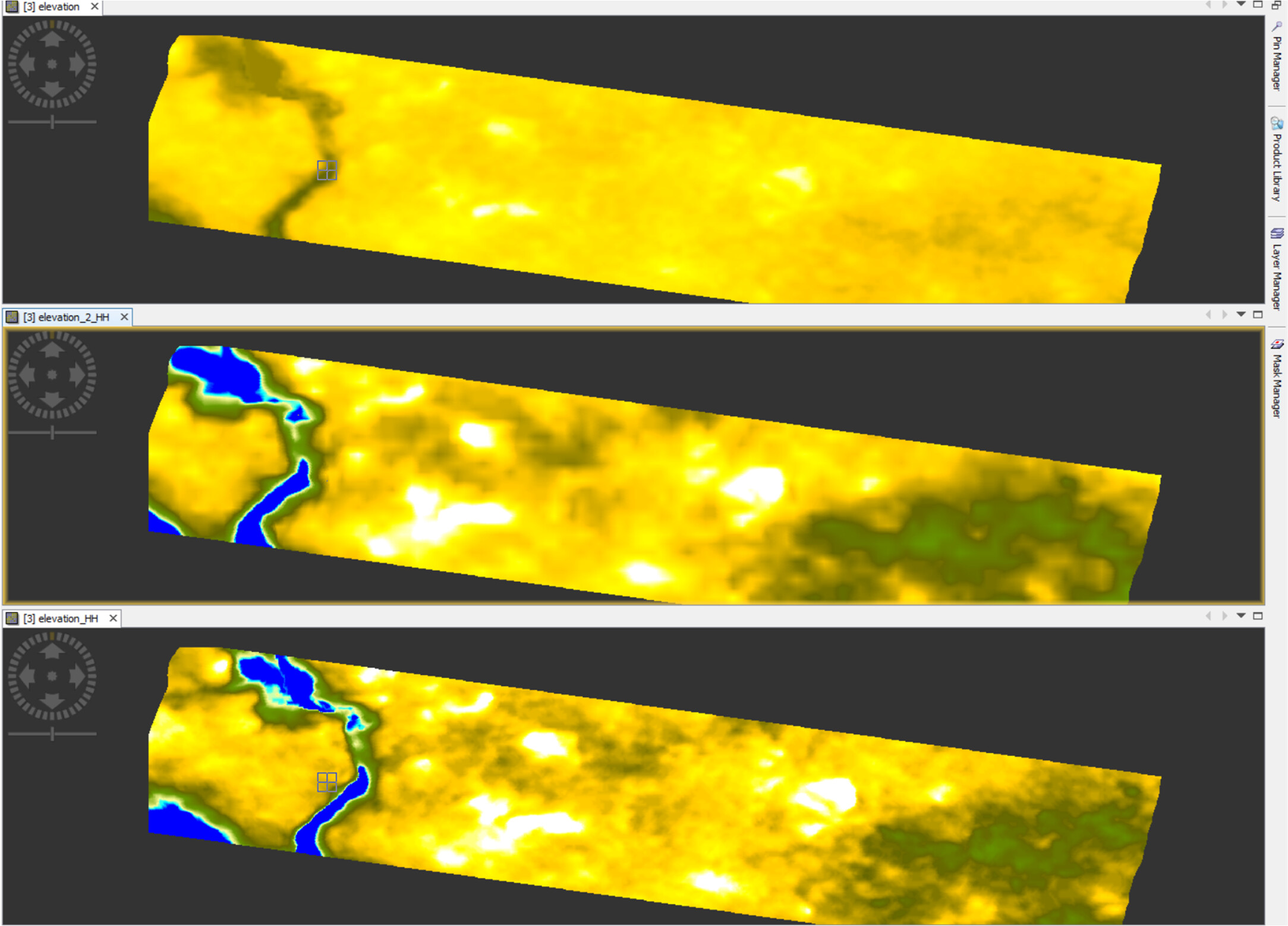
On the top: Elevation_DEM. Google projection suggested that this band matches the ground very good, so we will keep this as reference.
Middle: Elevation_add
Bottom: Elevation_ifg
It is observed that both elevations_ add/ifg do not match very good the DEM one. They are both adjacent to it, with a shift of about 200 or 300 meters each. This is apparent by looking at the cross symbol that apparently is placed at exactly the same spot in all displayed images.
-What to make of this?
-Since I get such a big shift between elevation_add and elevation_ifg, and since both of the them are not well placed on earth, can I really trust the end results of the coregistration and interferogram generation, and after all the end-displacement map?