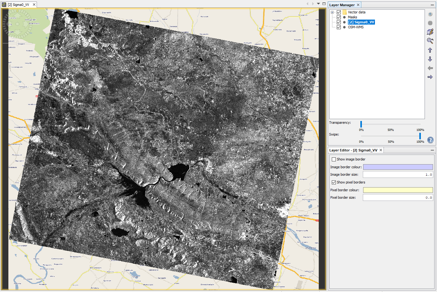
Hi, I’m just curious if its possible to have a better world map overlay in the SNAP platform as the default one here is rather pixelated and cant zoom in to see more detail of an area as shown below.
The thing is that only few global sources are free.
You could import the OSM web map service (WMS), or any other WMS which is available in your area, as a basemap:
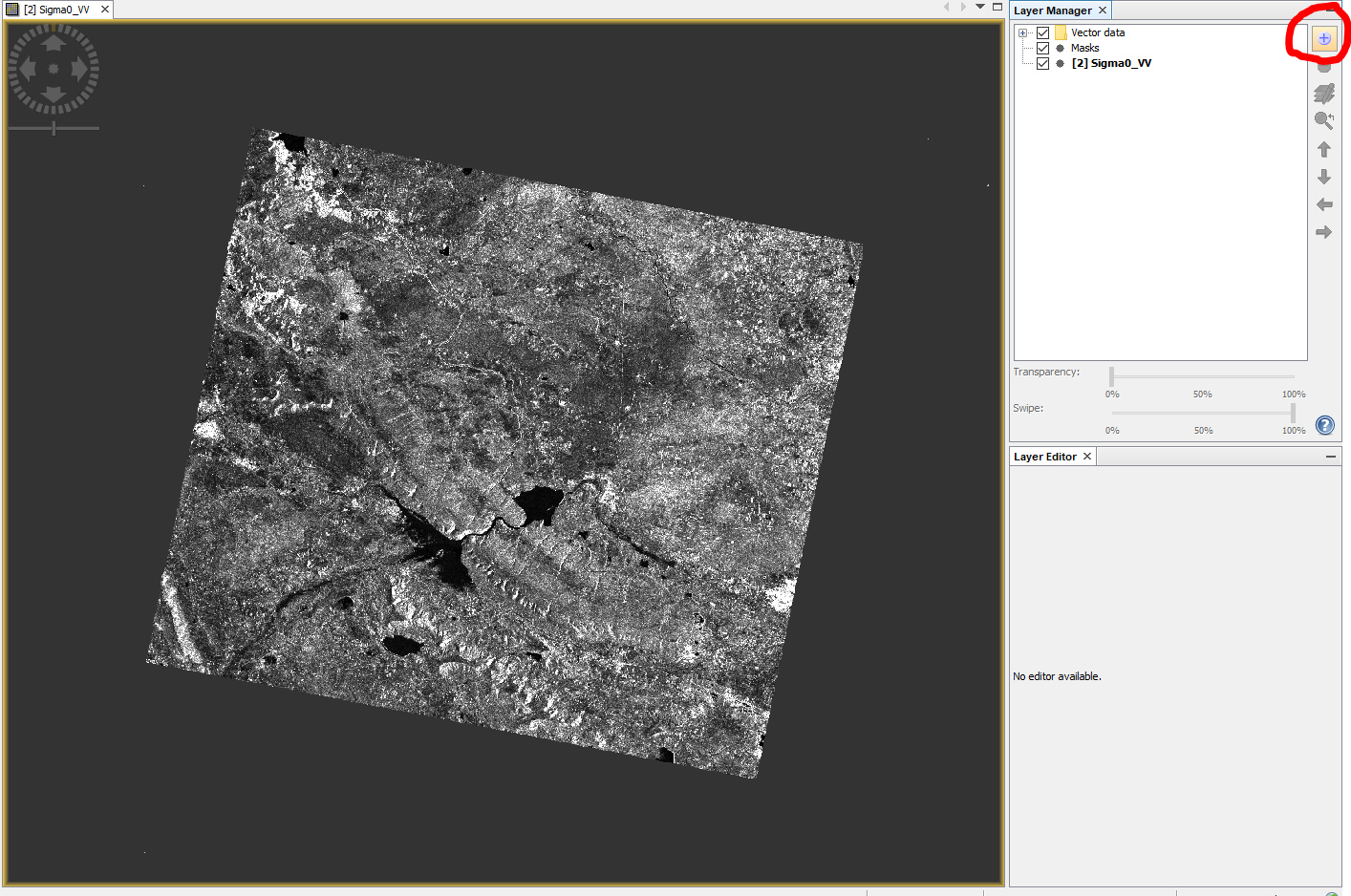
1 Open layer manager and click +
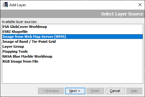
2 Select Image from Web map Server (WMS)
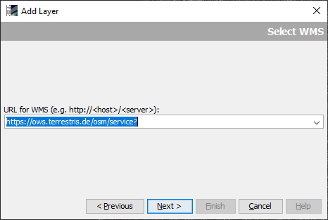
3 Enter https://ows.terrestris.de/osm/service?
 ,
,
4 Select the OSM layer of your choice
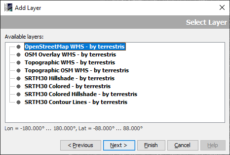
5 Adjust layer order (and transparency)
4 Likes
oh cool thanks! not sure if there are any wms in my study area (philippines) but, can i just use google maps ? please and thank you!
currently, there are no open WMS for google maps, sorry. Sometimes, they are published by individual people, but soon are taken down again, because Google, understandably, doesn’t want others to use their service without their control.
What to do if I see “Coordinate system not supported” message? I can’t find any tool to control CRS of the WMS maps.
a WMS is stored in one (or more) predefined coordinate systems. If the underlying one is not supported by SNAP you cannot do much about it, because it cannot be changed from the client side.
Thanks for instant reply!
I’m trying to use the Terrestris map as a backdrop for Sentinel2 image which is georeferenced in WGS 84 lat-lon and UTM so there should not be any conflict. But I get this error message no matter which Terrestris map I choose.
btw: I cannot display in (SNAP) any other WMS map using URLs that work perfectly in QGIS. Does SNAP require any special content or syntax of the URL?
I get the same message
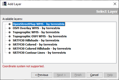
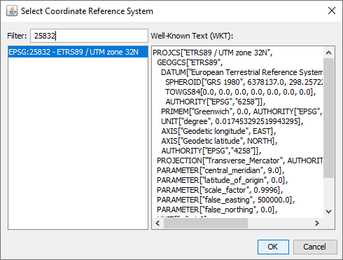
But according to the homepage off OWS Terrestris the WMS is not offered in all UTM zones (and only based on ERTS89 instead of WGS84)
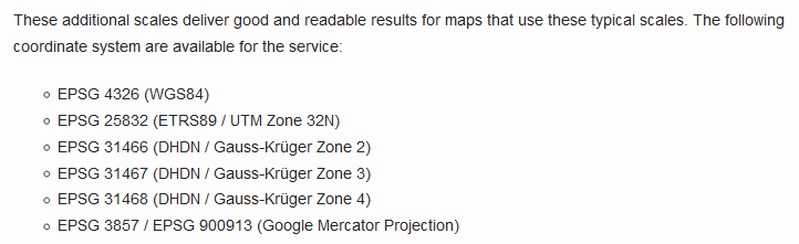
So I projected my data into this one
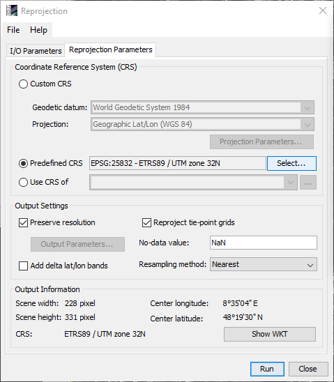
and this works

So you would probably have to translate your data into WGS84 (EPSG:4326) which is the only globally valid one.
Thanks; CRS that works in my case (few spots in Europe and in Sulawesi in Indonesia) and will probably do in any other is WGS84/Pseudo Mercator (EPSG 3857). It’s quite convenient because it is “universal”: it is not necessary to jump from zone to zone as is in UTM. Reprojection to it does not cause distortion of imagery (as is in the case of lat-lon).